Nội dung toàn văn Circular No.05/2011/TT-BXD regulating inspection, appraisal and acceptance
|
MINISTRY
OF CONSTRUCTION |
THE
SOCIALIST REPUBLIC OF VIETNAM |
|
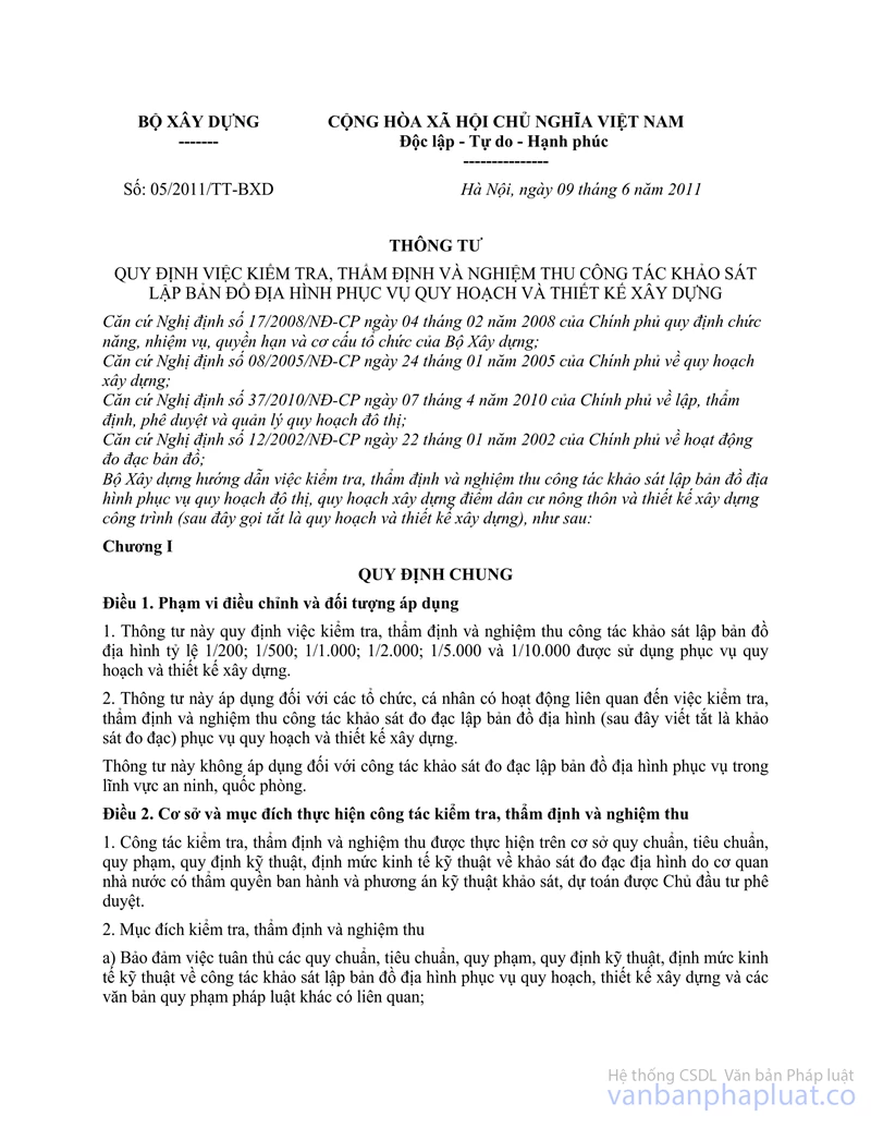
No.: 05/2011/TT-BXD |
Hanoi, June 09, 2011 |
CIRCULAR
REGULATING INSPECTION, APPRAISAL AND ACCEPTANCE OF THE SURVEY OF MAKING TOPOGRAPHIC MAP FOR PLANNING AND CONSTRUCTION DESIGN
Pursuant to Decree No.17/2008/ND-CP dated February 04, 2008 of the Government regulating functions, duties, powers and organizational structure of Ministry of Construction;
Pursuant to Decree No.08/2005/ND-CP dated January 24, 2005 of the Government on construction planning;
Pursuant to Decree No.37/2010/ND-CP dated April 07, 2010 by the Government on the formation, appraisal, approval and management of urban planning;
Pursuant to Decree No.12/2002/ND-CP dated January 22, 2002 of the Government on cartography activities;
Ministry of Construction guides inspection, appraisal and acceptance of the survey of making topographic map for urban planning, construction planning of rural residential area and construction design (hereinafter referred to as planning and construction design), as follows:
Chapter I
GENERAL PROVISIONS
Article 1. Scope of governing and application subjects
1. This Circular provides for the inspection, appraisal and acceptance of the survey of making topographic map of 1/200; 1/500; 1/1,000; 1/2,000; 1/5,000 and 1/10,000 to use for planning and construction design.
2. This Circular applies to organizations and individuals engaged in activities related to the inspection, appraisal and acceptance of the survey of making topographic map (hereinafter referred to as measurement survey) for planning and construction design.
This Circular does not apply to the measurement survey of making topographic map for the field of security and defense.
Article 2. Bases and purposes of the inspection, appraisal and acceptance
1. The inspection, appraisal and acceptance is done on the basis of regulations, standards, regulations, technical regulations and economic and technical norms on topographic measurement survey issued by the competent State agencies and the plans of survey techniques, the estimates approved by investor.
2. Purposes of inspection, appraisal and acceptance
a) To ensure compliance with regulations, standards, regulations, technical regulations, technical and economic norms on topographic measurement survey for planning, construction design and other concerned legal documents;
b) To detect errors and violations in the implementation process for timely treatment and remedy to ensure quality of topographic maps;
c) To verify the quality, volume of survey that has been completed.
Article 3. Responsibilities of the investors, contractors, and consulting organizations
1. Responsibilities of the investors
a) To implement quality management of survey including: formation and approval of survey tasks and approval of technical plans, estimates; and organization of monitoring, appraisal and acceptance of results. Where the investors are not qualified to perform the above works, hire qualified consultants as prescribed by law to perform;
b) To select qualified survey contractors in accordance with the law provisions, to organize, allocate personnel with appropriate professional skill to verify the competence of the contractor and survey managers;
c) To sign contract with the contractor, to task measurement survey and premise handover to contractor, create conditions for contractor to perform the work; to inspect, monitor and settle problems incurred (if any) during the contractor surveys; to make full payment to the contractor on the basis of volume of performance has been accepted;
d) To suspend construction or cancel part or all signed contract when the contractor fails to comply with measurement survey plan that has been approved;
đ) To take responsibility for the quality of the information and documents related to the survey provided for the Contractor;
e) To organize keeping measurement survey documents;
g) Upon receipt of the additional survey recommendations, if approved, investor supplements tasks and sign the survey contract for the arising volume with the contractor.
2. Contractor's Responsibility
a) To make task of measurement survey at the request of the investor; set up technical plans and estimates;
b) To conduct the survey in accordance with provisions, according to the business license on the basis of technical plan approved by the investor and the contract signed;
c) To appoint suitable qualified personnel to act as survey manager as prescribed by law. To allocate sufficient human resources with experience and proper expertise to conduct surveys;
d) To conduct internal inspection of technical plans and survey results before the submission to the investor; to take responsibility before investors and before law for the results of their implementation;
đ) To carry out systematic and regular supervision and inspection on the application of regulations, standards and procedures under the technical plan approved quality, volume and schedule from the beginning until completion of the work; to make report on inspection after the end of work;
e) When performing the measurement survey, if any volume occurs or the method, construction equipment is changed compared with the approved engineering plans, it must be proposed additional tasks with investors, adjusted the technical plan and is only done when the investors approve in writing;
g) To ensure safety for people, equipment, infrastructure works and other construction projects in the area, location surveyed; to protect environment, preserve landscape in the survey area; clean the field after the end of measurement survey;
h) To use machinery, equipment obtained standards and safety by the design features for the survey tested by competent authority. Not to use the equipment and measuring instruments that have not been tested, have the wrong features or the use life expired as prescribed;
i) To organize survey recordkeeping;
k) To perform the confidentiality according to provisions of the State for the documents with the security requirements related to the survey (if any);
l) To pay compensation for damage caused by the improper performance of survey tasks and technical plans approved or inappropriate use of the information, documents, regulations and standards to falsify the results, to arise the volume of surveys and other acts of damage caused by their fault.
3. Responsibility of consulting organizations in case the investors hire consultants to perform some or all of the works related to: inspection, monitoring, appraisal, and acceptance of survey work, the consulting organization is responsible for:
a) To fulfill the tasks required by investors reflected in economic contracts;
b) To appoint persons with appropriate skills to perform inspection, monitoring, appraisal and acceptance of survey work;
c) To inspect the conformity of the capability condition of the survey contractor, survey managers, the equipment that the contractor has committed with investor in the tendering dossier or in the contract signed;
d) To supervise the entire process of survey done in the field and in the room according to the approved technical plans;
đ) To appraise and accept to verify volume and quality of survey items for used as the bases for investor to make settlement;
e) To take responsibility before the investor, the law on the quality and volume of work survey. To compensate for damage if it is not detected that the contractor make improper performance of approved technical plan leading to actual results not meeting the requirements of the task and required to resurvey, make additional survey or other acts causing damage due to its fault.
Chapter II
DETAILED PROVISIONS
Article 4. Regulations on inspection
1. The contents of inspection of investors
a) To inspect the Contractor's capacity, the capacity of survey managers and personnel to perform the bidding package in accordance with tendering dossier and the provisions of relevant laws;
b) To inspect the equipment for conformity with the tendering dossier, to inspect records of testing of machinery and related technical equipment used for survey work;
c) To inspect quality of processing and install the standard landmarks, landmarks controlling high level and coordinates used in the measurement;
d) To inspect the safety assurance for people, equipment, infrastructure works and other construction projects in the area, locations of survey; the implementation of environmental protection, maintenance of landscapes in area and restoration of the original status after the end of the field survey of the contractor;
đ) To inspect the progress to implement the approved plans and contract’s provisions.
2. Content of inspection of the Contractors
a) To inspect the staff gage, machines and concerned technical equipment, measurement books, log books and other documents by technical requirement on cartography used for survey;
b) To inspect the quality and volume of the works done in the field (field), in the room (office) under the approved technical plan on conformity with the provisions of the construction standards of land surveying in the work construction and related industry standards. Contents of the field and office inspection shall follow Appendix 1 attached to this Circular;
c) To inspect the safety assurance for people and equipment in the survey process;
d) To inspect the progress of performance under the approved survey plan.
Article 5: Rules on the appraisal
1. The legal bases for appraisal
a) Technical plans - cost estimates approved by investor;
b) The regulations and standards and other related legal documents on survey of making the topographic map;
c) The other concerned legal documents.
2. Dossier submitted for appraisal
a) Written submission by the form stipulated in Appendix 2 attached to this Circular;
b) Capacity dossier of organization and individual participating in the implementation of the survey; contract; technical plan has been approved by investor;
c) Summary report on engineering of work surveyed (including drawings and explanations)
d) The concerned legal documents.
3. Contents of the appraisal
a) The contractor's capability condition and capacity to practice of the survey project manager as prescribed;
b) The application of regulations, standards and other concerned legal documents on survey of making the topographic map;
c) Measuring range and volume of practical performance;
d) The quality of works done in the field (field) including:
- Materials of testing machines, staff gage and other concerned technical equipment; the kinds of measurement books, the log books in the process of measuring connection of coordinates, altitude, mapping grid, measuring detailed topographic maps; quality of landmarks controlling high-level and coordinates;
- Documents, diagrams of landmarks system, the accuracy of the landmarks by standards and regulations of application, diagrams of mapping grid, diagrams of calculation, adjustment, measurement documents to control field images (if any);
- The accuracy of the contour and height of certain terrain, characterized ground objects such as housing and buildings, transport, irrigation systems, pipelines, high voltage transmission lines, telephone, lakes, rivers ... and other observed geological, physical phenomena such as faults, landslides, caster ... in the survey area;
đ) Quality of the works done in the room (office) including:
-The accuracy, synchronization, rationality, logicality of the documents, the parameters of reference, the division of map into pieces;
- Symbols of drawings, symbols of terrain by standards and regulations on topographic mapping; the accuracy, completeness showing the content factors by the symbols, revision of drawings as prescribed : line, dimensions, symbols, typefaces; precision on location of objects, the continuity of the line elements, the accuracy of high-level installation for geographical factors, the quality of the regions, or border ...
-The displaying of topography, the terrain compared with the high-level of the notes, the mutual position of the important terrain;
- Diagram of fragmentation; diagram of mapping grid; misclosure of forms, polar, the other conditions; road misclosure, the independent coupling loop (if any) for measuring high extradition, gravity;
- Documents calculating plane, altitude, valuating the accuracy of coordinates, altitude;
- The results of calculation and adjustment of block printed on paper and in data files;
- Statistical book of area (on paper and on CD; DVD ...);
- File recording the original map data (recorded on CD; DVD ...);
- File recording data of terrain model (recorded on CD; DVD ...);
The contents of the technical report are in accordance with the requirements of procedures, regulations, technical regulations, including the sufficiency and reasonability in explanations, the appendices with contents corresponding to words; clearly presented, clean, beautiful and complied with regulations.
e) Based on the ratio of the map, the level of difficulty of the conditions of terrain, geophysical objects, contract between the investor and survey contractor, the appraisal organization may consider part or all of the main points specified in point d and đ of this clause.
4. The appraisal results are the bases for investor to accept topographic map product.
5. Appraisal agency: Department of Construction shall appraise the topographic maps for construction planning; for the absence of local capital, the investment-deciding agency shall be responsible for organizing the appraisal; maps for designing work construction shall be appraised by investors.
In case of necessary, the appraisal agencies and organizations can hire consultants to verify some or all of the contents as prescribed in clause 3 of this Article.
Article 6: Regulations on acceptance
1. Content of acceptance
a) The volume performed gained the technical quality compared with the volume approved in the technical plans of survey and estimate;
b) The degree of difficulty of the conditions of topography, terrain for work items.
2. Dossiers for acceptance include
a) Minutes of certifying boundary of survey by the form in Appendix 3, issued together with this Circular;
b) Report on the inspection of survey of the contractor by the form in Appendix 4, issued together with this Circular;
c) A record of delivering surveying landmark constructed between the investor and contractor of survey by the form in Appendix 5, issued together with this Circular;
d) A written appraisal of quality, volume of survey of appraisal agencies, organizations;
đ) Minute of acceptance on the completion of works of investor by the form in Appendix 6, issued together with this Circular;
e) Dossier of measurement survey has been signed and sealed by the Contractor.
3. Acceptance period is not in access of fifteen (15) working days after the investor receives complete, valid dossier; acceptance results must be made into minute. Form of minute of dossier handover of measurement survey is according to Appendix 7, issued together with this Circular.
Article 7: Costs of inspection, appraisal, and acceptance
1. Costs of inspection, appraisal, and acceptance are included in the total investment of survey estimate and paid by the investor.
2. The cost is calculated by estimating according to the regulations on cost management and the provisions of Circular No.04/2007/TTLT-BTNMT-BTC dated February 27, 2007 guiding the formation of funding estimates of map measurement and land management.
Chapter III
ORGANIZATION OF IMPLEMENTATION
Article 8: Organization of implementation
1. Urban Development Department assists the Minister of Construction to check regularly, periodically the implementation of the contents specified in this Circular in the whole country.
2. Ministers, heads of ministerial-level agencies, governmental agencies; and presidents of the People's Committees of provinces and centrally-run cities shall direct the units, organizations to perform the survey of topographic map for planning and construction design; the units, other relevant organizations under their management to implement this Circular.
Article 9. Implementation provisions
1. This Circular takes effect as from July 25, 2011.
2. In the course of implementation, if any difficulties and problems arise, the organizations and individuals should submit comments to the Ministry of Construction for study and settlement./.
|
|
FOR
MINISTER |
APPENDIX 1
CONTENT OF INSPECTION OF QUALITY AND VOLUME OF
CONTRACTOR OF MEASUREMENT SURVEY
(Issued together with Circular No.05 /2011/TT-BXD, June 09, 2011 of Ministry
of Construction)
Based on the ratio of the map, the level of difficulty of the conditions of terrain, terrain and workload in approved technical plans of measurement survey, inspection content may include:
1. The field inspection (field)
- Materials testing machines, staff gage, and concerned technical equipment.
- All kinds of measurement books, log books and concerned documents during the measurement to connect coordinates, altitude, measuring grid, detailed measurement.
- Establishment of control grid, grid increased thickness of plain and high level for the survey.
- Selection of measurement line, the measurement location, quantity, location of lines and locations of measurement with design.
- Layout diagram and design of all kinds of landmarks, casting of landmarks: types, quality and specifications of landmarks; fixing landmarks in the ground: the method of fixing and placing landmarks.
- Fragmentation diagram of construction, diagram of measurement grid, connection measurement graph, and measurement line compared to the design.
- Checking measurement of high-level, coordinates, gravity (if any). Inspection of the soil form compared with high level of the notes, topographical shape, mutual position of the important terrain.
- The results of calculation and summary of measurement result, methods of measuring and evaluating accuracy of measurement result, the performance, the relevant documents.
2. The inspection in room (office)
- To inspect the uniformity and rationality, logicality of the documents.
- The using software: data processing software of grid controlling the drawing measurement area; graph editing software; software compiling the symbols and notes on the map; software drawing the contour; software digitizing topographic maps.
- The diagram of calculations, the premises adjustment, high-level; calculation documents.
- Misclosure of forms, polar, the other conditions; road misclosure, the independent coupling loop (if any) for measuring high-levels, gravity.
- The parameters of reference, division of the map into pieces.
- The angle of the frame, frame size, frame bias of map pieces, grid of kilometers, and transfer of detailed points into field, geographic coordinates.
- The accuracy, detail and completeness of the map which shows the content elements under the symbols, amendment of drawings in accordance with provisions: to attach attributes to objects, precision of location of objects, continuity of the line elements, the accuracy of the attachment of high-level value for the geographical factors, the quality of the areas, or the border ...
- The consistency of folder name, file name; form of digital data, the structure of the group, class, object code; data recorded on CD: the number of files and quality of the files.
- Once digitization, setting, transferring the map from the HN-72 to VN-2000, it needs to check: image file quality scanning documents and maps; results calculated to move coordinates of points to set images; quantity of setting points; error of setting images; boundary of set images; digitized content compared to the original map; the unity of the after-digitized maps and moving to VN-2000.
- Map draw bar: the accuracy, completeness of contents compared to the original compilation, symbol of editing instructions; line, symbol size, typefaces if the draw bar is separated from its color, the accuracy of the content separation according to color and position correlation between the factors on the separations.
- Technical report: content of technical report is in accordance with regulatory requirements, technical process; completeness, legality and reasonableness of the documents; the appendices with contents corresponding to the words; present statements in accordance with provisions.
APPENDIX 2
(Issued together with Circular No.05 /2011/TT-BXD, June 09, 2011 of Ministry of Construction)
|
INVESTOR |
THE
SOCIALIST REPUBLIC OF VIETNAM |
.........., date......... month......... year..........
STATEMENT
APPRASAL OF MEASUREMENT SURVEY OF MAKING TOPOGRAHIC MAP
To: (Name of agency, organization to conduct appraisal)
- Pursuant to Circular No. ... / ... 2011/TT-BXD on… of the Construction Ministry on regulating the inspection, appraisal, and acceptance of the survey of making topographic map for planning and construction design;
- Other concerned legal bases.
Investor submits for appraisal of the measurement survey of making topographic map with the following contents:
1. Project’s name: .......................................................................................
2. Investor: .....................................................................................
3. Survey contractor: ............................................................................
4. Survey manager: .........................................................................
5. Target (for planning, design of construction): ...........................
6. Content and scale (if ratio of map, area of measurement): ........................
7. Survey Location: ...........................................................................
8. Investment capital: ...........................................................................
9. Implementation period: .........................................................................
10. Other contents: .........................................................................
11. Conclusion: .......................................................................................
Investor submits ... (name of agency, organization to conduct appraisal) for appraisal of the survey of making topographic map./.
|
Recipient: |
INVESTOR |
APPENDIX 3
(Issued together with Circular No.05 /2011/TT-BXD, June 09, 2011 of Ministry of Construction)
THE
SOCIALIST REPUBLIC OF VIETNAM
Independence– Freedom – Happiness
---------------------------
….…, date …… month …….. year ……..
MINUTE
CERTIFICATION OF BOUNDARY TO CONDUCT MEASUREMENT SURVEY OF MAKING TOPOGRAPHIC MAP
- Based on the technical plan of measures survey to be approved in Decision No. ........ / QD, day ... month ... year ....;
- Pursuant to the written appraisal of the measurement survey quality of ... (name of appraisal organization);
- Pursuant to the dossiers of measurement survey product of topographic map made by (name of the survey contractor); Today, date ... month ... year .... at ......
The two parties are:
1. Representative of investor: ......................................................................
Mr. (Ms.): ........................................ Position: .................................
2 Representatives of contractor: .........................................................................
Mr. (Ms.): ....................................... Position: .................................
Shall certify the volume and boundary of measurement survey including:
1. To certify survey volume: ............................ (ha), increased (or decreased) compared with measurement survey tasks .... (ha).
2. The boundary of position using planning (or construction design) is determined as follows:
- The North is next to ...........................
- The East is next to........................
- The West is next to ...........................
- The South is next to ......................... (Attached to drawing)
This Minute is made into 06 copies, 03 copies for each party as a basis for appraisal, acceptance and settlement between investor and contractor of measurement survey./.
|
REPRESENTATIVE
OF CONTRACTOR |
REPRESENTATIVE
OF INVESTOR |
APPENDIX 4
(Issued together with Circular No.05 /2011/TT-BXD, June 09, 2011 of Ministry of Construction)
|
NAME
OF SURVEY CONTRACTOR |
THE
SOCIALIST REPUBLIC OF VIETNAM |
(Place name), date….. month…. year .......
REPORT
INSPECTION OF THE MEASUREMENT SURVEY OF MAKING TOPOGRAPHIC MAP, RATIO OF . . . . . OF CONTRACTOR
I. Situation of project performance
1. Name of project:……………………………………………………………………
2. Location:…………………………………………………………………………..
3. Construction unit:…………………………………………………………………..
4. Implementation duration: from month ... year ..... ..to month ... year…….....
5. Equipment of measurement survey:………………………………………………………..
6. Workload:…………………………………………………………...
|
No. |
Names of work items |
Unit |
Quantity |
Note |
|
|
By method |
Construction in reality |
||||
|
1 2 3 |
|
|
|
|
|
7. Materials used in construction:
(Indicate clearly the source of the materials used in the map measurement survey process, the landmark of original coordinates, base crossover grid).
8. Organization of implementation:
II. Content of inspection
1. Legal basis for inspection:
- Technical plans of measurement survey have been approved by the investor (state clearly the name of document, number, date, month, and year of Decision, the agency issuing the Decision).
- The legal documents, technical procedures, and inspection rules applied during the examination of product (specify number, date, month and year of Decision, the agency issuing the Decision).
2. Participants in the inspection and acceptance: (specify full names and positions of participants in acceptance test).
3. The content and level of examination: (specify the content and level of testing each item of work under the guidance in Appendix 1).
4. Quality testing results: (specify quality testing results of each item of work).
III. Conclusions and recommendations:
- On the volume completed:
- On quality (product’s name) was constructed meeting technical requirements according to regulations, standards, procedures and technical regulations applicable to the works and technical plan - estimates approved.
- Recommendations: the existing contents and the proposal of remedies./.
|
|
REPRESENTATIVE
OF CONTRACTOR |
APPENDIX 5
(Issued together with Circular No.05 /2011/TT-BXD, June 09, 2011 of Ministry of Construction)
THE
SOCIALIST REPUBLIC OF VIETNAM
Independence– Freedom – Happiness
-------------------------------
MINUTE OF HANDOVER OF SURVEYING LANDMARKS CONSTRUCTED
Work (prroject): ……………..………………………………………..
Today, date.......month....... year …. at ………………………………
The two parties include:
1. Representative of investor (receiver)……………………………………………….
Mr.(Ms.) :………………………………………………………………………………
Position:………………………………………………………………………………..
2. Representative of contractor: (deliverer)………………………………………………….
Mr.(Ms.) :………………………………………………………………………………
Position:………………………………………………………………………………...
Have conducted handover of volume of landmarks constructed, used in measurement, drawing of making topographic map with ratio of. . . at the field including:
|
No. |
Symbol of landmarks |
Coordinates |
High-level |
|
|
X (m) |
Y (m) |
Z (m) |
||
|
1 |
|
|
|
|
|
2 |
|
|
|
|
|
…. |
|
|
|
|
|
…. |
|
|
|
|
The surveying landmarks have been ensured quality, class, and specification as prescribed by construction contractor at site.
|
REPRESENTATIVE
OF CONTRACTOR |
REPRESENTATIVE
OF INVESTOR |
APPENDIX 6
(Issued together with Circular No.05 /2011/TT-BXD, June 09, 2011 of Ministry of Construction)
THE
SOCIALIST REPUBLIC OF VIETNAM
Independence– Freedom – Happiness
-------------------------------
MINUTE OF ACCEPTANCE OF THE MEASUREMENT OF MAKING TOPOGRAPHIC MAP
(Name of project, ratio of map)
Pursuant to the contract between the investor and contractor of survey No. . . signed on ...;
- Pursuant to a written certification of survey conducting boundary to make topographic map of (name of the investor) date . . .;
- Based on the handover minute of surveying landmark at site between the investor and contractor of survey, date.. .
- Based on reports on survey quality inspection of ... (name of contractor);
- Pursuant to the written appraisal of the quality, quantity of survey of the appraisal agency;
- Based on the acceptance minute of phase (if any);
- Pursuant to measurement survey dossier made by the survey contractor. The two parties are:
1. Representatives of the investor:
Mr. (Ms.):………………………………… Position:……………………………
2. Representatives of the contractor: ………………………………………………………
Mr. (Ms.):………………………………… Position:……………………………
Conducting the acceptance of the measurement survey of making topographic map for master plan (or design project) .............................. with the following contents:
- (Product’s name) is delivered in full accordance with the contract.
- Volume: (list the names of works and quantity of work performed, the level of difficulty of the condition of terrain, ground objects).
- Quality: (name of map) was constructed meeting technical requirements according to regulations, standards, applicable survey procedures, and technical regulations approved.
|
REPRESENTATIVE
OF CONTRACTOR |
REPRESENTATIVE
OF INVESTOR |
APPENDIX 7
(Issued together with Circular No.05 /2011/TT-BXD, June 09, 2011 of Ministry of Construction)
THE
SOCIALIST REPUBLIC OF VIETNAM
Independence– Freedom – Happiness
------------------------------
MINUTE OF DOCUMENTS HANDOVER
Work (project): ……………………………………
Date..........month ...... year……. , at ……………………………………………...
……………………………………………………………………………………………
1. Representative of the delivery party: (name of measurement, survey contractor)
Mr. (Ms.):……………………………………………………………………………….
Position:……………………………………………………………………………….
2. Representative of the receiving party: (name of investor)
Mr. (Ms.):……………………………………………………………………………….
Position:……………………………………………………………………………….
Have conducted the handover of documents ....., handover dossier includes:
Handover dossier includes:
- Explanation of technical Report .... book
- The set of topographic map printed on Troky paper with rate of ..... .... sets
- The CD disk contains the contents of the report, map .... disk
This minute is made into 06 copies, 03 copies for each party as a basis for contract payment./.
|
REPRESENTATIVE
OF CONTRACTOR |
REPRESENTATIVE
OF INVESTOR |