Decision No. 05/2011/QD-TTg approving the master plan on transport development đã được thay thế bởi Decision No. 2053/QD-TTg approving the adjusted master plan on transport development và được áp dụng kể từ ngày 23/11/2015.
Nội dung toàn văn Decision No. 05/2011/QD-TTg approving the master plan on transport development
|
THE
PRIME MINISTER |
SOCIALIST
REPUBLIC OF VIET NAM |
|
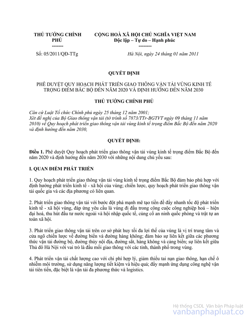
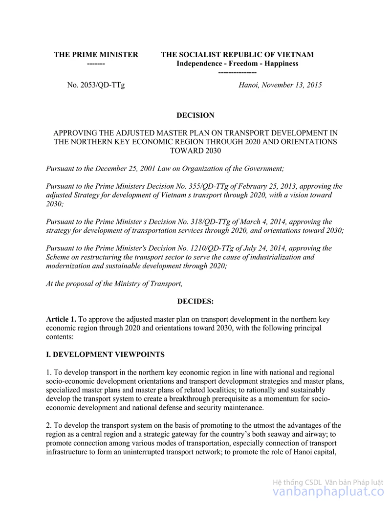
No. 05/2011/QD-TTg |
Hanoi, January 24, 2011 |
DECISION
APPROVING THE MASTER PLAN ON TRANSPORT DEVELOPMENT IN THE NORTHERN KEY ECONOMIC REGION THROUGH 2020 AND ORIENTATIONS TOWARDS 2030
THE PRIME MINISTER
Pursuant to the December 25.
2001 Law on Organization of the Government;
At the proposal of the. Ministry of Transport (Report No. 7873/Tlr-BGTVT of
November 9, 2010) regarding the master plan on transport development in the
northern key economic region through 2020 and orientations towards 2030,
DECIDES:
Article 1. To approve the master plan on transport development in the northern key economic region through 2020 and orientations towards 2030, with the following principal contents:
I. DEVELOPMENT VIEWPOINTS
1. The master plan on transport development in the northern key economic region must be in line with the regional socio-economic development orientations as well as national and local transport development strategies and plans.
2. To develop transport with strong breakthroughs as a prerequisite for accelerating regional socio-economic development so that the region can lead in the cause of industrialization and modernization, foreign investment attraction, international integration, and security, national defense and social order and safety maintenance.
3. To develop transport on the basis of promoting to the utmost the advantages of the region as a central region and a strategic gateway for both seaway and airway; to ensure linkage between road, inland waterway, railway, airway and airport transportation; and linkage between Hanoi capital as a transport hub and provinces and cities in the region.
4. To develop high-quality transportation at reasonable costs, reduce traffic accidents, limit environmental pollution and conserve energy; to step up the application of advanced transportation technologies, especially multimodal transportation and logistic services.
5. To attach importance to maintenance work for thoroughly tapping the capacity of existing transport infrastructure; to concentrate investment in urgent important works with priority given to those that help ease traffic congestion.
6. To strongly develop urban transport, especially in Hanoi capital. To closely link national and local transport systems, attaching importance to developing local transport, especially rural transport.
7. To mobilize all resources at home and abroad and encourage all economic sectors to invest in transport development in different forms.
8. To promote human resource advantages, apply advanced science and technology and enhance international cooperation in developing regional transport as a core for developing the entire transport sector.
9. To reserve a reasonable land fund for developing transport infrastructure and further assure traffic safety corridors.
II. DEVELOPMENT OBJECTIVES
E Development objectives through 2020
a/ Transportation: To meet the needs for cargo and passenger transportation with quality, safety and convenience and reasonable charges, control and reduce traffic accidents and limit environmental pollution on the basis of organizing rational transportation and strongly developing mass transit in urban centers, multimodal transportation and logistic services. Specific targets include:
The entire region's transportation volume will reach 450-500 million tons of cargo and 700-800 million passengers per year with an annual average growth rate of 9-10%. of which the volume of cargo to be handled at regional seaports will be 115-160 million tons/year, and the number of passengers to pass regional airports will be 25 million/year. Urban mass transit in Hanoi will account for 35%, in Hai Phong and other equivalent urban centers. 15-20%.
b/ Infrastructure facilities:
To upgrade the existing system of national highways up to prescribed technical standards; to accelerate the construction of expressways, striving to complete the construction of around 500 km of expressways by 2020. To upgrade provincial roads up to prescribed technical standards and build some new necessary routes. To further develop rural transport so that 80% of rural roads will he concreted.
To complete the renovation and upgrading of existing railway networks up to grade-1 national railway standards; to link, railways with international seaports, factories, economic zones, mining areas and major tourist centers. To rapidly develop large-volume iron-wheel transportation routes in urban centers, especially in Hanoi capital. To upgrade the Hanoi-Hai Phong railway into a electrified double-track railway. To complete the Yen Vien-Pha Lai-Ha Long-Cai Lan railway. To invest at an appropriate time in the Lao Cai-Hanoi-Hai Phong and Dong Dang-Hanoi railways and the north-south express railway.
To step by step upgrade and expand the system of seaports to meet cargo handling requirements in each period. To build some deep-water wharves up to international standards in Lach Huyen for ships of up to 100.000 DWT. and in Cai Lan for ships of up to 50,000 DWT. To develop on island districts ports of appropriate size to meet development needs and ensure security and national defense. To combine renovation and upgrading of navigable channels to ensure convenience for ships to enter and leave wharves and compatibility with wharf sizes.
To upgrade inland waterways currently under regional management up to prescribed technical standards for ships to operate round-the-clock, and strive to increase the length of such inland waterways. To build new Plui Dong container port and major passenger ports in Hanoi, Hai Phong and Quang Ninh. To shift Hanoi port to mainly serve tourism in combination with the loading of clean cargo.
To upgrade and expand existing airports to meet demand in each period and step by step build new airports under planning. To complete Noi Bai T2 terminal before 2015. To study the construction of Tien Lang airport and put it into operation when Cat 13i airport operates at full capacity.
For Hanoi capital, to upgrade and expand existing urban transport infrastructure works and concurrently manage the maintenance of such works for efficient use.. To accelerate the construction of key works, including urban trunk roads, centripetal roads, bell roads, high-volume iron-wheel routes, and sialic traffic systems under the planning on expanded Hanoi capital for easing traffic congestions and meeting people's (ravel needs. To strive to reserve 15% of land areas for urban traffic.
For Hai Phong city and other cities and towns, to complete plans on. and step by step develop, urban transport infrastructure works and mass transit to meet people's needs.
2. Development orientations towards 2030
To satisfy social needs for transportation and transportation services up lo international standards, with high quality, fast, safety, and reasonable and competitive charges. To ensure convenient transfer among modes of transportation and among provinces and cities in the region with the whole country and countries worldwide.
To basically complete and modernize the transport infrastructure network. To further develop transport infrastructure facilities under planning.
III. DEVELOPMENT PLANNING
1. Transportation development
To organize rational transportation on some major corridors, including:
- North-south corridor, with 4 modes of transportation: road, railway, seaway and airway. Long-distance cargo transportation will be mainly by sea and rail. Long-distance passenger transportation will gradually shift to railway and airway. Short-distance and intra-provincial transportation of cargo and passengers will be mainly by road.
- Hanoi-Hai Phong corridor, with 3 modes of transportation: road, railway and inland waterway. Passengers will mainly use road while cargo will be transported by road, rail and river.
- Hanoi-Quang Ninh corridor, with 3 modes of transportation: road, railway and inland waterway. Passengers will mainly use road and railway while cargo will be transported by road, rail and river.
- Hanoi-Lao Cai corridor, with 3 modes of transportation: road, railway and inland waterway. Due to terrain conditions, cargo and passengers will be transported mainly by road and rail.
- Hanoi-Lang Son corridor, with 2 modes of transportation: road and railway. Road transportation will be the overwhelming mode for both cargo and passengers.
- Ninh Binh-Hai Phong-Quang Ninh corridor, with 2 modes of transportation: road and inland waterway, of which road transportation be the overwhelming mode.
2. Transport infrastructure development
a/ Roads
Highways
- Thang Long boulevard: from Trung Hoa junction to national highway 21A in Hoa Lac (Hanoi), 30 km long. 6 high-speed lanes and 2 urban roads on both sides.
- Hanoi-Hai Phong expressway: from belt road III (Hanoi) to Dinh Vu dam (Hai Phong city). 105.5 km long, 6 lanes.
Tan Vu-Lach Huyen section: from Tan Vu junction to Lach Huyen gateway port (Hai Phong city), 16-17 km long. 4 lanes in phase I. and 6 lanes in phase IT, of which the Dinh Vu bridge-Cat Hai section is around 5 km long as a sea-crossing bridge.
- Hanoi-Viet Tri-Lao Cai expressway: from Noi Bai-Ha Long high-speed junction with national highway 2 (Hanoi) to Quang Kim commune (Bat Xat district, Lao Cai province), 264 km long (of which (he section within the northern key economic region is around 60 km long), 4 lanes in phase I and 6 lanes in phase II.
- Hanoi-Thai Nguyen expressway: from km 152+400 on new national highway IA in Ninh Hiep (Gia Lam district, Hanoi) to km 61+313 on national highway 3 in Thinh Dan (Thai Nguyen city), 61.3 km long (of which the section within the northern key economic region is 35 km long), 4 lanes in phase I and 6 lanes in phase II.
- Lang Son-Bac Giang-Bac Ninh expressway: from Huu Nghi border gate (Lang Son province) to Nhu Nguyet bridge (Bac Ninh province). 130 km long (of which the section within the northern key economic region is 11 km long). 4-6 lanes.
- Noi Bai-Ha Long expressway: from Bac Ninh city (Bac Ninh province) to Ha Long city (Quang Ninh province). 136 km long, 4 lanes in phase I and 6 lanes in phase II.
- Ha Long-Mong Cai expressway: from Ha Long city to Mong Cai (Quang Ninh province), 128 km long, 4-6 lanes.
- Phap Van-Gie bridge expressway (belonging to the north-south expressway): from Phap Van junction (Hanoi) to km 210 on national highway 1A (Ha Nam province). 32.3 km long. It currently has 4 lanes and is planned to have 6 lanes.
- Hoa Lac-Hoa Binh highway: from Hoa Lac junction (Hanoi) to Hoa Binh city (Hoa Binh province). 26 km long (of which the section within the northern key economic region is around 15 km long). 6 lanes.
Doan Hung-Hoa Lac-Pho Chau expressway (belonging to the western north-south expressway): from Doan Hung (Phu Tho province) to Pho Chau (Ha Tinh province), 457 km long (of which the section within the northern key economic region is 40 km long), 4-6 lanes.
- In the post-2020 period, to study the construction of the Ninh Binh-Hai Phong-Quang Ninh coastal expressway: from Ninh Binh city (Ninh Binh province) to Ha Long city (Quang Ninh province, 160 km long (of which the section within the northern key economic region is around 80 km long), 4 lanes.
National highways from Hanoi
- National highway 2: from km 13+600 (the boundary between Hanoi and Vinh Phuc province) to Thanh Thuy border gate (Ha Giang province) at km 312+500, which is 310 km long (of which the section wilhin the northern key economic region is 50.6 km long), The 17-km section from km 13+600 to km 30+600 is already up to grade-II road standards, with 4 lanes. The remaining section will be upgraded at least up to grade-III road standards, with 2 lanes. The sections running through heavy-traffic areas will reach grade-I or -II road standards, with 4-6 lanes.
- National highway 5: from Nhu Quynh (Hung Yen province) at km 11 + 135 to Dinh Vu (Hai Phong city) at km 106+300, which is 95.2 km long, will be maintained at grade-II road standards, with 4 lanes.
- National highway 6: from Ha Dong (Hanoi) to Muong Lay (Lai Chau province). 512 km long (of which the section within the northern key economic region is 34 km long), will be upgraded up to grade-I or -II road standards, with 4-6 lanes.
- National highway 32: from Son Tay-Hanoi (km 41) to Binh Lu (Lai Chau province), 393 km long (of which the section within the northern key economic region is 22 km long), will be upgraded up to grade-III road standards. with 2 lanes.
Urban belt roads
- Belt road III. Hanoi: Noi Bai-Mai Dich-Thanh Xuan-Phap Van-Thanh Tri bridge-Sai Dong-Ninh Hiep-Viet Hung-Dong Anh-Tien Duong-Nam Hong. 55 km long, as an urban road with a median high-speed lane.
- Belt road IV (regional belt road): linking satellite industrial-urban zones surrounding Hanoi capital, including Phuc Yen (Vinh Phuc province): Me Linh; Hong Ha (Dan Phuong); Duc Thuong and An Khanh (Hoai Duc); Yen Nghia (Ha Dong); Thuong Tin (Hanoi); Me So and Nhu Quynh (Hung Yen province); Tien Son and Yen Phong (Bac Ninh province); Hiep Hoa (Bac Giang province): Pho Ni. on national highway 2 at around km 11 +300 (Hanoi), around 125 km long. 6-8 lanes.
Belt road V (regional belt road): linking satellite cities and towns surrounding Hanoi, including Vinh Yen-Son Tay-Hoa Lac-Xuan Mai-Mieu Mon-Phu Ly-Thai Binh-Hai Duong-Chi Linh-Bac Giang-Thai Nguyen, around 320 km long, grade-I road standards. 4-6 lanes.
Other national highways
- National highway 10: from Long Bi (Quang Ninh province) to Hoang Hoa (Thanh Hoa province), 228 km long (of which the section within the northern key economic region is 58.2 km long), will be upgraded up to grade-TT road standards, with 4 lanes.
- National highway 18: from the junction with national highway 1A in Dai Phuc (Bac Ninh province) to Bac Luan bridge (Quang Ninh province), 303 km long; to upgrade 124-km Mong Duong-Mong Cai (Quang Ninh province) up to grade-Ill road standards with 2 lanes; to expand the 30-km Dong Bi-Tuan Chau (Quang Ninh province) section up to grade-II road standards, with 4 lanes.
- National highway 18C: from Tien Yen bridge to the Vietnam-China border (Quang Ninh province), 50 km long, will be upgraded up to grade-III road standards, with 2 lanes.
- National highway 38: from Bac Ninh city (Bac Ninh province) to Dau market (Ha Nam province), 81 km long (of which the section within the northern key economic region is 55 km long), will be upgraded up to grade-III road standards, with 2 lanes.
- National highway 39: from Pho Noi (Hung Yen province) to Diem Diet] (Thai Binh province). 108 km long (of which the section within the northern key economic region is 50.2 km long), will be upgraded up to grade-Ill road standards, with 2 lanes.
- National highway 21: from Son Tay town (Hanoi) to Hai Thinh (Nam Dinh province). 210 km long (of which the section within the northern key economic region is 46 km long), will be upgraded up to grade-Ill or -IV road standards, with 2 lanes.
- National highway 2IB: from Phu Lam (Hanoi) to 13a Da bridge (Ha Nam province). 59 km long (of which the section within the northern key economic region is 41.6 km long), will be upgraded up to grade-III road standards. with 2 lanes.
- National highu ay 2B: from Doc Lap to Tarn Dao (Vinh Phuc province), 25 km long. To upgrade intra-city sections up to urban road standards and remaining sections up to grade-IV road standards, with 2 lanes.
- National highway 2C: from Son Tay (Hanoi) to Son Duong (Tuyen Quang province), 141 km long (of which the section within the northern key economic region is 44.9 km long), will be upgraded up to grade-Ill road standards, with 2 lanes.
- Hanoi-Hai Phong and Gie bridge-Ninh Binh express routes: from Hanoi-Hai Phong express junction and national highway 39 to the left of this highway. 2-4 km from Hung Yen city, crossing Pho I lien University of Culture, passing the Red River, with the same direction with that of provincial road 449, to Liem Tuyen junction (Gie bridge-Ninh Binh expressway). 47.7 km long. grade-II road standards, 4 lanes in phase I and 6 lanes in phase II. Regional linkage axes
- Belt roads:
National highway 4 system, including national highways 4A, 4B, 4C. 4D and 4E, from Quang Ninh province to Lai Chan province, around 687 km long (of which the section within the northern key economic region is 27 km long), will be step by step upgraded at least up to grade-IV road standards, with 2 lanes.
Section linking national highway 4B with Van Don economic zone (Quang Ninh province): from Tien Yen running west of Cai Bail island (the major island of Van Don economic zone) to existing Van Don bridge, around 32 km long. grade-Ill road standards. 2 lanes in phase I and 6 lanes in phase II.
National highway 279: from Bai Chay (Quang Ninh province) to Tay Trang (Dien Bicn province). 744 km long (of which the section within the northern key economic region is 42.5 km long), will be upgraded at least up to gradc-IV road standards, with 2 lanes.
National highway 37: from Diem Dien (Thai Binh province) to Co Noi (Son La province), 485 km long (of which the section within the northern key economic region is 85.3 km long), will be upgraded at least up to gradc-IV road standards, with 2 lanes in mountainous areas; and grade-Ill road standards, with 2 lanes in densely populated and delta areas.
- Coastal road: from Nui Do port and Mai Ngoc in Binh Ngoc commune, Mong Cai city (Quang Ninh province) to Ha Tien border gate in Ha Tien town (Kien Giang province), around 3.041 km (of which the section within the northern key economic region is 307.5 km long), al least grade-Ill road standards, with 2 lanes.
- Ho Chi Minh road: from Pac Bo (Cao Bang province) to Dat Mui (Ca Mau province), around 3.167 km long (of which the section within the northern key economic region is 49.6 km long), grade-Ill road standards, 2 lanes in phase I and 4-6 lanes in phase IT.
On all national highways, to step by step expand the sections running through urban and densely populated areas under approved planning. To build by-pass roads in necessary urban centers. To consider the upgrading of some routes into national highways to meet practical needs and criteria of national highways provided in the Law on Road Traffic.
b/ Railways
Existing railways
- North-south railway: 1,726 km long (of which the section within the northern key economic region is 33 km long). To complete the upgrading of this railway up to grade-I national railway standards.
- Hanoi-Hai Phong railway: 106 km long. To complete the upgrading and electrification of the whole railway.
- Hanoi-Lao Cai railway: 296 km long (of which the section within the northern key economic region is 42.5 km long). To complete the upgrading of the whole railway up to prescribed technical standards.
- Hanoi-Dong Dang railway: 162 km long (of which the section within the northern key-economic region is 22.5 km long). To complete the upgrading of the whole railway up to prescribed technical standards.
-Dong Anh-Quan Trieu railway: 54 km long (of which the section within the northern key economic region is 18.5 km long). To complete the upgrading of the whole railway up to prescribed technical standards.
New railways
- Hanoi-Ho Chi Minh City express railway: 1.570 km long (of which the section within the northern key economic region is 33.5 km long). To study the construction of the Hanoi-Vinh section at an appropriate time based on capital raising needs and capacity.
- Yen Vien-Pha Lai-Ha Long-Cai Lan railway: 128 km long. To build a single-track dual-gauge railway.
- Lao Cai-Hanoi-Hai Phong railway: 381 km long (of which the section within the northern key economic region is 128.5 km long). To study the construction of an electrified double-track railway of 1.435 mm.
- Dong Dang-Hanoi railway: 156 km long (of which the section within the northern key economic region is 22.5 km long). To study the construction of an electrified double-track railway of 1,435 mm.
Tn the post-2020 period, to study the construction of the following railways: the 120-km coastal Nam Dinh-Thai Binh-Hai Phong-Quang Ninh railway up to gradc-1 single-track railway standards, and the 11a Long-Mong Cai railway up to grade-11 single-track railway standards; the 95-km Lang Son-Quang Ninh-Mui Chua railway up to grade-II single-track railway standards; and railways linking seaports and industrial parks. To completely link Hanoi capital's major railway with the Hanoi capital's inter-regional railway network.
c/ Seaways
Seaports
- Hai Phong port: This is a national general port and international holder gate (grade 1A) with the following functional zones:
Lach Huyen wharf zone: This is a major wharf zone of Hai Phong port which mainly handles containerized imports and exports on offshore routes for ships of 4,000-6,000 TEU and up to 100,000 DWT. Infrastructure and loading, managing and exploiting technologies will be modernized up to international standards. To build a logistics center in the adjacent industrial-service zone behind the harbor. Investment will focus on wharf bridges, technical infrastructure linking the national port network and the port logistics industrial-service zone. To build the zone to reach a capacity of 20.8-38.8 million tons/year.
Dinh Vu zone: This zone will mainly handle general container cargo on onshore routes for ships of 20,000-30,000 DWT. To build a special-use wharf to directly serve the zone's production-service establishment. To build the zone with a capacity of 18-20 million tons/year.
Cam river zone: This zone has the main function of handling local cargo for ships of 5,000-10.000 DWT; to step by step remove and shift the functions of the zone on the basis of reorganizing and making in-depth investment to maintain its capacity of 5-6 million tons/year. Chua Ve and Vat Cach are major wharves in this zone.
Chanh river zone (Yen Hung. Quang Ninh province): This zone is a special-use zone with a general container wharf for accommodating ships of 10,000-40,000 DWT. for Yen Hung-Nha Mac dam industrial park, for building and repairing ships using oil products (at Qua Muom islet). To build the zone with a capacity of up to 10-15 million tons/year.
Other special-use and satellite wharves will directly serve the riverside industrial-service zone and local wharves for small-sized vehicles in the region (including Diem Dicn in Thai Binh province and Hai Thinh in Nam Dinh province). To develop these wharves according to the general construction planning as satellite wharves of Hai Phong port.
- Hon Gai port-Quang Ninh: This is a national general port in the region, embracing the general wharf zone. Cai Lan container wharf and other satellite special-use wharves.
Cai Lan zone: This is a major wharf zone of Cai Lan port, which mainly handles containerized and general cargo for ships of up to 50,000 DWT and containers of up to 3,000 TEU. To complete this zone with a port logistics center as an investment focus in the planning period. To build the zone with a capacity of 15-18 million tons/year.
Satellite special-use wharves: B12 oil special-use wharf, which will be gradually relocated and transformed. The sizes of special-use wharves of cement and thermo-power plants will be kept unchanged but in-depth investment will be made to raise their capacity and minimize adverse impacts on the environment. In the long term, to limit the development of this kind of wharf in Cua Luc and Ha Long bays. To step by step develop special-use wharves for ship building and repair industries and for Cai Lan and Viet Hung industrial parks according to the general construction planning as satellite wharves of Cai Lan wharf zone. To completely build Hon Gai passenger wharf into a major wharf for international tourists and for the north-south road.
- Cam Pha porl-Quang Ninh: This port will operate as a special-use porl with a general container wharf mainly for coal mining activities of the Vietnam Coal and Mineral Industries Group, Cua Ong will be the major wharf zone to accommodate ships of 50.000-70.000 DWT at wharf bridges, and ships of 120.000 DWT in transshipment areas. To make in-depth investment but not expand south Trang bridge wharf and Cam Pha cement plant, which will be the port's satellite areas. To build the port with a capacity of 25-27 million tons/year.
- Hai Ha port-Quang Ninh: To step by step build a special-use port in association with the industrial park. In the initial phase, to build a special-use port with a general wharf for ships of 50,000-80.000 DWT. In the long term, to develop it into a major port in the region which will also handle transited cargo for southern China.
- Van Gia port-Quang Ninh: This is a local general port and a seaway gateway of Mong Cai border gate city. It consists of a transshipment area for ships of up to 10,000 DWT and satellite wharves for small-sized vehicles in Dan Tien and along Ka Long river. To build the port with a capacity of 3.5-4.5 million tons/year.
- Mui Chua, Van Hoa port-Quang Ninh: This is a local port for ships of 3.000-5.000 DWT. Mui Chua wharf is exclusively reserved for mining chemical industries, which also handles general cargo for Cao Bang and Lang Son provinces. Van Hoa general wharf will directly serve Van Don economic zone. To build the port with a capacity of 2-2.5 million tons/year.
Port channels: To dredge the outside section of the Lach Huyen wharf zone for ships of 100.000 DWT and container ships of 6.000 TEU to meet the standards of an international gateway port. The inside section in the Chanh river wharf zone will be for ships of 30,000-50.000 DWT, in the Dinh Vu wharf zone for ships of 20,000-30,000 DWT (half load draft), and in the Cam river wharf zone for ships of 10.000 DWT.
Dry ports: To build 5 dry ports in the region and economic corridor for cargo to be handled at Hai Phong and Quang Ninh ports.
- Coastal economic zone, which embraces the provinces of Thai Binh. Nam Dinh. Ha Nam. Ninh Binh and Hoa Binh, and western Hanoi, and will handle around 630.000 TEU/year.
- Hanoi-Lao Cai economic corridor, which embraces the provinces of Lao Cai, Yen Bai, Phu Tho. Vinh Phuc. Tuyen Quang and Ha Giang. and will handle 720.000 TEU/year.
- Hanoi-Lang Son economic corridor, which embraces the provinces of Lang Son, Cao Bang. Bac Giang and Bac Ninh, and will handle 550.000 TEU/year.
- Northwestern Hanoi economic zone, which embraces Hanoi and Phu Tho. Hoa Binh, Son La, Dien Bien and Lai Chau provinces, and will handle 380,000 TEU/year.
- Southeastern Hanoi economic zone, which embraces Hanoi and Bac Ninh, Hai Duong. Hung Yen, Thai Nguyen and Bac Can provinces, and will handle 1.3 million TEU/year.
d/ Inland waterways
Channel routes
- Lach Giang-Hanoi channel: 187 km long. To upgrade this channel up to grade-I channel standards. To upgrade it up to grade-II channel standards for accommodating ships of 1,000 tons at Hanoi port; its frequency corresponds to the ship operating water level of 70%.
- Quang Ninh-Ninh Binh channel (crossing Dao and Luoc rivers): 266.5 km long. To plan this channel as follows:
+ Option 1: The current channel crossing Dao river in Hai Phong will be planned to reach grade-III channel standards.
+ Option 2: The channel entering Lach Tray river mouth and linking Dong canal under option 1 will be planned to reach grade-IT channel standards. To upgrade Lach Tray river (49 km), Luoc river (72 kin) and some sandbanks in the Red River's section.
- Hai Phong-Hanoi channel (crossing Duong river): 154 km long, crossing Cam. Han, Kinh Thay, Thai Binh, Duong and Red rivers. To upgrade the whole channel up to grade-11 channel standards.
- Hanoi-Viet Tri-Lao Cai channel: 362 km long. To maintain the Hanoi-Viet Tri section at grade-li channel standards; to upgrade the Viet Tri-Yen Bai section up to grade-Ill channel standards; in the Yen Bai-Lao Cai section, to build a ship dock and a water dam so that the whole channel can accommodate ships of up to 300 tons to Lao Cai.
- Quang Ninh-Pha Lai channel: 128 km long. To upgrade the whole channel up to grade-II channel standards.
- Pha Lai-Da Phuc and Pha Lai-A Lu channels: 123 km long. To upgrade them up to grade-Ill channel standards.
Inland waterway ports
To upgrade Khuven Luong port to reach a capacity of 1.7 million tons/year. To build Phu Dong cargo port with a capacity of 1.1 million tons/year. Chem port, 400.000 tons/year, and a new port north of Hanoi, 2 million tons/year.
e/ Airways
- Xoi Bai international airport: This is the biggest international airport in the northern key economic region and the whole northern Vietnam as well. It can receive A380 aircraft and equivalent. To upgrade T1 terminal. To complete the construction of T2 passenger terminal of a capacity of 25 million arrivals and 0.5 million tons of cargo per year, then 50 million arrivals and 2 million tons of cargo per year in the subsequent period.
- Cat Bi international airport: To upgrade and develop it into an international airport for receiving B777 aircraft and equivalent with a capacity of 4 million arrivals and 0.4 million tons of cargo per year. After 2020. it will be replaced with Tien Lang airport.
- Gia Lam airport: To upgrade it for local Bights and for receiving ATR72/F70 aircraft or equivalent with a capacity of 167.000 passenger arrivals and 2.000 tons of cargo per year.
- Quang Ninh airport; To build this airport to serve sightseeing at the world natural heritage and receive A320/321 aircraft with a capacity of 1-2 million passenger arrivals per year.
- Tien Lang international airport: To complete the planning on this airport and build it so that after 2020 it will replace Cat Bi airport.
f/ Urban and local transport
To develop urban and local transport under approved plans of the provinces and cities.
3. Estimated land funds
Land funds for development of the national transport infrastructure system in the northern key economic region under planning are estimated at over 97.000 ha. accounting for 6.2% of the region's area (excluding land for urban and local transport).
IV MAJOR SOLUTIONS AND POLICIES
1. Transportation development solutions and policies
- To create a fair business environment for and encourage all economic sectors to engage in transportation business and provide transportation services; to renew vehicles and transportation technologies and equipment, with priority given to developing container and multimodal transportation and logistic services in order to rationally regulate modes oi transportation.
- To adopt policies to support and develop urban mass transit, particularly large-capacity transportation, and control the increase of individual vehicles.
- To rationally organize transportation terminals, especially in Hanoi, and reduce vehicles passing the city's center and causing traffic congestion.
2. Transport infrastructure development solutions and policies
- In the period up to 2015. to locus investment in transport infrastructure for increasing regional linkage and transfer among modes of transportation, and reduce traffic congestion.
- To mobilize all resources, attaching importance to internal resources and attract domestic and foreign investment from different economic sectors and in different forms for transport infrastructure development.
- To apply new technologies and materials to transport infrastructure construction.
- To enhance the management of transport infrastructure maintenance, reserving appropriate funds for maintenance management work. To early set up a road maintenance fund.
3. Traffic safety assurance solutions and policies
-To step up public information and education about, in combination with enforcement of, the law on traffic order and safety.
- To appraise traffic safely for all upgraded and newly built works and enhance the application of smart traffic technologies for traffic support and control.
- To raise the quality of driving training and tests and management oi drivers and inspection of motor vehicles.
4. Environmental protection solutions and policies
- To closely manage the assessment of environmental impacts on transport development projects, especially projects on expressways running through and seaports in conservation zones; to properly supervise environmental management and increase regular environmental protection inspection of transport construction, production and business units.
- To control the quality of vehicles and fuel for minimizing environmental pollution; to encourage the use of clean vehicles and fuel.
Article 2. Organization of implementation
1. The Ministry of Transport shall assume the prime responsibility for. and coordinate with ministries, sectors and People's Committees of provinces and cities in the region in, managing and organizing the implementation of this master plan. in the course of implementation of this master plan, the Ministry of Transport shall make consideration and evaluation for prompt modification to meet practical requirements.
2. Ministries, sectors and People's Committees of provinces and cities in the region shall review and adjust relevant plans in line with this master plan, and at the same time coordinate with the Ministry of Transport and other ministries, sectors and localities in the course of implementation to ensure such plans are feasible and compatible, helping create an uninterrupted and linked regional transport system in order to increase the capacity o: the whole transport network.
Article 3. This Decision takes effect on March 10, 2011.
Article 4. Ministers, heads of ministerial-level agencies, heads of government-attached agencies, and chairpersons of People's Committees of provinces and cities in the northern key economic region shall implement this Decision.
|
|
PRIME
MINISTER |
APPENDIX
LIST OF PRIORITIZED TRANSPORT DEVELOPMENT PROJECTS
IN THE NORTHERN KEY ECONOMIC REGION
(To the Prime Minister's Decision No. 05/2011/QD-TTg of January 24, 2011)
|
No. |
Name of project |
Size |
|
I |
Roads |
|
|
1 |
Phap Van-Gie bridge expressway |
32.3 km. 6 lanes |
|
2 |
Noi Bai-Lao Cai expressway |
264 km. including 60 km in the region. 4-6 lanes |
|
3 |
Hanoi-Lang Son expressway |
130 km. including 11 km in the region, 4-6 lanes |
|
4 |
Hanoi-Hai Phong expressway |
105.5km, 6 lanes |
|
5 |
Tan Vu-Lach Huyen road (including Dinh Vu-Cat Hai bridge) |
17 km (of which Dinh Vu-Cal Hai bridge is 5 kin). 4-6 lanes |
|
6 |
Noi Bai-Ha Long expressway |
136 km. 4-6 lanes |
|
7 |
Ha Long-Mong Cai expressway |
128 km, 4-6 lanes |
|
8 |
Hanoi-Thai Nguyen expressway |
61.3 km, including 35 km in the region, 4-6 lanes |
|
9 |
Belt road III. Hanoi (phase II) |
55 km, urban road with a median high-speed lane |
|
10 |
Nhat Tan-Noi Bai road |
12.2 km, cross-section of 80-100 m |
|
11 |
Nhat Tan bridge |
3.9 km, cross-section of 33 m, 8 lanes |
|
12 |
Mai Dich-Noi Bai road |
12.2 km, cross-section of 29 m. 6 lanes |
|
13 |
Vinh Thinh bridge |
5.5 km. cross-section of 16.5 in, 4 lanes |
|
IV |
Seawavs |
|
|
1 |
Lach Huycn-Hai Phong port zone |
For receiving ships of 100,000 DWT/6,00()TEU, with a capacity of 20.8-38.8 tons/ycai |
|
14 |
Road linking the Hanoi-Hai Phong expressway and Gie bridge-Ninh Binh expressway |
47.7 km. 4-6 lanes |
|
15 |
Section linking national highway 4B-Van Don |
32 km, 6 lanes |
|
16 |
Upgrading and expansion of former national highway 3, national highways 2C, 37, 39. 21. etc |
Gradc-lII road standards, 2 lanes |
|
II |
Railways |
|
|
1 |
Yen Vien-Pha Lai-Ha Long-Cai Lan |
128 km, single-track dual-gauge railway |
|
|
- Pha Lai-Ha Long section |
|
|
|
- Yen Vien-Lim section |
|
|
2 |
Yen Vien-Ngoc Hoi |
25 km, sky railway (national railway in combination with urban railway) |
|
3 |
Cat Linh-Ha Dong |
13 km, urban railway |
|
4 |
Noi Bai-city's center-Thuong Dinh |
33.9 km. urban railway |
|
5 |
Nhon-Hanoi railway station-Hoang Mai |
21 km. urban railway |
|
III |
Inland waterways |
|
|
1 |
Project on transport development in the northern delta: - Quang Ninh-Viel Tri route - Quang Ninh-Ninh Binh route - Lach Giang-Hanoi route |
Around 700 km, grade I to III |
|
2 |
Upgrading of Quang Ninh-Hai Phong-Nam Dinh-Ninh Binh waterway |
266.5 km. grade II or III |
|
3 |
Upgrading of Tai Xa-Mui Chua waterway |
31.5 km, for receiving ships of 100 tons |
|
4 |
Upgrading of the Red River section -Hanoi region |
For receiving ships of 1,000 tons |
|
5 |
Project on increasing safety of river passenger wharves and re-establishing order of inland waterway traffic safety corridor |
7 provinces and cities in the region |
|
2 |
Cai Lan-Hon Gai port zone |
For receiving ships of 50,000 DWT/3,000TEU, with a capacity of 15-18 tons/year |
|
3 |
Dinh Vu-Hai phong port zone |
Foi receiving ships of 20.000-30.000 DWT, with a capacity of 18-20 tons/year |
|
4 |
Channel to Lach linyen port-Hai Phong pott |
For receiving ships of 100.000 DWT/6.000TEU |
|
V |
Airways |
|
|
I |
Noi Bai international airport |
To build airport grounds, taxiways of passenger terminals. T2 cargo terminal, with a capacity of 25 million passenger arrivals/year, for receiving A380 aircraft |
|
2 |
Cat Bi international airport |
To upgrade and expand runways, taxiways and airport grounds, with a capacity of 4 million passenger arrivals/year, for receiving B777 aircraft |
|
3 |
Quang Ninh airport |
To build new with a capacity of 1-2 million passenger arrivals/year, for receiving A3 20/321 aircraft |
|
4 |
Gia Lam airport |
To upgrade to reach a capacity of 167,000 passenger arrivals/year, for receiving ATR72/F70 aircraft |