Nội dung toàn văn Decision No. 1448/QD-TTg construction general planning of Hai Phong city by 2025
|
THE PRIME
MINISTER |
SOCIALIST
REPUBLIC OF VIET NAM |
|
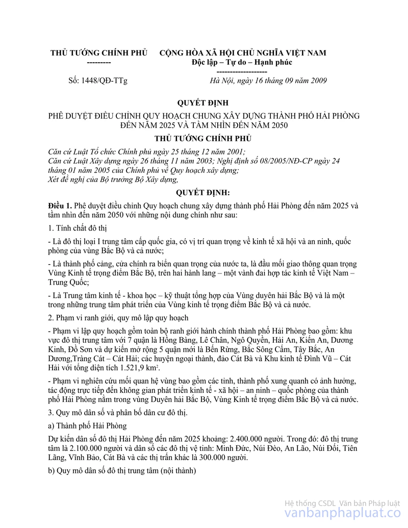
No. 1448/QD-TTg |
Hanoi, September 16, 2009 |
DECISION
ON APPROVING ADJUSTMENT OF CONSTRUCTION GENERAL PLANNING OF HAI PHONG CITY BY 2025 AND WITH A VISION TILL 2050
THE PRIME MINISTER
Pursuant to the December 25, 2001 Law on organization of Government;
Pursuant to the November 26, 2003 Law on construction; the Government’s Decree No. 08/2005/ND-CP dated January 24, 2005, on planning construction;
At the proposal of Minister of Construction,
DECIDES:
Article 1. To approve adjustment of construction general planning of Hai Phong city by 2025 and a vision till 2050 with the following principal contents:
1. Urban nature:
- Being grade-I urban center at national level, having important position of society, economy and security, defense of the North region and whole country;
- Being a port city, an important gateway towards sea of Vietnam, being an important focal area of the North key economic region, locating on two corridors – one economic-corporation belt between Vietnam and China;
- Being a synthetic economic-scientific-technical center of the North coastal region and being one of development center of the North key economic region and whole country.
2. Boundary scope and scale of planning
- Scope of planning includes entire administrative boundary of Hai Phong city: The urban center with 7 districts of Hong Bang, Le Chan, Ngo Quyen, Hai An, Kien An, Duong Kinh, Do Son and expected to expand 5 new districts of Ben Rung, Bac Song Cam, Tay Bac, An Duong, Trang Cat – Cat Hai; suburb rural districts, Cat Ba island and Dinh Vu – Cat Hai economic zone with total area of 1,521.9 km2.
- Scope of regional relation research includes surrounding provinces and cities that influence, affect directly to economic-social-security-defense development space of Hai Phong city located in the North Coastal region, the North key economic region and whole country.
3. The population size and distribution of urban residents.
a) Hai Phong city
By 2025, Hai Phong urban population is expected to be about: 2,400,000 people. In which: Urban center will be 2,100,000 people and people of satellite urban areas such as: Minh Duc, Nui Deo, An Lao, Nui Doi, Tien Lang, Vinh Bao, Cat Ba and other townships will be 300,000 people.
b) The population size of urban centers (interior of city).
- Status in 2007: 824,980 people.
- Forecast by 2015: 1,674,000 people.
- Forecast by 2025: 2,100,000 people.
4. Land area for urban construction
- By 2015, land for urban construction will be about 23,000 - 24,000 ha, with a criterion of 145 m2 / person; in which civil land will be 9,500 - 10,900 ha, with a criterion of 65.5 m2 / person.
- By 2015, land for urban construction will be about 47,500 - 48,900 ha, with a criterion of 160 m2 / person (in urban centers); in which civil land will be 17,100 ha, with a criterion of 70.84 m2 / person (in satellite urban areas).
5. Urban space development orientation of Hai Phong
a) Selection of land for urban construction:
- To renovate and embellish the existing old urban area, develop the alternating land fund not yet used for construction.
- To develop urban area in expanding to suburb areas nearing urban area, essentially in Eastern and Southeast directions, along to route 353 (from Pham Van Dong road to Do Son township), the Northwest direction along to national road 5.
- To expand reasonable development of Ben Rung area, north area of Cam river and An Duong area.
- To exploit reasonably land fund along to routes: Ha Noi - Hai Phong highway, national road 10, highways along seashores of North Coastal region.
- To develop Cat Hai island, Dinh Vu alluvial ground, Trang Cat area.
- To develop satellite urban areas: Upgrade the existing townships, establish new townships, new urban centers.
b) Functional sub-zones
- Urban residential areas: Total area: 7,539 ha
+ Areas limited development: Including old urban areas limited from Bach Dang – Nguyen Tri Phuong – Hoang Dieu – Le Thanh Tong – Ton Duc Thang – Nguyen Van Linh – Nguyen Binh Khiem – Chua Ve roads (the belt 1) and a central part of Kien An district including 33 existing wards, population of about 428,110 people. Average land for urban construction is about 100 m2 /person. To concentrate on renovation, embellishment in association with new construction works, no conduct bid changes on land use structure, avoid the overload of urban infrastructure. Gradually to move factories, plants, warehouses to save land for construction of public service works and green addition. Port land part near Cam river, after relocation, shall be used for development of urban functional zones, prioritize works for public services, green plants, offices and commerce. The average storey high is 3 ÷ 5 storeys, construction density is about 50%, and land use coefficient is 1.5 ÷ 2.5 times.
+ The expanded development areas include:
. The north Song Cam new urban center: Develop a new administrative –politic center of city, a finance – commerce – service center formed in modern new urban center. Forecast by 2025: 251,000 people with area of 728 ha.
. Expansion towards the East: Use entire land fund for construction of new residential housing areas in Hai An district. Area is about 1008 ha.
. Expansion towards the Southeast along Pham Van Dong road: To become new urban center 353, Do Son golf course and areas of education, training, convalescence near green belt of Da Do river. Area is about 1.899 ha.
. Expansion towards the West, Northwest: To develop industrial and hi-tech urban areas (An Hong, Le Thien, Dai Ban …), to develop are in Hong Bang district to An Duong rural district and a part of An Lao rural district, form a large civil area and area of training and convalescence at gateway of city. Area is about 1.570 ha.
. Expansion towards the South: To develop Kien An district into a new urban center, new tourism area, on the basis of exploiting the landscape of Lach Tray river, Thien Van mountain. Area is about 770 ha.
- A system of centers of public service works:
Total land area for construction of system of public service centers is about 1,163 ha and distributed as follows:
+ Commercial services: 888 ha.
+ Education: 40 ha.
+ Medical services: 30 ha.
+ Culture: 25 ha.
+ Administrative-politic agencies: 180 ha.
. The commercial, cultural, administrative, medical, educational centers (district level) are located in center axes: Hoang Van Thu, Cau Dat, Lach Tray, axles of Le Hong Phong boulevard, boulevard 13-5 (Lach Tray – Ho Dong), Ho Sen – Cau Rao axles, Pham Van Dong axles, North Song Cam urban area and districts.
. The construction works in irregular serve shall be dispersed, not concentrated. Periodical serving systems are attached with central system in districts and housing areas. Daily serving works are attached with unit.
. To further complete and build the existing recreation centers: In districts: Hong Bang, Le Chan, Kien An, Duong Kinh, Do Son and Cat Ba island.
- Areas of green plants, sport and physical exercise: Total area: 3,890 ha.
+ City green parks: Total area: 3,866 ha
. Vu Yen island park: 750 ha.
. An Bien park: 40 ha.
. Phuong Luu park: 49 ha.
. Thien Van hill park: 100 ha.
. Ho Dong park: 418 ha.
. Tan Thanh park: 500 ha.
. System of green plants at district level: 2,009 ha.
+ Centers of Physical Exercise and Sport at city and district levels: Total area of 24 ha.
- Specialized centers: Total area of 786.5 ha.
+ Administrative-politic area of city: 150 ha
. Stage by 2015: at current position
. Stage by 2025: develop it to the North of Cam river
+ Center of culture, information, conferences and workshops … at the North of Cam river: 43 ha.
+ Education and training centers at regional level: Total area of 139 ha.
. Thuy Nguyen area: 25 ha.
. Kien An area: 18 ha.
. Duong Kinh area: 81 ha.
. Ngo Quyen area: 15 ha
+ Medical centers at regional level: Total area of 44 ha.
. Thuy Nguyen area: 24 ha
. An Dong area: 20 ha
+ Center of recreation, physical exercise and sport: Total area of 410.5 ha.
. Lach Tray area: 4.5 ha
. The Olympic Sports complex: 100 ha
. Thuy Nguyen golf course: 150 ha
. Do Son golf course: 156 ha
Dinh Vu – Cat Hai economic zone: Total area of 21,640 ha including 8 wards in Thuy Nguyen district, area of Vu Yen island, Dinh Vu, Trang Cat and Cat Hai island of which construction investment will be managed and developed under a separate scheme on construction planning.
- Tourism centers: Do Son and Cat Ba are defined to be international and national tourism centers in association with tourism area in Ha Long bay
- Industrial zones, warehouses:
Total land area of industry and warehouses by 2025 will reach 16,329 ha and divided into industrial zones and clusters:
+ Industrial zones: Include 16 industrial zones which have been approved by the Prime Minister in planning of Vietnam industrial zone system with total area of 9,504 ha.
+ Local industrial clusters: Having area of about 6,825 ha, concentrating in the following zones: along national road 5, national road 10, Thuy Nguyen, Kien Thuy, Tien Lang and Vinh Bao rural districts, Hai An and Do Son districts and riparian area of Van Uc, Bach Dang and Cam rivers meeting eco-social development demand of Hai Phong city.
- Area of defense and security: Total area: 2,027 ha
On the basis of defense and security areas already been approved by the Prime Minister at the Decision No. 107/QD-TTg dated August 12, 2002, the Ministry of National Defense and the Ministry of Public Security shall plan position of Military and security areas in line with the master plan and require to ensure the economy, defense and security combination; submit to the Prime Minister for the approval.
- Historical relics and religious areas: Total area: 268 ha
- Area of cemetery: Total area: 1,095 ha
- Other functional zones:
The existing agricultural zones surrounding urban center development areas (land fund saved for development) limited construction, to create greenswards for urban areas and have effect to moderation of urban ecological environment, create balance for urban areas.
Areas prohibited construction including: Safe corridors of technical infrastructure system, corridors of military zones, corridors of dykes, protective trees, protected area of the ranked relics, clearance area of access to Cat Bi, Kien An airport and under other regulations, zones for biosphere reserve and national parks.
c) Spatial organization of suburb area:
Suburb area of Hai Phong city includes 8 rural districts with total natural area of 118,910.78 ha, proportion of 76% of entire city. By 2025, including 7 rural districts with total natural area of 98,481.83 ha, proportion of 65% of entire city. Population in suburb area by 2025 will be about 900,000 people, in which urban population will be about 300,000 people, rural population will be about 600,000 people.
- Urban system and residential spots in suburb area will be distributed as follow:
+ Seven (7) satellite urban areas: Minh Duc, Nui Deo, An Lao, Nui Doi, Tien Lang, Vinh Bao, Cat Ba;
+ Six (6) townships: Quang Thanh, Luu Kiem, Hoa Binh, Hung Thang, Tam Cuong, Bach Long Vi;
+ Rural residential spots.
- To develop infrastructure in association with suburb residential spots of Hai Phong city in order to ensure the uniformity of urban system, satisfy demand of urban development, allocate to get space and architecture reason, adequate connection of infrastructure system aiming to ensure the optimal cost of moving duration for accommodation, working, recreation of rural residents in city. The rural traffic network will be gradually upgraded, invested in complete construction to ensure the harmonious and stable development of economy, society, security and defense.
- Distribution of agricultural land zone: To be concentrated essentially at the South of city, in Vinh Bao, Tien Lang, Kien Thuy rural districts and a North part of Thuy Nguyen rural district, a West part of An Lao rural district.
- Distribution of aquaculture land area: To be concentrated essentially in islands of: Cat Ba, Bach Long Vy.
- Distribution of forestry land zone: System of mangrove forests, specialized forests, protective forests and production forests. To form the city protective green belts, parks in Thien Van forest, Voi mountain, Deo mountain, Vu Yen, Do Son, and Cat Ba, Do Son resorts. To complete functions of suburb zones meeting the requirements of rural industrialization and modernization.
6. Orientations of urban architecture and landscape
Hai Phong city is divided into 2 typical architectural and landscape zones: Urban architectural and landscape zone with area of about 48,956 ha and natural landscape zone with area of about 103,153 ha.
a) Urban architectural and landscape zone:
- For old urban areas: To keep and embellish the valid cultural and historical relics, architectural works. To renovate and upgrade technical infrastructure, increase area of green plants, public service works; to build some multi-storey houses at appropriate positions not deforming cultural shape and environment of urban areas.
- For areas expanded for urban development: To maintain and embellish system of green plants, ponds and landscape along Cam, Lach Trang, Da Do, Tam Bac and Gia rivers to connect with coastal zones and create corridors of green plants for city.
- To develop new urban centers with adequate and modern technical infrastructure system, high proportion of green plants and land for blank space for development of multi-storey houses at main centers and urban axes, increase rate of high storey, construction density, create spacious appearance for new urban centers.
b) Natural landscape zones:
- Being rural, coastal and suburb areas, islands including Trang Kenh area, Deo, Thien Van and Voi mountains, Do Son area, Cat Ba island and rural areas near Van Uc and Hoa rivers.
- To elaborate the protection regulation for rivers, river basins and water supply sources in serve of rural and urban residents; to conduct the traditional value preservation and promotion of folk architecture; research on reasonable planning and development of plants, promote efficiency of suburb agricultural zones; to develop infrastructure, especially traffic in association with urban centers.
- This is a zone which needs to be kept and exploited reasonably, in compliance with law on relics, law on biodiversity and law on forest protection and development.
7. Orientations of infrastructure system development
a) Technical preparations:
- Determining the construction foundation level:
On the basis of orientation on spatial planning, functional sub-zones in combination the terrain and hydrologic conditions stated with condition of high sea-level rise because temperature of earth is hotter; the construction foundation level is determined (based on level of nautical chart) as follows:
+ Riparian and coastal areas: Level of construction foundation: ³ +5.0 m.
+ Old urban areas: To keep intact of construction foundation level 3.8 m to +4.2 m.
+Area for construction of new urban centers: Construction foundation level is +4.2 m to +4.5m.
+ Construction foundation slope is 0.1% to 0.2%.
- Stormwater drainage:
+ To build separate stormwater drainage, drainage under gravity in combination of motive force according to method: gather water by systems of drains, canals – moderation lakes, drains preventing flood tide – pumping stations - drainage to river, sea.
+ Stormwater will be run out according a completed system, ensure for thoroughly drainage, effective prevention against the flooding and inundation in conditions of bad weather, flood tide.
+ To upgrade, renovate the existing moderation lakes with area of 89.3 ha; to build new 12 moderation lakes for stormwater drainage with total area of 709.5 ha at developed and expanded urban areas and areas where are sunken, low, store water naturally of city.
+ The works for prevention against natural disaster:
. River dyke: To upgrade and build newly system of river dykes, to ensure prevention and fighting of flood and storm which till 2025 may suffer storm level of above 12 level, frequency P = 0.2 %. To upgrade the river dyke routes of: Hoa, Luoc, Thai Binh, Van Uc, Lach Tray, Cam, Kinh Thay, Da Bac, Moi and Thai rivers and total length of dykes will be 312.09 km. Height of dyke peak is from +5.9m to +6.9 m (level of nautical chart).
. Sea dykes: To upgrade and build newly system of sea dykes, to ensure prevention and fighting of flood and storm which till 2025 may suffer storm level of above 12 level, frequency P = 0.2 %, and include sea-level rise due to climate changes. System of sea dykes including sea dykes 1 and 2 (Do Son – Kien Thuy), Cat Hai sea dyke, Trang Cat dyke, Bach Dang dyke. Total length is 105 km, width of dyke face is 5.0m, and height of dyke peak is from +6.2 m to +7.5 m (level of nautical chart).
b) Traffic:
- External traffic:
+ Road:
. National road 5: length of 29.0 km. Section outside urban areas has 63.5 m width; section in urban areas has 54.0 m width;
. National road 10: to upgrade, improve into plain road level 2, with 52.5 km length and 61.5 m width.
. Ha Noi- Hai Phong Highway has: 33.5 km length, 100 m width.
. Coastal highway has: 43.8 km length, 120.0 m width.
. National road 37: to upgrade, improve into plain road level 3, with 20.1 km length and 52.0 m width.
+ Railroad:
. Rail routes To upgrade the existing Hanoi-Hai Phong railway, double line, gauge of 1,435 mm, the section from Thuong Ly station to Haiphong station is overhead. To build newly Ha Noi – Hai Phong high-speed rail route, double line, gauge of 1,435 mm to Hai Phong international gateway port; route has branch to Dinh Vu port station, passing DAP plant of fertilizer production; at Minh Tan commune (Kien Thuy rural district) a branch to South Do Son Military Port. To built new railway for North coastal zone, double line, and gauge of 1,435 mm.
. Rail stations: To upgrade, improve Hai Phong passenger station, to built new stations: Truong Tho passenger station (An Lao rural district), Dai Dong passenger station (Kien Thuy rural district), Minh Tan train station (Kien Thuy rural district), Hung Vuong technical station (Hong Bang district), Dinh Cu station, Hai Phong international gateway port station, Nam Dinh Vu industrial zone station cluster, South Do Son military port station. Total area of rail stations is 312.5 ha.
+ Airway:
. Cat Bi international airport: Area of 491.13 ha; 3.050mx 50m runways.
. Kien An Military airport is: Managed by the Ministry of National Defense.
. To build a taxi airport in Do Son, Cat Ba, Bach Long Vi for tourism and rescue.
. After 2025, to research to build new airport of regional level at Vinh Quang commune, Tien Lang rural district, area of about 2,100 ha (7,000 m x 3,000 m).
+ Waterway transport:
. Sea way: Improve capability of Chua Ve, Dinh Vu ports; to build newly Nam Dinh Vu industrial zone port, Hai Phong international gateway port, South Do Son military port, international passenger wharf at Hoang Dieu port.
. River way: The North route: Hai Phong – Quang Ninh – Hai Duong – Ha Noi – Tuyen Quang – Viet Tri – Hoa Binh – Lao Cai. The South route: Hai Phong – Ha Noi – Thai Binh – Nam Dinh – Ninh Binh.
. River flows: To dredge to ensure flows of river from level 1 to level 4.
. River port: To improve, upgrade the existing river ports of Vat Cach and So Dau; to build new special-use ports for cement plants, thermal-power plants and industrial zones along rivers. To improve and upgrade passenger wharves of: Cat Ba, Gia Luan, Ben Beo; to build neo domestic passenger port at Cam gate port.
- Internal traffic:
+ Network of urban roads: Main urban roads and inter-zone roads with 34.0 m – 76.0 m width; zone-level road with 24.0 m - 34.0 m width. Traffic density up to 5.7 km/km2 (including zone-level main roads).
+ To build 03 belt roads (belts 1, 2 and 3), afferent pathways, urban routes to ensure the connection among residential zones with centers, industrial clusters.
+ To upgrade, improve provincial roads 352, 354, roads through islands, Han – Hoa road reach plain road level 3.
+ Bridges:
. Bridges passing Cam river: To upgrade and improve Kien, Binh bridges; to build newly Vat Cach, Ben Lam, Nguyen Trai, and Hoang Van Thu bridges, highway tunnel from Nguyen Binh Khiem to Vu Yen Island, highway tunnel on coastal highway.
. Bridges passing Bach Dang river: To build newly bridge located on coastal high way, Dinh Vu - Cat Hai bridge and highway tunnel passing Ha Nam canal.
. Bridges passing Lach Tray river: To upgrade and improve Tram Bac, Kien An, Niem and Rao bridges; to build newly Dong Hoa, Niem 2, Rao 2, Hai Thanh and Tan Thanh bridges.
. Bridges passing Van Uc river: To upgrade and improve Tien Cuu bridge; to build newly Thanh Ha, Khue, Duong Ao, Doan Xa (Kien Thuy rural district) bridges.
. To improve and upgrade urban bridges.
- The public traffic system:
+ Public transport type: urban bus, railway.
+ Planning of public bus routes.
+ Urban railroad: To build 06 urban railways with 152.0 km length; central stations: Stations at the North of Cam river and Lac Vien six-road intersection with total area of 14.05 ha; roundhouse stations: To build 04 roundhouse stations of urban railways with total area of 73.0 ha; to build stations for turning direction and stations on routes.
- Traffic infrastructure:
+ The static traffic system:
. Taxi/bus stations: To improve and upgrade Taxi/bus stations: Niem Nghia (Le Chin district), Cau Rao (Ngo Quyen district), Tam Bac, Lac Long (Hong Bang district) into urban Taxi/bus stations; to build newly 05 inter-province Taxi/bus stations in Kenh Giang (Thuy Nguyen rural district), Bac Son (An Duong rural district), Truong Tho (An Lao rural district), Tan Vu (Hai An district), Minh Tan (Kien Thuy rural district). Total area of 15.0 ha.
. Car parks: To use up the existing car parks, to use thoroughly other land fund in old urban areas to improve, build underground car parks, multi-storey car parks, public service works must have car parks under regulations; to built car parks at centers, commercial zones in new development areas. Total area of land for static transport will be 436.29 ha.
+ Other intersections with various elevations:
To make construction plan of intersections with various elevations at positions where highways cross urban roads, main urban roads cross each other, roads cross railways. To forecast to build 18 intersection with various elevation and total area of about 416.7 ha.
+ Urban underground traffic:
. To build underground railway with 38.3 km length; to build underground stations for urban railway.
. To build tunnels crossing rivers with 5.2 km length.
c) Water supply:
- To select water sources:
Water sources for Hai Phong urban areas are surface water sources taken from system of rivers including: Re, Da Do and Gia rivers.
- Determination of water use demand:
Forecast of the water use demand by 2025 will be about 1,371,000 m3/day. 100% of urban people will be supplied clean water.
- Water plants supplying water for urban centers:
+ The existing water plants will be improved, upgraded capacity up to Q = 389,000 m3/day including water plants at: Vat Cach (An Duong rural district), An Duong (Le Chan district), and Cau Nguyet (Kien An district).
+ To build newly water plants with total capacity of Q = 823,300 m3/day including plants: Hung Dao (Duong Kinh district), Ngu Lao (Thuy Nguyen rural district), Kim Son (An Duong rural district), Dinh Vu (Hai An district).
- Water plants supplying water for townships:
+ To improve and upgrade capacity of the existing water plants up to Q = 64,500 m3/day including water plants at townships of: Minh Duc, Nui Deo, An Lao, Vinh Bao, Cat Ba and Bach Long Vy island.
+ To build newly water plants with capacity up to Q = 94,500 m3/day including water plants at Tien Lang, Quang Thanh, Luu Kiem, Tien Cuong, Cap Tien townships.
d) Drainage of sewage, collection and treatment of solid waste and cemetery.
- Forecast of sewage drainage by 2025:
+ Having drain system to collect separately sewage. Rate of collection reaches 90% of standard involving daily-life water supply.
+ Daily-life sewage: for old urban areas: gradually build separate system of sewage collection; for new urban centers: build drain system for separate sewage drainage and putting to treatment station of each zone.
+ Industrial sewage is preliminarily processed at each plant and put to a concentrated treatment station, satisfying the permitted standard before letting out to the receipt source.
+ Daily-life sewage treatment stations include: Vinh Niem, Ho Dong, Dong Hoa stations, stations in Trang Cat and Hai Thanh wards, station at end section of He river, station in Tan Thanh ward, Tan Thanh moderation pond station, Van Bun, Bang La stations, Hong river station, urban station the North of Cam river, Ben Rung urban station, Hoang Mai station, station in Dong Van hamlet (Dai Ban commune). Total area of daily-life sewage treatment stations will be 132.5 ha.
+ Sewage treatment stations in Industrial zones: Having total 16 concentrated treatment stations with area of 94.3 ha.
- Sewage drainage of townships, central areas including many communes: Collection of daily-life sewage must reach 80% of standard involving daily-life water supply. Each township or central area including many communes will have a sewage treatment station of 3 ha - 5 ha.
- Environmental hygiene:
+ Forecast of Solid waste by 2025:
. Rate of solid waste collection is 100%;
. Total collected solid waste volume will be 7,950 ton/day;
. The existing treatment zones are Trang Cat (Hai An district), Gia Minh (Thuy Nguyen rural district), Do Son (Do Son district), Dinh Vu (Hai An district).
. A concentrated solid waste treatment zone of city will be built in Tran Duong ward, Vinh Bao rural district with area of about 100 ha.
. Some small-size and dispersal solid waste treatment zones will be built to serve demand of rural districts: Tien Lang, Kien Thuy, Vinh Bao, Cat Hai, An Duong, An Lao, Bach Long Vy island. Total area of garbage treatment zones will be 54.63 ha.
. Hazardous solid waste treatment: Hazardous solid waste will be brought to the inter-region waste treatment zone in Hoang Bo, Quang Ninh province.
+ Cemeteries:
. City’s cemetery planning: Phi Liet cemetery, in Thuy Nguyen rural district will be upgraded and expanded by 2025 with area of 25 ha.
. After 2025, Ninh Hai cemetery will be closed and moved to Phi Liet cemetery.
. Burial technology: Apply form of first burial and cremation (cremation is encouraged).
. Separate cemeteries will be built in Cat Hai and Bach Long Vy island districts.
dd) Electricity supply and public lighting:
- Electricity supply:
+ Total tentative capacity to supply for entire city by 2025 will be 3,260 MW.
+ Power source: Includes Pha Lai Thermal-power plant, Uong Bi Thermal-power plant, Hai Phong Hydro-power plant and Gia Duc Thermal-power plant. In addition to Hydro-power and Thermal-power sources, it is encouraged to use other energy sources such as diesel, wind power, sun energy.
+ Power grid: Includes 50KV, 220KV, and 110KV power grids.
+ Substations:
. To build newly 5000KV Gia Duc – Thuy Nguyen substation with capacity of 1,200MVA.
. 220KV Substations: There are 06 substations with capacity of 2,250MVA, in which 3 ones are upgraded and 3 ones are built newly.
. 110KV Substations: There are 43 substations with capacity of 2,229MVA, in which 19 ones are upgraded and 24 ones are built newly.
+ The existing medium-voltage and low-voltage power grids will be gradually laid underground in order to ensure safety and urban beauty.
+ The medium-voltage and low-voltage power grids built newly must be laid underground along urban roads under planning.
- Public lighting:
+ Criteria of lighting planning for entire city by 2025:
. 100% of urban roads will be lighted.
. 80 -90% of lanes and hamlet will be lighted.
. To use 100% of lighting source, lighting devices with high efficiency and electrical thrifty at public areas, traffic works, advertisement zones.
+ Lighting of traffic works:
. To organize the lighting of main apartment axles, streets at the request.
. New bridges crossing Cam, Bach Dang and Lach Tray rivers... will be lighted with high aestheticism.
. Entrances, gateways of city will be lighted in combination with architectures to make prominent spots.
+ Lighting of public space and outer faces of works
. New parks, flower gardens, streets along two sides of rivers, squares will be lighted with various forms (Cam, Tam Bac, Lach Tray rivers).
. Multi-storey works, theatres, banks, commercial centers.... will be lighted the surfaces with various forms.
+ Advertisement lighting: In areas of city, it will be arranged, regulated for conformity aiming to avoid light pollution, ensure combination between advertisement lighting and the lighting of works and adjacent spatial areas.
+ A center for control urban lighting will be built.
e) Postal and telecommunication:
- To develop postal and telecommunication of Hai Phong in direction of mechanization, automation, and computerization. By 2025, information and telecommunication infrastructure of city will be invested, ensure connection of all rural districts, communes in Hai Phong which is transmitted by system of optical fiber cables, broadband and multimedia.
- To build zone postal stations and public telephone network; to develop advanced postal and telecommunication services. By 2025, 100% of households will have telephones; high-quality internet services will be supplied to research institutions, universities, schools, hospitals, recreation spots … in entire city.
- Postal and telecommunication technology: To update modern and advanced technologies for setting up information infrastructure. The selected technologies must be anticipation, compatible, consistent to trend of technological convergence of world and region. To apply advances of science and technology in postal and telecommunication: Equipment, network, service, industry, management and human resource.
g) Assessment on strategic environment: To build overall solutions to settle environmental issues, including:
+ Urban environment protection: To build zones for waste treatment, collection and classification …
+ Environment protection of industrial zones: To move old and obsolete manufacture facilities far away residential zones. To build the concentrated waste treatment zones at Industrial zones. To apply advanced and modern technologies.
+ Protection of rural and traditional village environment.
+ Coastal environment protection: To prevent environmental deterioration due to erosion, deposition at river gates, sea gates. To protect biodiversity, protect ecological environment in mangrove forests near river gates.
+ Technical and technological measures for environmental protection.
+ Solutions of management, mechanism, policy.
+ Programs on managing and supervising environment.
8. Construction planning at the first stage (period from 2009 to 2015):
a) Construction planning at the first stage:
- Planning on renovation and embellishment for Hai Phong urban centers;
- Planning and building urban center along two sides of Cam river to create landscape and attraction for city;
- General planning and detailed planning on construction of Dinh Vu – Cat Hai economic zone;
- Planning on construction of industrial parks and clusters;
- Planning on construction of specialized centers: Culture and Sport center, regional training center of university and college, commercial centers;
- Planning on construction of new urban centers in Duong Kinh, Do Son and Kien An districts, new urban centers at the North of Cam river, urban center near Lach Tray river…;
- Planning on construction of system of green parks, tourism services to ensure rest demand in city: Green parks for recreation at Vu Yen, Ho Dong, Deo mountain, Thien Van mountain, Doi mountain, Voi mountain, zone at two shores of Gia river;
- Planning on construction of Cat Ba island, Do Son area to become tourism centers of city, region and whole country, towards international tourism;
- Planning on construction of satellite urban areas – the existing townships, district capitals and developing new townships: Tam Cuong, Hoa Binh, Hung Thang, Luu Kiem, Quang Thanh aiming to create development motivation, modernization of rural and agricultural areas;
- Planning on construction of urban traffic system and external routes;
- Planning on construction of new ones and completing solid waste treatment zones, sewage treatment zones …. satisfying standards on environmental hygiene.
b) Programs and projects prioritized in the first stage:
(the enclosed list)
Article 2. To assign the People’s Committee of Hai Phong city:
1. Announcement of adjustment of construction general planning of Hai Phong city by 2025 and a vision till 2050, organization of planning implementation under current legislations.
2. Adoption of Regulation on managing urban architecture applicable to Hai Phong city under the approved planning.
3. Elaboration and approval for schemes on detailed planning of urban functional zones and adjustment of detailed planning of the approved schemes to be consistent with the approved planning.
Article 3. This Decision takes effect on the day of its signing.
Minister of Construction, Chairperson of People’s Committee of Hai Phong city and relevant agencies shall implement this Decision.
|
|
FOR THE
PRIME MINISTER |
ANNEX
LIST OF PROGRAMS
AND PROJECTS PRIORITIZED IN THE FIRST STAGE
(Promulgated together with Decision No.1448/QD-TTg dated September 16, 2009
of the Prime Minister)
1. Programs or projects on social infrastructures: (7 investment programs and projects)
+ To elaborate center of coastal international conference and workshop;
+ To build regional hospitals at An Dong;
+ To build City and regional sport center;
+ To build Cat Ba, Do Son into concentrated tourism zones with international and national class;
+ To build center of education and labor number 2;
+ To build center of education and training at regional level;
+ To build Tran Phu Special School.
2. Programs or projects on technical infrastructures: (14 investment programs and projects)
+ To build and upgrade Hai Phong international gateway port.
+ Tan Vy car road to Hai Phong international gateway port (Dinh Vu – Cat Hai bridge);
+ To upgrade Cat Bi international airport;
+ To build and upgrade completely urban main axes: Center road 13-5 (Lach Tray – Ho Dong), Ho Sen – Cau Rao II road, urban main axis (center of city – An Duong industrial park), Dong Khe II road, contour at the Southeast Hai Dan district, center axles in Kien An district, axles of Dinh Vu industrial park;
+ To upgrade national road 37, section passing Hai Phong;
+ Inter-province road from Thuy Nguyen to Kinh Mon (Hai Duong);
+ To build some inter-province bus stations and improve, upgrade some routes, streets in interior of city;
+ To build cruise terminals for receipt of international and domestic passengers;
+To build new water plants: Hung Dao, Ngu Lao, Kim Son, Cap Tien. To expand Vat Cach water plant. To upgrade An Duong water plant, Quan Vinh crude water pumping station;
+ To built and upgrade lighting systems for Le Hong Phong, Pham Van Dong, Lach Tray – Cau Dat axes, city center axis, central axis 13-5, Ho Sen – Cau Rao 2 axis;
+ To build Hai Phong Thermal-power plant 3;
+ To upgrade and expand 6 110kV substations and 2 220 KV substations, to build some 110kV substations and 220kV substations, to build 110kV and 220kV lines (two circuits);
+ To build solid waste treatment plant in Gia Minh (Thuy Nguyen rural district) and Tan Trao (Kien Thuy rural district);
+ To upgrade some river dykes, sea dykes in city.
3. Other investment programs and projects:
+ To build and develop Dinh Vu – Cat Hai economic zone:
+ To build infrastructure of industrial zones along Van Uc river, Nam Cau Kien industrial zone, Thuy Nguyen industrial zone, An Duong industrial zone, Nam Dinh Vu industrial zone;
+ To build fishing logistics zone on Cat Ba, Bach Long Vi islands and anchorage areas, storm shelters for vessels.
------------------------------------------------------------------------------------------------------
This translation is made by LawSoft,
for reference only. LawSoft
is protected by copyright under clause 2, article 14 of the Law on Intellectual Property. LawSoft
always welcome your comments