Nội dung toàn văn Decision No. 1547/QĐ-TTg 2008 approving the master plan for flood prevention in Ho Chi Minh city
|
THE PRIME MINISTER |
SOCIALIST REPUBLIC OF VIETNAM |
|
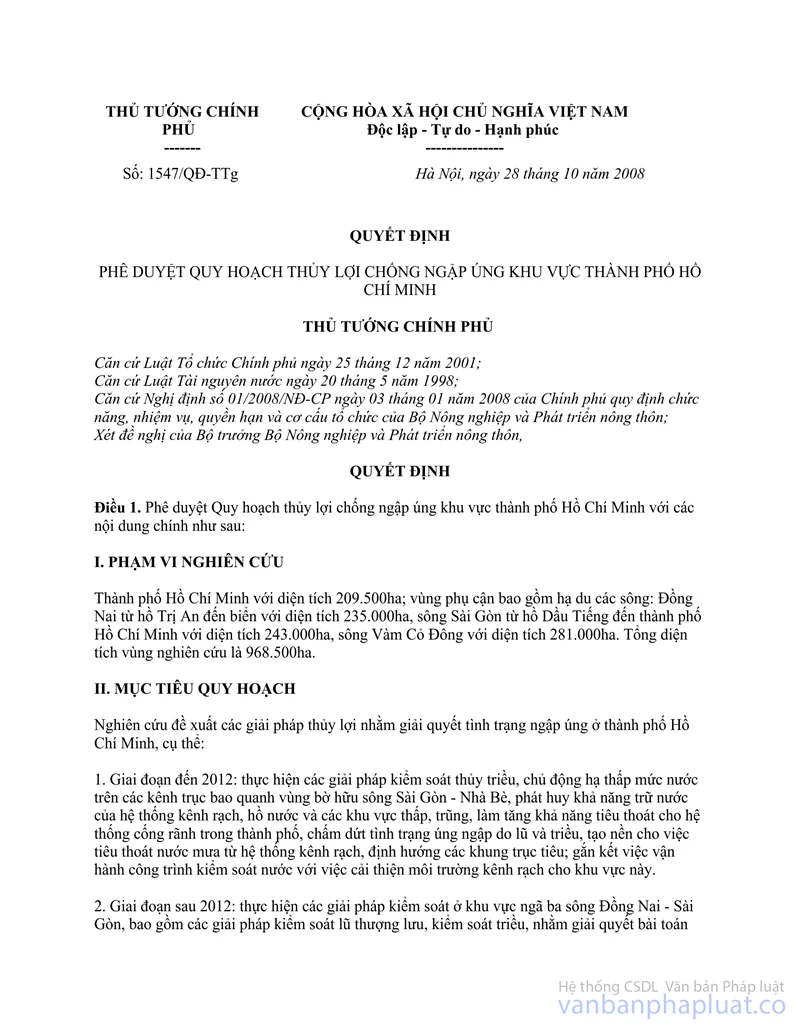
No: 1547/QĐ-TTg |
Hanoi, October 28, 2008 |
DECISION
APPROVING THE MASTER PLAN FOR FLOOD PREVENTION IN HO CHI MINH CITY
THE PRIME MINISTER
Pursuant to the Law on Government organization dated December 25, 2001;
Pursuant to the Law on Water Resources dated May 20, 1998;
Pursuant to the Government's Decree No. 01/2008/NĐ-CP on January 03, 2008, defining the functions, tasks, powers and organizational structure of the Ministry of Agriculture and Rural development;
At the request of the Minister of Agriculture and Rural development,
HEREBY DECIDES
Article 1. To approve the master Plan for flood prevention in Ho Chi Minh city with the main following contents:
I. STUDY SCOPE
Ho Chi Minh City with the area of 209,500ha; the vicinity including the lowland of rivers :Dong Nai from Tri An lake to the sea with the area of 235,000ha, Saigon from Dau Tieng lake to Ho Chi Minh City with the area of 243,000ha, Vam Co Dong with the area of 281,000ha. The total study area is 968,500ha.
II. OBJECTIVES
Study and propose solutions for solving the flooding in Ho Chi Minh City, in particular:
1. Up to 2012: Implement solutions for controlling tide, proactive lowering the water level in the canals surrounding the right bank of the Saigon – Nha Be rivers, promoting water retention capacity of the system of canals , lakes, and low-lying, sunken areas, increasing capacity to drain of the system of canals, lakes in the city, ending the flooding due to tide and flood, providing the basis for the drainage of rainwater from canals, orienting the drainage axes; associate the operation of water control works with the improvement of the canal environment for this area.
2. After 2012: Implement solutions for flood control at Dong Nai– Saigon river junction, including solutions for upstream flood control, tide control in order to solve the problem of flood in the city if heavy flooding in upstream location occurs and sea level rises in the future; associate the operation of water control works with the improvement of canal environment and acid sulphate soils.
III. PLAN
1. Based on the natural characteristics, topography conditions, flooding properties, ability to control extraneous water, development planning, basis of science-technology, economy and environment, the plan of flood prevention divides Ho Chi Minh City into 3 water control areas, including:
- Region I consists of the entire right bank of Saigon – Nha Be rivers, including the old inner- city area, where now there are many urgent matters of urban drainage, environment, the southern area of the city and a part of Long An province (the left bank of Vam Co river and Vam Co Dong river) which is mainly farmland and uncultivated land of which alkaline soils and acid sulphate soils are required for improvement. This is the central area of the master Plan.
- Region II includes the entire Dong Nai - Saigon river junction which is developing area and of which drainage is more favorable, thus works of flood prevention and drainage can be constructed here.
- Region III includes the entire left bank of Nha Be-Soai Rap rivers which is now a biosphere area. Thus large-scale water control works can be constructed here n the future, depending on the sea level rise and the process of urban development in the south of the city.
2. The plan of flood prevention on the right bank of Saigon - Nha Be rivers (region I):
- A dyke system along the right bank of Saigon river (from Ben Suc), Soai Rap river and the left bank of Vam Co Dong river to Provincial Route 824 (Duc Hoa town - Long An province) shall be built. The dyke route from Ben Suc to Vam Thuat is constructed according to the dyke route of the irrigation project of the right bank of Saigon river; The remaining section is constructed according to existing roads along the river.
- The closed system of culverts is located in estuaries and canals flowing to Saigon, Nha Be, Vam Co, and Vam Co Dong rivers. The main culverts are: Rach Tra, Vam Thuat, Ben Nghe, Tan Thuan, Phu Xuan, Muong Chuoi, Kinh river , Kinh Lo, Kinh Hang, Thu Bo, Ben Luc, Xang Lon canal. These culverts shall control the water level and water environment inside the dike area, which shall not be higher than the allowed level under the drainage requirements, shall not cause a major obstacle to inter-regional waterway traffic, and shall proactively cut the tide crest; the culverts without any task or with only local traffic task shall be operated with two-way automatic mode.
- Water drainage main direction in the study area is North - South, so the main drainage canal system includes canals along this direction. Rach Tra - Thay Cai - An Ha - Cho Dem canal axis is renovated, dredged, extended to convey water from low-lying area of the city to the South. Vam Thuat - Tham Luong - Ben Cat –Rach Nuoc Len canal route that was approved of investment by the city’s People's Committee shall be improved the water drainage ability after the completion.
- “Reservoirs" include ponds, lakes, canals and some low-lying areas which are renovated in order to have sufficient capacity to reserve rainwater drained from the city center during high tides .
People’s Committee of Ho Chi Minh city is assigned to guide, study the master plan of reservoir network distributed for each region, area, and foundation in order to adjust the master plan of land use, the master plan of transport accordingly and ensure that the land used for the reservoirs is not smaller than 17% of total area of the region.
3. Plan of flood prevention in Dong Nai – Saigon river junction (region II):
- The ground in urban areas shall be raised about + 2,5m higher than the flood level.
- Closed dykes with drainage culverts under the dykes in case of low flood must be constructed in garden house, tourist areas.
- Rivers and canals must be renovated in Thu Duc, District 9 in order to improve the drainage.
- Canal axes must be dredged, renovated and the pressure of Dong Nai River flood on new urban areas along Saigon river must be reduced in order to improve waterway traffic.
- Water of Dong Nai river is used in soil and environmental improvement.
4. Plan of flood prevention on the left right of Nha Be - Soai Rap rivers (region III): This region is determined as a buffer zone of which drainage shall be solved in the future by constructing big works, depending on sea level rise and the urban development in the South of the city. In the immediate future, the small dykes and sea dykes (sea dike shall be considered in another master plan) must be used to prevent flooding in the current conditions.
5. Upstream flood control
- Supplement the task for regulating flood and improving the process of operation of the reservoirs in order to ensure safety and control flood facilitating the flood prevention in lowland areas.
- Cooperate to operating the flood discharge in lakes: Dau Tieng, Tri An, Phuoc Hoa and other lakes in upstream areas considering the tide conditions in the estuary segment.
- Conduct flood diversion from Dong Nai river into Thi Vai river through Dong Mon river, combined with environmental improvement.
- Conduct flood diversion from Saigon river to Rach Tra river. Flood diversion is combined with soil and environmental improvement (region I) in order to reduce flooding pressure in the city center.
- Prevent and redirect the drainage of flood overflowing into the city from the west is.
IV. ORDERS
1. Period I: implementation of the projects of the right bank of Saigon – Nha Be rivers
Stage 1: build 6 large culverts: Phu Xuan, Muong Chuoi, King river, Kinh Lo, Thu Bo, Hang canal and small culverts in other canals; construct a dike route connecting such culverts; dredge the drainage canal in the South of the city center.
b. Stage 2: build 2 large culverts : Rach Tra, Vam Thuat and other small culverts connecting with the small projects of irrigation system on the right bank of the Saigon river; dredge the axes : Rach Tra - An Ha - Nam Saigon and Vam Thuat – Tham Luong - Ben Cat – Nuoc Len canal.
c. Stage 3: Build 4 culverts: Ben Nghe, Tan Thuan, Ben Luc, Xang Lon canal, open the existing An Ha; complete the dyke route and small culverts under the dykes.
Estimated total investment in the above works is 10,080 billion VND, of which amount spent on stage I is 5,600 billion VND, stage II is 2,800 billion VND, and stage III is 1,680 billion VND.
2. Period II: solving the flooding in Dong Nai - Sai Gon river junction.
Estimated total investment in this period is 1,451 billion VND of which amount spent on the bridge and culvert system is 665 billion VND, amount spent on the dike system is 122 billion VND, and amount spent on dredging, renovation of canals is 664 billion VND.
3. Based on the ability to balance the annual state budget, the Ministry of Agriculture and Rural Development, People's Committee of Ho Chi Minh City, the People's Committees of provinces and cities in the planned areas, relevant Ministries, departments must arrange the order of priority in order to ensure synchronous and effective investment.
- Give priority to unfinished construction works and ensure synchronization in order to complete and put them into use as soon as possible to promote the effectiveness immediately.
- Build large culverts and complete the dyke route, dredge the main drainage axes, drainage canals from the city center to the South.
- Improve the dyke system and small culverts under the dyke.
- Dredge and renovate the canal system in order to improve drainage and serve waterway traffic.
V. TOTAL INVESTMENT
Estimated total investment in the construction of anti-flooding works in Ho Chi Minh City is 11, 531 billion VND (eleven thousand five hundred and thirty-one billion dong). Including:
1. Period I: 10, 080 billion dong
2. Period II: 1, 451 billion dong
Investment capital source is the annual state budget including central budget, local budget, Government bonds, ODA.
Article 2. Implementation
1. The Steering Committee of project of flood prevention in Ho Chi Minh City is established of which Chairman is 01 leader of the Ministry of Agriculture and Rural Development; Steering Committee members include representatives of Departments in Ministries, sectors and localities: Planning and Investment, Finance, Construction, Science and Technology, Natural Resources and Environment , the People's Committee of Ho Chi Minh City, the People's Committee of Long An province.
The Steering Committee shall organize and cooperate with relevant Ministries, sectors and localities to promote the implementation of the projects under the master Plan; direct the management, operation, monitoring the effectiveness of the invested works and report to the Prime Minister
The Minister of Agriculture and Rural development shall approve the list of the Steering Committee.
2. The Ministry of Agriculture and Rural development:
a. Direct and cooperate closely with localities to implement the master Plan; update, handle new matters arising during the implementation in order to ensure that the projects are implemented with proper purposes and effectively.
b. Commence the setting-up and approval of investment of projects of works having large scale and technical complexity, including Muong Chuoi Culvert, Kinh Lo (Rach Giong) Culvert, Thu Bo Culvert.
Be allowed to appoint consultants to set up investment projects, create technical design, and make total estimates of 3 above works; be allowed to hire foreign consultants to provide technical assistance during investment preparation and project implementation preparation.
c. Direct, guide, inspect, and urge the relevant localities to commence the investment in construction of works according to the master Plan in the area. Take charge and cooperate with the localities to implement the detailed master Plan, approve the adjustments of the detailed master Plan of each region, area accordingly.
d. Systematically monitor the operation of works, ensure the effectiveness and sustainability of the master Plan.
dd) Take charge and cooperate with relevant Ministers, sectors and localities to study, set up processes, and implement the plans, processes of flood discharge of the reservoirs in upstream area in order to facilitate the flood prevention in Ho Chi Minh city, set up the process of operating culvert system to prevent flooding, tide serving flood prevention, environmental improvement of the canal systems in the city.
3. People’s Committee of Ho Chi Minh city
a. Direct functional agencies to implement the master Plan including construction of works in the master Plan in the area according to the investment decentralization (listed in Annex I provided in this Decision) and works of renovating the drainage system inner the city, control the reclamation of ponds, lakes, low-lying areas, leaving the rain water regulation capacity as determined in the master Plan in order to ensure the synchronism and promote investment effectiveness.
b. Cooperate with the Ministry of Agriculture and Rural Development and relevant agencies to review the master plan of drainage inner the city, meeting requirements for drainage and ensuring the economic effectiveness of the project;
c. Direct the setting-up, assess, and approve the projects after obtaining the agreement on the technique of the Ministry of Agriculture Technical and Rural Development; be allowed to appoint consultants to set up investment projects, technical designs - total estimates and hire foreign consultants to provide technical assistance during investment preparation and project implementation in accordance with the regulations;
d. Balance the budget and other sources of investment capital to implement synchronously the system of anti-flooding works as prescribed for works of which investor is the People’s Committee of Ho Chi Minh city.
4. People’s Committee of Long An province shall be responsible for implementing works in the master Plan in the area (listed in Annex I) and directing the setting-up, assessment, and approval of projects after obtaining the agreement on technique of the Ministry of Agriculture Technical and Rural Development.
5. the Ministry of Planning and Investment shall take charge and cooperate with the Ministry of Finance, the Ministry of Agriculture and Rural development, the Ministry of Construction, People’s Committee of Ho Chi Minh city, People’s Committee of Long An province allocates the investment capital in constructing works determined in the master Plan and the drainage system inner Ho Chi Minh city.
6. the Ministry of Science and Technology implements the research project of setting-up the process of operating flood discharge in lakes in Dong Nai – Saigon river basin in order to prevent flooding; setting-up the process of operating culvert system in order to prevent floods, tide to serve flooding prevention and environment improvement of canals in Ho Chi Minh City.
7. Ministries, departments according to their assigned functions and tasks shall cooperate with the Ministry of Agriculture and Rural Development, the People's Committees of provinces and cities under the scope of the master Plan to implement effectively the master Plan of flood prevention in Ho Chi Minh city, and consider adjusting the master Plan of departments, localities in consistence with the contents of this master Plan.
Article 3. This Decision takes effect after its signing.
Article 4. The Ministers of Agriculture and Rural Development, Planning and Investment, Finance, Construction, Transport, Science and Technology, Natural Resources and Environment, the President of the People’s Committee of Ho Chi Minh city, the President of the People’s Committee of Long An province shall be responsible for the implementation of this Decision.
|
|
THE PRIME MINISTER |
APPENDIX I
LIST OF PROJECTS PLANNED FOR CONSTRUCTION IN PERIOD I (Enclosed herewith the Prime Minister’s Decision No. 1547/QĐ-TTg dated October 28, 2008)
Table 1. Large culverts under dyke routes
|
No. |
Project |
Size |
Operation mode |
Expected investor |
|
|
Breadth (m) |
Bottom level (m) |
|
|
||
|
1 |
Rach Tra culvert (lock) |
60 |
-4.0 |
Manual |
Ho Chi Minh city |
|
2 |
Vam Thuan Culvert |
40 |
-4.0 |
Manual |
Ho Chi Minh city |
|
3 |
Ben Nghe Culvert |
20 |
-4.0 |
Manual |
Ho Chi Minh city |
|
4 |
Tan Thuan Culvert (Lock) |
60 |
-4.0 |
Manual |
Ho Chi Minh city |
|
5 |
Phu Xuan Culvert |
60 |
-4.0 |
Manual |
Ho Chi Minh city |
|
6 |
Muong Chuoi Culvert (Lock) |
60 |
-6.0 |
Automatic |
The Ministry of Agriculture and Rural development |
|
120 |
-10.0 |
Manual |
|||
|
7 |
Song Kinh Culvert |
60 |
-4.0 |
Manual |
Ho Chi Minh city |
|
8 |
Kinh Lo (Giong canal) Culvert |
60 |
-6.0 |
Manual |
The Ministry of Agriculture and Rural development |
|
9 |
Kenh Hang Culvert |
120 |
-4.0 |
Manual |
Long An province |
|
10 |
Thu Bo Culvert (Lock) |
80 |
-4.0 |
Automatic |
The Ministry of Agriculture and Rural development |
|
120 |
-8.0 |
Manual |
|||
|
11 |
Ben Luc Culvert (Lock) |
60 |
-4,0 |
Manual |
Long An province |
|
12 |
Xang Lon canal Culvert |
20 |
-4.0 |
Manual |
Long An province |
Table 2. Main dyke routes
|
No. |
Route |
Length (km) |
Crest level |
Breadth of dike surface |
Note |
Expected investor |
|
1 |
Ben Suc-Rach Son |
19,735 |
+3,0m |
7,5m |
Dike along Saigon river |
Ho Chi Minh city |
|
2 |
Nang Am canal-Provincial Route 8 |
16,855 |
+2,8m |
7,5m |
Dike along Saigon river |
Ho Chi Minh city |
|
3 |
Provincial Route 8-Vam Thuan |
23,552 |
+2,5m |
7,5m |
Dike along Saigon river |
Ho Chi Minh city |
|
4 |
Vam Thuan-Kinh Lo |
30,42 |
+3,0m |
According to the scale of roads |
Ho Chi Minh city |
|
|
5 |
Kinh Lo-Thu Bo |
13,40 |
+3,0m |
According to the scale of roads |
Long An province |
|
|
6 |
Thu Bo-Provincial 824 |
68,29 |
+2,0m |
According to the scale of roads |
Long An province |
|
|
|
Total |
172,252 |
|
|
|
|
Table 3. Main drainage axis requiring renovation
|
No. |
Canal/river’s name |
Length (km) |
Note |
|
I |
Drainage axis in inner Ho Chi Minh city |
28,1 |
|
|
1 |
Thu Dao canal |
4,434 |
Bottom breadth B=40m, Bottom level = -4,0m |
|
2 |
Ba Lon canal |
7,55 |
Bottom breadth B=40m, Bottom level = -4,0m |
|
3 |
Lung Man canal |
2,554 |
Bottom breadth B=40m, Bottom level = -4,0m |
|
4 |
Xom Cui canal |
7,638 |
Bottom breadth B=40m, Bottom level = -4,0m |
|
5 |
Ong Be canal |
3,324 |
Bottom breadth B=40m, Bottom level = -4,0m |
|
6 |
Thay Tieu canal |
2,600 |
Bottom breadth B=40m, Bottom level = -4,0m |
|
II |
North-south drainage axis |
80,518 |
|
|
1 |
Can Giuoc river |
11,75 |
Bottom breadth B=100m, Bottom level = -6,0m |
|
2 |
Vam Thuan-Tham Luong-Ben Cat- Nuoc Len canal (*) |
30,378 |
Bottom breadth B=40m, Bottom level = -4,0m |
|
3 |
Rach Tra-Kenh Xang-An Ha- Xang Lon canal |
38,39 |
Bottom breadth B=60m, Bottom level = -4,0m |
|
|
Total |
108,618 |
|
(*)Vam Thuat - Tham Luong - Ben Cat – Nuoc Len canal drainage axis is being under construction of period I according to the project that has been approved by the city.
APPENDIX II
LIST OF PROJECTS PLANNED FOR CONSTRUCTION IN PERIOD II (enclosed herewith the Prime Minister’s Decision No. 1547/QĐ-TTg dated October 28, 2008)
1. Dyke:
- Dyke along Saigon river (from the left bank of Ong Dau canal to Vinh Binh cannal- also used for traffic purpose):
Total length: 6.000 m;
Crest level: 2.5m;
Breadth: 12m.
- Dyke along Dong Nai river, also used for traffic purpose from Long Phuoc, Long Truong, Truong Thanh to Phu Huu:
Total length: 13.500m;
Crest level: 3.0 – 3.2m;
Breadth: 12m
2. Traffic Bridge: Major traffic bridges on the left bank of Saigon river are in the following table:
|
No. |
Work |
Size |
Unit |
Note |
|
I |
Bridge |
|
|
|
|
1 |
Ky Ha Bridge |
90 |
m |
Breadth of bridge deck: 12m |
|
2 |
Giong Ong To bridge |
135 |
m |
Breadth of bridge deck: 12m |
|
3 |
Rach chiec bridge |
135 |
m |
Breadth of bridge deck: 12m |
|
4 |
Go Dua bridge |
135 |
m |
Breadth of bridge deck: 12m |
|
5 |
Ong Dau bridge |
45 |
m |
Breadth of bridge deck: 12m |
|
6 |
Cau Dap bridge |
45 |
m |
Breadth of bridge deck: 12m |
|
7 |
Rach Ba Cua bridge |
135 |
m |
Breadth of bridge deck: 12m |
|
8 |
Rach Ong Nhieu bridge |
180 |
m |
Breadth of bridge deck: 12m |
|
II |
Embankment |
13.5 |
km |
|
3. Renovation of canals: dredging waterways used for drainage and serving traffic: total length: 83.200m; Average breadth: 6 - 15m; Average depth: -2.0 ÷ -4.0m.
The canal routes that need renovating are in the following table (Document of the Service of Agriculture and Rural development of Ho Chi Minh City)
|
No. |
River/Canal |
Length (m) |
cross section of the design |
Technical Level |
Note |
|
|
B(m) |
Ñd (m) |
|
|
|||
|
1 |
Ong Nhieu canal |
7.500 |
60 |
-4 |
4 |
Local |
|
2 |
Ba Cua canal |
7.000 |
60 |
-4 |
4 |
Local |
|
3 |
Giong Ong To canal |
7.000 |
50 |
-3 |
4 |
Local |
|
4 |
Chiec-Trau Trau canal |
11.500 |
50 |
-3 |
4 |
Local |
|
5 |
Go Cong canal |
5.700 |
40 |
|
6 |
Local |
|
6 |
Cay Cam canal |
3.500 |
20 |
-3 |
|
Long Truong ward |
|
7 |
Thau canal |
2.500 |
20 |
-2 |
|
Long Truong ward |
|
8 |
Nuoc Duc canal |
2.500 |
20 |
-2 |
|
Long Truong ward |
|
9 |
Mot Tan canal |
4.000 |
20 |
-2 |
|
Phu Huu ward |
|
10 |
Dat Set-Ba Lang canal |
3.000 |
20 |
-2 |
|
Phu Huu ward |
|
11 |
Ruot Ngua canal |
2.000 |
20 |
-2 |
|
Phu Huu ward |
|
12 |
Ba Hien canal |
2.000 |
20 |
-2 |
|
Phu Huu ward |
|
13 |
Go Lon canal |
1.500 |
15 |
-2 |
|
Phu Huu ward |
|
14 |
Ngon Ngang canal |
2,500 |
15 |
-2 |
|
Phu Huu ward |
|
15 |
Ngon Giua canal |
2.500 |
15 |
-2 |
|
Phu Huu ward |
|
16 |
Ngon Tiem canal |
3.000 |
15 |
-2 |
|
Phu Huu ward |
|
17 |
Rach Bang |
2.500 |
20 |
-2 |
|
Phu Huu ward |
|
18 |
Ca Tre Lon canal |
4.000 |
20 |
-2 |
|
Phu Huu ward |
|
19 |
Cau Ong Lap canal |
2.000 |
10 |
-2 |
|
Phu Huu ward |
|
20 |
Rach Muong |
2.500 |
20 |
-2 |
|
Phu Huu ward |
|
21 |
Ky Ha-Ong Keo canals |
4.500 |
30 |
-2 |
|
Phu Huu ward |
|
|
Total |
83.200 |
|
|
|
|
------------------------------------------------------------------------------------------------------
This translation is made by LawSoft and
for reference purposes only. Its copyright is owned by LawSoft
and protected under Clause 2, Article 14 of the Law on Intellectual Property.Your comments are always welcomed