Nội dung toàn văn Decision No. 2456/QD-TTg 2013 development of Nam Can economic zone in the Ca Mau province by 2030
|
THE PRIME MINISTER |
SOCIALIST
REPUBLIC OF VIETNAM |
|
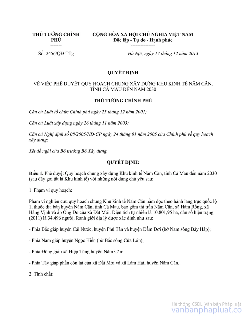
No. 2456/QD-TTg |
Hanoi, December 17, 2013 |
DECISION
ON APPROVING THE MASTER PLAN FOR THE DEVELOPMENT OF NAM CAN ECONOMIC ZONE IN THE CA MAU PROVINCE BY 2030
THE PRIME MINISTER
Pursuant to the Law on Organization of the Government dated December 25, 2001;
Pursuant to the Law on Construction dated November 26, 2003;
Pursuant to the Decree No.08/2005/NĐ-GOVERNMENT dated January 24, 2005 of the Government on construction planning;
At the request of the Minister of Construction,
HEREBY DECIDES
Article 1. Approval for the construction master plan of Nam Can Economic Zone in the Ca Mau Province by 2030 (hereinafter referred to as the Economic Zone) with the following major contents:
1. Planned coverage:
According to the construction master plan, the Nam Can Economic Zone is located along the main enclosure of National Route No.1A at Nam Can District and Ca Mau Province, which encompasses Nam Can Town, Ham Rong, Hang Vinh Commune and Ong Do Hamlet of Dat Moi Commune. This region has the natural areas of 10,801.95 hectares and the actual population of 34,496 residents in 2011. The geographical boundaries are defined as follows:
The economic zone is bordered by:
- Cai Nuoc, Phu Tan and Dam Doi District (southern Bay Hap River shore) to the north;
- Ngoc Hien District (northern Cua Lon River shore) to the South;
- Hiep Tung Commune of Nam Can District to the East;
- The rest of Dat Moi and Lam Hai hamlets of Nam Can Commune to the West.
2. Nam Can Economic Zone aims to become:
- A multidisciplinary economic zone including non-tariff (such sectors as industry, commerce and service) and tariff zone (urban area, state-of-the-art aquaculture, ecotourism services and regional logistics centers in the Ca Mau Province).
- An international trading junction of the Ca Mau Province and Mekong delta.
- A driving force for the economic development at the southern sub-region of Ca Mau Province, which mainly focuses on developing the mechanical engineering, ship building, financial services, and telecommunications.
- A regional center for mangrove forest ecotourism, industry, commerce, service, aquaculture and aquatic product processing in the Mekong delta.
- A likely strategic head-quarter of National defense and security in the Mekong Delta.
3. Objectives:
- Take full advantage of its natural condition, eco-geographical and political location in trading and providing international and domestic services, which will help to boost up the economic and social growth of Ca Mau Province and other Mekong Delta’s regions.
- Develop the Nam Can Economic Zone with key industries such as mechanical engineering, ship building and repair, machine and electronic assembling, aquatic product processing for export, petroleum industry services, textiles, building materials, consumer goods and other supporting industries. Develop eco-tourism services at coastal mangrove forest areas and marine islands tourism, economic port and non-tariff zone near seaports and urban residential areas.
- Create employments and build a place to train and improve the workforce quality and increase income for the employees.
4. Forecast for population and land size:
Population: the total population in the zone is about 45,000 residents, including 28,000 urban residents by 2020; and the population is forecast to grow by about 90,000 residents, including 80,000 residents by 2030.
Land: The construction of urban areas and non-tariff zones is intended to occupy an area of about 875 hectares by 2020, in which non-tariff zone will cover an area of about 320 hectares while a residential land by this period is expected to reach 90-110 m2 per person; by 2030 the construction of urban areas and non-tariff zones aims to occupy about 2,170 hectares, in which the land for non-tariff zone is about 800 hectares and residential lands by this period is expected to reach 100 - 130 m2 per person.
5. Developmental orientation towards the architectural space:
a) Spatial layout and structure:
The Nam Can economic zone is developed and designed as a chain of urban areas and non-tariff zones along the axes of waterway economic corridors like Cua Lon River, Cai Nai Canal and the road system such as the National Route No.1A, eastern and western sea embankments.
The traffic structure of Nam Can Economic Zone consists of main road systems such as Trans-Asia route, National Route No.1A, also called Ho Chi Minh road to Dat Mui, roads built on eastern and western sea embankment; provincial roads DT.988B and DT.988C; and main waterway transport systems such as Cua Lon River, Bay Hap River, Cai Nai Channel, Cai Ngay Canal and other connecting canals.
The non-tariff zone will include the Government’s management unit and trading, service and industrial facilities near the National Route No. 1A and Cua Lon River.
A chain of urban areas include Nam Can, Dat Moi and Ham Rong urban economic area, all of which are arranged as intersecting areas with the axis of National Route No.1A.
The community areas for locals living in this zone, including the communal centers and rural residential sites, lie along the road and waterway traffic systems.
Planned areas intended for agricultural, landscaping and open spatial development will comprise separate agricultural, aqua cultural areas; combined area for aquaculture and forestation; a spacious area for the eco-tourism and hospitality service development; public areas for urban landscaping and greenery as well as the network of rivers and canals.
b) Functional zones:
Non-tariff zone will be located in the center of the economic zone and connected with the areas of urban development through the main traffic systems such as National Route No. 1A, Cua Lon River and other streets running past the zone. The non-tariff zone will cover a total area of about 800 hectares by 2030; and the proposed land size for industrial development is expected to cover an area of 500 hectares by 2030.
Planned urban areas will include Nam Can, Ham Rong and Dat Moi urban area, all of which will be linked together to lie along the National Route No.1A and eastern and western sea embankment. The total construction land of urban areas is about 1,370 hectares.
Community areas for locals living in this zone will be developed, including the residential areas along canals running past Nam Can urban area, the communal centers and rural residential areas along road and waterway traffic systems.
Planned areas intended for aqua cultural development will be mainly located at Ham Rong, Hang Bay, Hang Vinh, Dat Moi hamlets and a part of the Nam Can urban area. It will be situated along both sides of the National Route No.1A and split into two areas for the specialized cultivation of aquatic products and the combination of aquaculture and forestation.
Planned areas intended for the development of landscape and open space will include green belt (theme parks, planted forests, landscapes and greenery areas) encompassing the urban areas and non-tariff zones, landscaping tree lines along canals, storage dams combined with landscaping, eco-tourism areas to the west of Nam Can urban area.
c) Developmental orientation towards the architectural space of the non-tariff zone:
- Planned area intended for the management will be situated at the Nam Can urban area to the north and east, bordered by National Route No.1A and Cua Lon River; it will be reserved for the customs agency to manage relevant activities such as immigration, import and export of goods (through seaports and roads) and others performed by the non-tariff zone. The land size will amount to about 100 hectares by 2030, including No.1 Zone (approximate 50 hectares) in close proximity to the National Route No.1A, where all of road transportation will be , and No.2 Zone (approximate 50 hectares) in the proximity of Cua Lon river, where both waterway and road transportation will be examined.
-The trading and service area is located to the north of management unit No.1, bordered by National Route No.1A. It includes duty-free shopping malls, financial and banking centers, product exhibition and display halls; hotels and restaurants, entertainment and recreational centers and tree parks. The planned land for construction will be nearly 200 hectares by 2030. Functional zones are reasonably located at proper areas in order to make better use of spacious areas along the National Route No.1A, which will be connected with the Government’s management unit, and take full advantage of the natural landscapes (water surface, concentrated trees, canal and storage dam to the east and north) to create modern and original architectural space in the zone.
- Centralized industrial area is expected to cover an area of 500 hectares by 2030. The area will house facilities to serve for various industries such as shipbuilding; energy (oil, gas and electricity); assembling and processing of goods; production of building materials, new materials; supportive industry for marine fisheries; export processing, training and research; logistics; terminal area; industrial services and concentrated tree areas and seaport. Architectural space is arranged into two particular areas: the No1 industrial area situated to the southeast of the No. 1 management unit, covering an area of about 200 hectares, and the No.2 industrial area situated to the east of the No. 2 management unit, covering an area of about 300 hectares.
d) Developmental orientation towards the architectural space of urban areas:
The urban areas in the Nam Can Economic Zone will encompass Nam Can urban area (at the existing Nam Can Town); two specialized urban areas such as Ham Rong urban area to the North and Dat Moi urban area in the center of the Economic Zone. Total urban population in the whole Nam Can Economic Zone is forecast to grow by nearly 28,000 residents by 2020 and approximate 80,000 residents by 2030.
- Nam Can Urban area:
+ Location: it is bordered by Cu Lon River to the South and Ong Tinh canal to the North.
+The population will amount to about 25,000 residents by 2020, including 20,000 urban dwellers; and by 2030 the population is expected to reach about 65,000 residents, including 60,000 urban dwellers.
+ Land size used for the urban construction is about 555 hectares by 2020 and will increase by 1,370 hectares by 2030.
+ Objective: it is planned to become a 3rd graded urban area, an administrative-political, economic, cultural, scientific and technical center of Nam Can District and the south sub-region of the Ca Mau Province; a center of ecotourism and mangroves services; trade and service center to the south of the Ca Mau Province. It will be emerged as a junction of crucial urban economic corridors of the Mekong Delta and nationwide. As regards the location, it will play a strategic role in national defense and security in the Mekong Delta and across the country.
+ Developmental orientation towards architectural space:
. Main axes of traffic transportation including National Route No.1A (also called Ho Chi Minh Road); roads built on the East and West sea embankments and main traffic axis of the urban area; Cua Lon river and Cai Nai canal. The main developmental direction will run along National Route No.1A, the east side of the National Route No.1A and the north side of East-West sea embankment and Cua Lon River.
. The administrative headquarter of Nam Can District is located in the center of Nam Can urban area, the west side of Cai Nai canal, which will be connected with other regional centers in the south region.
. The residential land is distributed in two sides of National Route No.1A, Cai Nai canal with densely populated areas developed along the main urban traffic axis while less populated areas will be adjacent from behind to play a role as a link with urban greenery area.
. The regional specialized centers will consist of commercial services and healthcare center, which is located in the center of the urban zone and to the east of National Route No.1A; training and sport centers located in the west side of Cai Nai canal in close proximity to the main traffic axis of the economic zone.
. Planned areas intended for commerce, services and community facilities will be arranged like a widespread network in residential zones.
.Planned areas for the eco-tourism and hospitality services will be located in the center of the urban zone, bordered by Cai Nai canal to the East and Khong Quan canal to the North and Xeo Thung to the west.
. The urban greenery areas and parks will be mainly located at Ong Do canal, along Cai Nai Channel, which are linked with the administrative center of the District and regional cultural –training zones.
. Planned areas for the landscaping and open space will be located along Xeo Lon, Khong Quan, Ong Tinh canal, which are linked with the storage dam in Nam Can urban zone.
- Ham Rong urban zone:
+ Location: it will be situated to the North of the Economic Zone, bordered by Bay Hap river.
+ The population is about 8,000 residents by 2020 and is expected to surge by nearly 15,000 residents by 2030.
+Land size for the urban construction will amount to about 123 hectares by 2020 and is expected to increase by about 300 hectares by 2030.
+ Objective: it will become an urban area specializing in trading, services and handicraft production.
+ Developmental orientation for architectural space:
. Main axes of architectural space comprise the National Route No.1A (Ho Chi Minh Road) and communal street 60 (Ham Rong- Cay Duong road), the South bank of Bay Hap River, Nam Can and Don Canal. The main developmental direction is along the east side of National Route No.1A and the south bank of Bay Hap River.
. The residential land is mainly located to the east of the National Route No.1A and the south side of Bay Hap River with the type of densely populated areas situated along the main urban axes; the less populated areas are developed to the west of the National Route No.1A and the north of the urban zone.
. The administrative center and community service facilities will be derived from the center of Ham Rong hamlet.
. Commercial-service centers are located in the center of Ham Rong urban zone linked with National Route No.1A and handicraft clusters, which can facilitate trading activities.
. The handicraft section will cover an area of 50 hectares and will be located to the south of the urban zone linked with National Route No.1A through the south area of handicraft clusters.
-Dat Moi urban area:
+Location: in the west of the National Route No.1A and Nam Can Channel.
+The population is about 5,000 residents by 2030. The land area of urban construction is about 55 hectares by 2030.
+Characteristics: it is an urban area specialized in services of the economic zone.
+ Spatial developmental orientation:
.The primary spatial axes of the urban area include the axis of the National Route No.1A, Cai Nai Channel, Ong Ta canal, Ong Do canal (Dat Moi commune)
.The residential land is located in the west of the National Route No.1A, Cai Nai Channel with the type of residential zones with high density concentrated along the west of the National Route No.1A and the residential zones with low density placed behind residential zones with high density.
. The construction of urban public services derived from the center of existing Dat Moi commune.
.The commercial and ecotourism services center is located at the interflow of Ong Do canal and Nam Can Canal close to National Route 1A axis and the main entrance into the center of the urban area.
dd) Developmental orientation towards rural residential areas:
Rural residential areas will include rural towns, communal center and the rural population clusters, all of which will be linked with agricultural production areas by the road and waterway transport systems.
The center of Hang Vinh commune will replace the existing one. The center of Ham Rong will be relocated at the interflow of Chong My and Cai Ngay Canal. The center of Dat Moi will be relocated at the interflow of Can Channel and Bay Hap River.
By 2030, the land size used for the construction of rural residential areas is expected to achieve about 250 hectares based on the existing rural areas and they shall be developed according to the program of new rural development that has been initiated in the province since 2009.
e) Developmental orientation towards urban greenery, open space and landscape:
The river landscapes will include Cua Lon, Bay Hap River and planted forest to the west of National Route No.1A, Nam Can bird garden, Dat Mui, U Minh Ha national park throughout the province. The landscaping greenery system is located along rivers and canals, linked with the storage dams.
According to the planning, the land size intended for greenery, landscapes and storage dams will cover an area of about 800 hectares by 2020 and rise by about 1,100 hectares by 2030.
g) Developmental orientation towards aquaculture zones:
The aqua cultural zones are planned to cover an area of about 6,100 hectares. The west side of the National Route No.1A will be developed to become the integrated area for medium-sized aquaculture, planted forest and mangrove forest. To the east of National Route No.1A, an aqua cultural area will be developed according to the requirements for industrialization.
h) National defense and security zones:
The existing border police station and the naval base Region 5 in the economic zone will be located at Hang Vinh commune to make most use of the contiguous position with Cua Lon river to provide favorable conditions for the protection and security of national sovereignty in the East Sea and Gulf of Thailand as well as support any possible rescue missions in the regional seas. The defense and security zone in the Nam Can economic zone is expected to cover an area of nearly 20 hectares.
6. Land use planning in different stages:
|
No. |
Description |
Planned area by 2020 (ha) |
Planned area by 2030 (ha) |
|
|
Total natural land area |
10,801.95 |
10,801.95 |
|
I |
Land for urban construction |
555 |
1,370 |
|
1 |
-Land for civil use |
345 |
1,050 |
|
2 |
- Any type other than land for civilian use |
210 |
320 |
|
II |
Free trade zone |
320 |
800 |
|
III |
Land for agricultural and rural development |
8,070 |
6,350 |
|
1 |
-Land for residential construction in rural areas |
250 |
250 |
|
2 |
-Land for industrial aquaculture |
4,370 |
3,900 |
|
3 |
- Land for combining planted forest with aquaculture |
3,450 |
2,200 |
|
IV |
Others |
1,856.95 |
2,281.95 |
|
1 |
- Land for greenery and landscaping areas |
800 |
1,100 |
|
2 |
-Land for National defense and security |
20 |
20 |
|
3 |
- Religious land |
0.1 |
0.1 |
|
4 |
- Water surface (rivers, canals and storage dams) |
1,036.85 |
1,161.85 |
7. Developmental orientation of landscape architecture (urban design):
a) The controlled zone of urban architectural space is divided into three sections including controlled urban zone of the center of Nam Can urban zone; the state management zone and commercial – service non-tariff zone; Dat Moi and Ham Rong urban area.
b) The main architectural space of the economic zone are organized to various controlled sections including the main axes such as National Route No.1A, roads built on the eastern and western sea embankment, district road 61 (Dat Moi - Tay Hai road), district 60 (Ham Rong- Cay Duong road).
c) The significant works will be arranged along the main axes of architectural space and at controlled zones. The existing ones will be renovated while regional specialized centers and public service centers will be developed in the close vicinity of the main urban axes and gateways.
d) Regulations on the building density: the existing and renovated Nam Can urban area will be built at the highest density rate (less than 70%); Ham Rong, Dat Moi urban area, suburban areas and rural residential areas will be built at the lowest density rate (less than 30%); The new or expanded areas at the urban areas, specialized centers and the non-tariff zone will be built at the average density rate (less than 50%).
dd) Regulations on building floors: the maximum number of construction floors in the Nam Can urban area is five floors. The maximum number of construction floors in The Ham Rong and Dat Moi urban area is 4 floors. And the maximum number of construction floors in the non-tariff zones is 5 floors; any construction project with special requirements of floor quantity must be licensed.
8. Developmental orientation towards the technical infrastructure systems:
a) Transportation:
- External transportation:
+ The National Route No.1A (Ho Chi Minh Road) is the trans-Asia route to Cambodia. The length of the road running through the economic zone is about 15 kilometers according to the standards of urban roads. The building line of the primary road is 40 meters (the pavement width of 10.5 meters on each side, median strip width of 3 meters, sidewalk width of 8 meters on each side and the two parallel roads running along the main road)
+ The sea embankment road to the east will obtain the Class-IV delta standards and the width of pavement is 7, 0 meters on each side; the road bed width is 9, 0 meters; and the enclosure width is 10 meters on each side. Within the Nam Can Economic Zone, it will amount to about 10 kilometers.
+ The sea embankment road to the west will be planned to encompass the west side of the province, which will obtain the Class-IV delta standards. The width of pavement is 7, 0 meters, the road bed is 9, 0 meters and the enclosure is 10 meters on each side. Within the Nam Can Economic Zone, it will amount to about 1.2 kilometers.
+ The provincial road: There is no provincial roads within the territory of the economic zone but there exists one provincial road route 988B along the western boundary (Dam Doi - Phu Tan Road) with the length of 52.0 kilometers and, near the eastern boundary, there is a 988C provincial road (Ca Mau - Dam Doi - Phu Tan roads) with the length of 45.1 kilometers.
- Waterway transportation:
+ The seaway routes allow ships for the entry and exit from the Ca Mau peninsula:
. It is planned to build the main seaway route for the southern zone of the Ca Mau peninsula. The route is about 47 kilometers in length on the Cua Lon River.
. The seaway route will link Rach Goc town with Hon Khoai island with 22.3 kilometers in length. On the Hon Khoai island, a deep-water port (transshipment ports for imported coal and petroleum, etc.) will be developed with twelve piers in total, out of which six ones will be constructed in the first stage.
. The Nam Can Economic Zone will be connected with Rach Goc estuary through the seaway route of Ba Buong or Ong Dinh canal.
+ The waterway system managed by the Government shall comply with the approved planning:
. Bay Hap route: it will link Bay Hap river with Cua Lon river, which achieves the Class-III standard - DTND with the width from 20 meters to 30 meters and the average depth from 2.0 meters to 3.0 meters.
. Cai Ngay and Cai Nhep route will have the length of 16.5 kilometers and achieve the Class-III standards.
.Cai Nai and Cai Tac Nam Can canal route will have the length of 12 kilometers and achieve the Class-III standards.
+The traffic system on canals and rivers will be managed by the provincial authorities:
. Traffic canals and rivers in Nam Can economic zone managed by the province must achieve the Class-IV-DTND standards.
.The traffic system on canals and rivers will be managed by the district’s authorities.
. As for the waterway system managed by the district’s authorities, the proper planning and improvement will be carried out to comply with the Class-V standards.
- The traffic system of urban areas and non-tariff zone:
+ Main road network
. Road cross-section ratio 1-1: the building line is 50 meters in width, including pavement width of 15 meters on either side of the road, median strip width of 4 meters and sidewalk width of 8 meters on either side.
. Road cross-section ratio 2-2: the building line is 43 meters in width, including pavement width of 12 meters on either side of the road, median strip width of 3 meters and sidewalk width of 8 meters on either side.
. Road cross-section ratio 3-3: the building line is 30 meters in width, including pavement width of 8 meters on either side of the road, median strip width of 2 meters and sidewalk width of 6 meters on either side.
. Road cross-section ratio 4-4: the building line is 30 meters in width like the road cross section 3-3 but with more 20 meters used for the enclosure to protect rivers and canals.
. Road cross-section ratio 5-5: the building line is 25 meters in width, including pavement width of 15 meters and sidewalk width of 5 meters on either side.
. Road cross-section ratio 6-6: the building line is 25 meters in width like the road cross section 5-5 but with more 10 meters used for the enclosure to protect rivers and canals.
- Road bridges
The bridges or culverts will be built on the roads where rivers, ditches and canals are running through. Navigational clearance of every bridge will be calculated and determined in specific projects.
- Key technical infrastructure:
+ Nam Can port:
. It is located on the left bank of the Cua Lon River in the Nam Can urban area. The distance of entry and exit in or out the port from Bo De estuary to the East Sea will be 46.8 in length. It is able to provide the customs clearance for 300 thousand tonnes of freight per annum, including 150 thousand tonnes of petroleum per annum by 2015.
. One new dedicated bridge for oil freightliner with the weight of 5,000 DWT and length of 75 metric meters (as a replacement for the floating dock) will be built. It will have the customs clearance capacity of 500 thousand tonnes per annum (including 300 thousand tonnes of petroleum per annum), which matches with the approved developmental planning of marine ports.
+ Deep-water port:
. Deep-water port (transshipment of goods: imported coal, petroleum, etc.) can serve any freighter of 250,000 DWT in Hon Khoai island, located at a waterway distance of 50 km from the Nam Can economic zone, which will match with the approved developmental planning of marine ports.
+ Combined transport terminal for road and waterway passengers:
. It is not located within a walking distance to the Ho Chi Minh Road and will be kept unchanged.
. A new terminal will be built at the first end of the main road (between Ho Chi Minh road and Cai Nai river) with the expected size of 0.5 hectares.
+ Airway transportation with Nam Can airport: Maintain and upgrade the existing airport to serve the demands of tourism, sightseeing, defense – security, oil and gas searching and surveying activities.
+ Passenger transport terminals
.The inter-district terminal: Build a new station to serve the whole demands in Nam Can economic zone with the land size of about 4.0 hectares adjacent to the National Route No.1A (Ho Chi Minh road) and opposite to the available combined terminal for road and waterway passengers.
. Truck parking areas will be arranged in industrial zones and sections, which is planned to occupy 01 hectares out of 100 hectares of the whole zone.
b) Earthworks for the construction:
- Ground subgrade:
+The Nam Can urban area and others along the National Route No.1A: For any area within the sea embankment, the construction height (H) will be chosen to equal 2.25 m. For any area outside the sea embankment, the construction height (H) shall equal 3.00 m.
+ All of Cua Lon, Bay Hap, Cai Nai, Cai Nhep river shores and the canals in the economic zone must carry out any necessary survey and probe on their beds to timely prevent any possible landslide in some areas, especially Cua Lon river.
+ Dig a number of large lakes to use soil for the ground subgrade, which is later developed into landscaping and storage dam areas.
- Rain water drainage:
+ Renovating the existing system: Continue dredging and mending the existing culverts or piles, and handling any clogged drainage system within the center of Nam Can urban zone.
+ Designing the rain water drainage system separate from the waste water drainage in combination with the circular sewers, canal ditches, open ditches and storage dam.
+ Nam Can urban zone: all rain water is largely drained out to Cai Nai canal, Xe Thung and Xe Nan trench, Xom Hue Canal, Ong Tinh trench, Co canal and Ong Do canal, etc.
+ Other areas: the drainage systems are designed to drain rain water away to Long Tong canal, Ong Bun, Ong U canal, Lun Lo canal, Tu and Nam canal to flow down into the storage dam.
+The northern zones: the rain water is discharged into Bay Hap river, Cai Nhep canal, Nam Cung canal, Don canal and Tac Nam Can canal.
c) Water supply
-The supplied water source: by 2020, carry out the groundwater extraction with the capacity of 500 - 1.000 m3 per well every day for urban areas and rural residential locations. By 2030, the surface water sources shall be further added from the Song Hau water plant through the water supply systems from Ca Mau city to Nam Can district.
-The water demands:
+ Total water demand is about 10,800m3 per day by 2020, out of which the demand for domestic water is about 4,160 m3 per day and for industrial use is about 4,080 m3 per day.
+ Total water demand is about 26,800 m3 per day by 2030, out of which the demand for domestic use is about 10,600 m3 per day and for industrial use is about 10,800 m3 per day.
- Developmental orientation towards the water supply
+ Non-tariff zone: the output of water station is about 4,300 m3 per day by 2020 and surges about 11,000 m3 per day by 2030 to serve the industrial and state management zones.
+ Nam Can urban zone: the output of water supply is about 3,000 m3 per day by 2020 and about 10,000 m3 per day by 2030.
+ Ham Rong urban zone: the output of water supply is about 1,700 m3 per day by 2020 and 3,800 m3 per day by 2030 to serve Ham Rong urban zone and Ham Rong industrial section.
+ Dat Moi urban zone: the output of water supply is 800 m3 per day.
d) Power supply:
- Power supply source:
+ The source of power supply at the first stage will be taken from 110/22 kV Ngoc Hien station with the output of 1x40 MVA and plan to develop the 110/22 kV - Ngoc Hien station with an elevated output of 1x40 MVA +1 x25 by 2030.
+ The industrial zones at the first stage can receive the power supplied from the 110 kV Ngoc Hien station. Then another 110 kV station with the output of 2x63 MVA will be erected to serve the purpose of particular power supply.
- Standards of power supply and electricity demands:
+ Standards of civil power supply: 1,500 kWh per person every year.
+ Standards of industrial power supply: 250 kW per hectare.
+ Total output of power supply for consumption calculated at the loss rate of 10% and the backup rate of 5% by 2020: 46,800 kW per annum.
+ Total output of power supply for consumption calculated at the loss rate of 10% and the backup rate of 5% by 2030: 143, 600 kW per annum.
- Power networks
+ Some of current 22 kV power network will be retained or upgraded to increase the transmission output and will be changed into underground cable network.
+ 22 kV power networks will be built over-ground but in the central areas will develop a network of underground power cables.
+ The 22/0, 4 kV step-down stations are kind of the collector substation or indoor substation.
dd) Wastewater drainage, solid waste control and cemetery facilities:
- Developmental orientation of wastewater drainage system:
+ In the non-tariff zone, develop two wastewater treatment stations; 01 station with the capacity of 3,000 m3 /day for the State management area, trade - service zones and the industrial zone in the north; 01 waste water treatment station with the capacity of 4,800m3/day for the State management and the industrial zone in the south.
+ In Nam Can urban zone, develop two waste water treatment stations. The capacity of the station to the north of the zone is 2,000 m3 /day while that of the station to the south of the zone is 4,300m3/day.
+ In Ham Rong urban zone, develop waste water collection and treatment stations with the capacity of 1,600 m3 /day for the urban areas and the waste water treatment station with the capacity of 960 m3 /day for the industrial sections.
+ In Dat Moi urban area, develop the waste water station with the capacity of 530 m3/day.
- Solid waste control:
+ A quantity of solid wastes being emitted every day is 0.8 to 1.0 kg per capita.
+ Total amount of solid wastes in the whole economic zones is about 121 tonnes per day and that of industrial solid wastes is about 45 tonnes per day. The collection rate will achieve 100%.
+ By 2020, develop the solid waste treatment zone in Lam Hai commune, covering an area of about 6 hectares. After 2020, complete the solid waste treatment and processing zone in Tan Hung Dong commune, Cai Nuoc district, covering an area of about 15 hectares with the capacity of 300-400 tonnes per day as a replacement for the landfills in Lam Hai commune.
+ The hazardous solid wastes emitted by clinics and hospitals must be collected, classified and processed to match with the regulated standards before transporting them to the main treatment zone in the district.
- Cemetery:
+ The martyr’s cemetery of the district will cover an area of about 4 hectares near National Route No.1A in the direction of Ca Mau City.
+The People’s cemetery at the district will be located in Lam Hai commune. The crematory furnaces with advanced technology are built in the cemetery.
+ Gradually eliminate outdated burying practices and relocate the cemeteries located in residential zones due to adverse effects on the residential environment and hygiene as well as land waste. Raise public awareness and persuade people not to bury dead person in the garden.
9. Prioritized investment projects:
- In terms of the technical infrastructure:
+ Upgrade and develop the National Route No. 1A which runs through the Nam Can district.
+ Develop the eastern and western sea embankment roads.
+ Develop the main road route of the economic zone.
+ Expand Nam Can seaport.
+ Develop a part of technical infrastructure for the non-tariff zone (the non-tariff trade zone and the State management section bordered by the National Route No.1A)
+ Develop the bridge system for Nam Can urban area.
+ Develop the water plants and water supply systems to the main residential zones in the Nam Can urban area.
+ Develop the 110 Kv station in the Nam Can urban area and the power transmission systems to Dat Moi, Ham Rong, Hang Vinh urban areas.
+ Develop the telecommunication center.
- In terms of social infrastructure:
+ Develop the regional service system.
+ Develop a part of the administrative center of the Nam Can urban zone.
+ Develop the residential zones in Nam Can and Ham Rong urban zones.
+ Reform the existing residential zones.
- In terms of environment
+ Improve the system of primary canals and trenches in Nam Can urban zone.
+ Develop the embankment for the main canals in the center of Nam Can urban zone.
+ Develop the drainage system in Nam Can urban zone.
Article 2. The following tasks are assigned to the People‘s Committee of Ca Mau province:
1. Issue the regulations on the management according to the approved master plan for the development of Nam Can Economic Zone in Ca Mau Province.
2. Cooperate with the Ministry of Construction; publicize the approved master plan for the development of Nam Can Economic Zone in Ca Mau Province.
3. Check, adjust and establish the planning and design of developmental sections as well as the detailed planning, urban design and rural residential zones, etc., all of which must adhere to the approved master plan for the development of Nam Can Economic Zone in Ca Mau Province.
4. Set up policies, financial resources and workforce for technical infrastructure projects so that the Economic Zone shall become a driving force to boost up the development of Ca Mau Province.
Article 3.This Decision shall take effect from the date of issuance.
The chairperson of the People‘s Committee of Ca Mau province, the Minister of Construction and the Heads of relevant authorities are responsible for the implementation of this Decision. /.
|
|
PP.PRIME MINISTER |
------------------------------------------------------------------------------------------------------
This translation is made by LawSoft and
for reference purposes only. Its copyright is owned by LawSoft
and protected under Clause 2, Article 14 of the Law on Intellectual Property.Your comments are always welcomed