Nội dung toàn văn Decision No. 490/QD-TTg of May 5, 2008, approving the planning on construction of hanoi capital region up to 2020, with a vision toward 2050.
|
THE
PRIME MINISTER |
SOCIALIST
REPUBLIC OF VIET NAM |
|
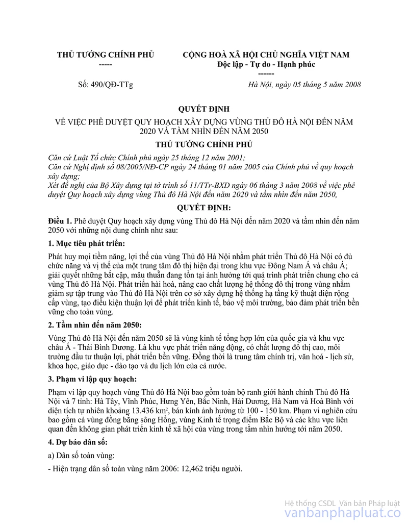
No. 490/QD-TTg |
Hanoi, May 5, 2008 |
DECISION
APPROVING THE PLANNING ON CONSTRUCTION OF HANOI CAPITAL REGION UP TO 2020, WITH A VISION TOWARD 2050
THE PRIME MINISTER
Pursuant to the December 25,
2001 Law on Organization of the Government;
Pursuant to the Governments Decree No. 08/ 2005/ND-CP of January 24, 2005, on
construction planning;
At the proposal of the Ministry of Construction in its Report No. 11/TTr-BXD of
March 6, 2008, approving the planning on constniction of Hanoi capital region
up to 2020, with a vision toward 2050,
DECIDES:
Article 1. To approve the planning on construction of Hanoi capital region up to 2020, with a vision toward 2050 with the following principal contents:
1. Development objectives:
To bring into full play all potential and advantages of Hanoi capital region in order to develop Hanoi capital into a modem urban center with full functions and an appropriate position in the Southeast Asia and Asia. To solve problems and contradictions which are affecting the general development of the whole Hanoi capital region. To harmoniously develop and improve the urban system in the region in order to reduce the pressure on Hanoi capital by building a regional-level wide-area technical infrastructure system, creating favorable conditions for economic development and environmental protection, and ensuring sustainable development of the whole region.
2. Vision toward 2050:
By 2050, the Hanoi capital region will be a major general economic region of the nation and the Asian-Pacific region. It will become a region of dynamic development, high urban quality, a favorable investment environment and sustainable development. It will also play the role of a major political, cultural, historical, scientific, educational, training and tourist center of the whole country.
3. Planning scope:
The planning scope of Hanoi capital region encompasses the whole administrative territories of Hanoi capital and seven provinces of Ha Tay, Vinh Phuc, Hung Yen. Bac Ninh, Hai Duong. Ha Nam and Hoa Binh with a total land area of around 13,436 km2 and an influential radius of 100-150 km. The study scope covers the Red River delta, the northern key economic region and areas related to the regions socio-economic development space in a vision toward 2050.
4. Population forecasts:
a/ Population of the whole region:
- Population of the whole region in 2006: 12.462 million.
- Projected population of the whole region by 2010: 13.2- 13.5 million.
- Projected population of the whole region by 2020: 14.5 - 15 million.
- Projected population of the whole region by 2050: 18 - 18.2 million.
b/Urban population:
- Urban population of the whole region in 2006: 3.26 million.
- Projected urban population of the whole region by 2010: 4.1 -4.5 million.
- Projected population of the whole region by 2020: 8.1 - 9.2 million.
- Projected population of the whole region by 2050: 14.4 - 15.4 million.
c/ Urbanization percentage:
- Urbanization percentage in 2006: 26.17% (27.12% for the whole country).
- Forecast urbanization percentage by 2010: 30 - 35%.
- Forecast urbanization percentage by 2020: 55 - 62.5%.
- Forecast urbanization percentage by 2050: 80 - 85%.
5. Land use planning:
- Present area: The total land area of the whole capital region is 1,343,600 hectares (13,436 km2).
- By 2010: The total land area for urban construction will be around 55,110 hectares, accounting for 4.12% of the whole capital regions land area and including more than 6,200 hectares of industrial land and 59.000 - 60,000 hectares for construction of rural residential areas. The per-capita land use norm will be 135 m2
- By 2020: The urban construction land area will be around 111,500 hectares, including around 15,000 - 24,000 hectares for industrial construction, with a per-capita land use norm of 120 m2. The land area for construction of rural residential areas will be around 45,000 - 50,000 hectares.
- Vision toward 2050: The urban construction land area will be around 172,800 hectares, including around 32,000 - 34,000 hectares for industrial construction, with a per-capita land use norm of 115 m2. The land area for construction of rural residential areas will be around 24,000 - 33,000 hectares.
6. Orientations for the regions spati development:
a/ Major orientations for development of the capital region:
- The Hanoi capital region will develop into a multi-polar concentrated urban region with spatial links between Hanoi city (the core urban area at the center and its adjacent areas) and surrounding provinces (the counterbalance development area), with provincial capital cities being the cores of the counterbalance development area. The regions development orientations are to promote the socio-economic development of provincial capital cities in order to bring into play their role and potential, through developing their technical and social infrastructure systems, and reduce the overload pressure on Hanoi city.
- The core urban area: Hanoi capital will play a leading role in the region, accommodating largely political, administrative, cultural, commercial, financial, service and hi-tech centers, research institutes and a tourist center of the whole region and the country.
- Hanoi adjacent areas are areas around the present Hanoi city.
- Areas of rapid urbanization cover industrial-service urban centers to be developed to the east and tourist-training-hi-tech urban centers to be developed to the west of the region, forming east-west economic-urban counterbalance spatial axes.
- Areas of dynamic economic, industrial and service development along concentrated along the economic axis linking the core urban area of Hanoi city with Hai Phong and Ha Long cities, with Hai Duong city to play the role as a regional urban center in which light industries and high technologies will be developed to support the development of processing industries in plain areas to the south-southeast of the Red River delta.
- Provincial capital cities will develop in scope and quality through investing in the construction of their social-technical infrastructure associated with surrounding industrial-service areas in order to better attract resources for urban development. To develop inter-urban traffic systems connected to the core urban area in order to create a major development framework for the counterbalance area. To select big urban areas to be developed into regional centers, including Hai Phong, Hoa Binh and Vinh Yen cities, and pay special attention to developing Hai Duong city into a major urban area in the future.
- To develop medium- and small-sized urban areas associated with agricultural zones into industrial, cottage industry and rural service centers, creating jobs for local laborers.
- To protect natural areas (free from urban construction and development), including: low and trough areas in river basins, flood-diverging areas, dikes, areas in which construction is limited, areas of beautiful landscape, national cultural and historical relics in the Hanoi region and main agricultural sub-zones of the provinces in the region.
- To study the expansion of the boundaries of Hanoi capital to have more land areas for the development of national key projects, including: the National Administrative Center; new urban centers: and service, tourist, research, training and hi-tech centers into which industrial zones and polluting works from Hanoi city will be relocated.
b/ Organization of the development space of the Hanoi capital region:
The space of the capital region is divided into two sub-regions:
The core urban area and adjacent areas. Tne counterbalance development area.
- The core urban area and adjacent areas: For the core urban area being expanded Hanoi capital, to select appropriate models of economic development, control population growth and land use. and form major national commercial and financial centers, hi-tech research and training institutions and cultural centers. In the comins period, to promote development in areas with potential to be merged into the capital through developing a number of urban, tourist, research and training, and hi-tech centers, limiting large-scale industrial concentration and controlling environmental protection.
Adjacent areas of 25 to 30 km wide will have the function of supporting the development and expansion of the core urban area, play the role of development interaction and pervasion between Hanoi capital and surrounding provinces. These areas will function as green belts to supply farm produce and foodstuffs for the capital. At the same time, small and cottage industries, traditional craft villages, and cultural and ecological tourism will be developed in these areas.
- The counterbalance development area of 30 to 60 km wide will be formed from three smaller areas having provincial capitals as their development cores.
+ The counterbalance area to the west of Hanoi capital: This area is in Hoa Binh province with the half-mountain and half-plain terrain and diversified natural landscapes. This area has great potential for the development of tourist resorts, cultural villages, etc., and for the construction of major technical infrastructure works.
+ The counterbalance area to the east and southeast of Hanoi capital: This area covers delta provinces linking the Red River delta with the northern coastal region, including: Bac Ninh, Hung Yen, Hai Duong and Ha Nam, and lying on economic axes linking Hanoi capital with the northern seaports. This area has potential for agricultural and industrial development.
+ The counterbalance area to the north and northeast of Hanoi capital: This area is mainly the half-mountain and half-plain area in Vlnh Phuc province to the north of Red River and along national highway 18. With vast hilly land areas, this area has potential for the development of industrial and urban service zones.
c/ Development of residential areas, urban systems and social infrastructure services:
To ensure sustainable development at different levels in different areas, concentrating on urban centers and surrounding areas, use land in an economical manner and make investment in infrastructure services with a view to raising the quality and attractiveness of infrastructure, housing and employment services for urban areas in the region.
- The urban system is divided into the following:
+ Hanoi capital: Its space will be developed in the following three major areas:
The urban area to the south of Red River, which will be embellished and expanded west-southwest of Hanoi city;
The urban area to the north of Red River, which will be a new commercial-urban center and a national traffic hub on the Kunming - Ha Long economic corridor;
The urban area to the east of Red River and the south of Duong river, which will provide residential houses linked with industrial, small and cottage industry zones and commercial service centers.
To limit industrial development, attract investment in hi-tech industrial zones associated with the formation of service cities and the creation of industrial economic centers on major axes of the region.
+ Regional and sub-regional cities, including Hai Duong, Vinh Yen and Hoa Binh cities, with Hai Duong city being a regional city and Bac Ninh, Hung Yen and Phu Ly being provincial capital cities. To develop provincial capital cities and locally run cities in the direction of concentrated investment, higher architectural quality and better urban and infrastructure service conditions in order to attract investment, develop their population, workforces and major central works in the region.
+ Specialized urban areas, which are mainly new urban centers attached to training and hi-tech centers (Hoa Lac), industrial zones (Pho Noi, Dong Van, etc.), tourist sites (Son Tay, Sao Do - Chi Linh, Tam Dao, Luong Son, Quan Son, etc.) or commercial service and housing development zones (An Khanh, Me Linh, Van Giang, Tu Son, etc.).
+ District-level urban areas and townships, which are medium- and small -sized industrial and agricultural and rural service centers. In urbanized rural residential areas, non-agricultural activities will gradually increase; handicrafts, services and trade, rural medium and small industries will develop; and the quality of public services and rural infrastructure systems will be raised. District urban centers will provide services for agricultural and rural areas. Small industrial zones and clusters must be located near district centers or commune cluster centers.
d/ Organization of the industrial space of the Hanoi capital region:
To form major industrial areas in the region in line with the orientations for the development space of the whole region, including:
- In the central core urban area:
+To develop industries with a high gray-matter content, high and new technologies, which are non-polluting, require a low land occupancy rate, employ selected workers and are associated with the research sector.
+ To build Hanoi hi-tech park in Nam Thang Long industrial zone.
+ To review the types of other industrial zones and develop them in adjacent areas.
- In the counterbalance areas:
+ The industrial area along national highway 18: To develop energy, construction materials, mineral exploitation and processing, engineering and chemical industries in Quang Ninh and Bac Giang provinces. To develop the industrial and urban spatial axis along the Kunming-Ha Long economic corridor and linked with seaports. Heavy industry establishments will be relocated north and northeast to hilly areas to the north of national highway 18 and some areas in Thai Nguyen, Quang Ninh (Dong Trieu - Mao Khe) and Bac Giang provinces.
+The industrial area to the north of Red River: This area consists of Soc Son - Noi Bai. Me Linh - Phuc Yen - Vinh Yen. In this area, automobile and motorbike assembly and electronic industries will be developed, and processing and polluting industries will be limited.
+ Pha Lai area: thermoelectric industry.
+ Industrial areas attached to two big satellite cities of Viet Tri and Thai Nguyen, with Thai Nguyen city and its southern suburban areas (Cong river, Pho Yen) to develop steel and construction materials industries.
+ To develop industrial areas attached to the regions eastern axis of rapid urbanization toward Hai Phong seaport, with manufacture, food and foodstuff processing, high-class materials and light industries, and agricultural production services.
+ To build the western hi-tech area (combined with Phu Cat industrial park) in Hoa Lac area.
+ Hydropower industry in Hoa Binh.
+ To develop traditional craft villages in Ha Tay province.
+ To develop small-sized industrial clusters attached to urban areas, such as Xuan Mai, Luong Son and Hoa Binh on national highway 6.
+ In the south of the region, to form a multi-sector industrial area attached to two southern urban areas of Hung Yen and Phu Ly, consisting of the following two clusters:
An industrial cluster for exploitation of stone and manufacture of cement and construction materials in But Son - Kim Bang - Kien Khe.
A cluster for light industries and consumer goods production along the axis of Dong Van - Hoa Mac - Chau Son.
- The key industrial area:
The key industrial area of Hanoi capital region will be largely located in the eastern area (from the central urban area to Hai Phong and Quang Ninh), creating a major economic corridor of the whole region linking the East-West expressways and a corridor of rapid urbanization with big development centers intermingled with urban-industrial-service clusters along the whole axis, and forming a development counterbalance area of the central city.
For Hanoi capital: To renovate, upgrade and relocate polluting industrial establishments out of the inner city (synchronous environmental protection measures must be taken upon relocation of these establishments to suburban areas) and concurrently form satellite and new urban centers, such as Bac Thang Long, Nam Thang Long. Bo De (Gia Lam) and Yen Vien.
For the development of industrial parks and hi-tech parks: To accelerate the planned construction and operation of Hoa Lac hi-tech park. For the near future, to concentrate efforts on creating favorable conditions and adopting more open policies to attract domestic and foreign investment in existing industrial parks. To review construction plannings of industrial parks of the whole region in order to ensure sustainable and balanced development. To plan the coordinated construction of residential areas and social infrastructure works in service of industrial parks.
e/ Organization of the tourist space of the region:
- Tourist potential of the region:
+ The organization of the tourist space of Hanoi capital region within the planned tourist center of Hanoi and adjacent areas and is determined in the master plan on development of tourism in the North, encompassing Hanoi capital, neighboring provinces within the Hanoi capital region and surrounding provinces of Phu Tho. Bac Giang. Ninh Binh. Nam Dinh. Thai Binh and Thanh Hoa. This is a large region with different terrains and the most abundant natural and human resources for tourism in the North and the most important among five important tourist centers prioritized for development investment.
+ The space for the tourist region constitutes part of the development space determined for the Hanoi capital region, helps create tourist products characterized with peculiar identities of each area in the region and form and develop several tourist service towns in association with large ecological areas.
+ Ecological tourism in half-mountain and half-plain areas and relic tourism attached to agricultural villages in the Red River delta are particularities of the Hanoi capital region, making it different from coastal areas. To create satellite tourist centers in order to expand the radius of attraction of the core center being Hanoi capital.
+ The system of tourist routes is a reasonable connection of valuable tourist centers, clusters and spots within the tourist territorial space limits of the Hanoi tourist center and adjacent areas, forming continuous and closed tourist routes.
+ To select for construction investment a number of tourist centers at national and international levels. Hanoi will be an international-level tourist center while Ba Vi-Huong Son-Tam Chuc, Tam Dao-Tay Thien, Chi Linh-Sao Do and Pho Hien will be national-level tourist centers. Regional-level tourist routes and spots will also be selected for investment.
- Organization of the tourist space of the Hanoi capital region:
+ Areas prioritized for investment in tourism development: These areas are the core of tourist centers; major tourist spots: and areas where abundant natural resources for tourism are available and can be simultaneously exploited.
+ Space of tourist centers: Hanoi city will be the tourist center of the region since it has a large variety of historical, cultural and architectural relics as well as traditional festivals and recognized relics, including two special relics regarded as the biggest sites for humanity tourism of the whole country. In these sites, investment in the building of service facilities and roads and upgrading of sight-seeing spots will be prioritized.
+ Space of satellite tourist centers: These centers will be developed in association with urban areas in the region such as Viet Tri, Vinh Yen, Son Tay, Hoa Binh, Nam Dinh, Bac Ninh and Hai Duong cities, with prioritized investment in building accommodation establishments, traffic and service works.
+ Major tourist areas:
The ecological - entertainment - spoil - resort tourism area in Ba Vi - Ha Tay. consisting of tourist sites and resorts surrounding mountains and lakes of Ba Vi - Suoi Hai area. Projects under construction include Dong Mo golf course, the tourist and cultural village of Vietnamese nationalities and a number of small-sized tourist service spots. To invest in an urban area of high-class tourist resorts in Suoi Hai area.
The ecological and resort tourism area in Tam Dao - Tay Thien: Tourist centers of Tam Dao national park and Dai Lai lake which have been invested and developed in the direction of being attached to urban areas shall be controlled under strict management regulations. For Tam Dao district township, careful studies should be conducted to limit construction density and guide a typical style of urban architecture.
The area for cultural and festival tourism combined with lake and rock mountain tourist attraction in Huong Son - Quan Son - Tam Chuc: Hoa Binh tourist area for sight-seeing and study visits to Muong ethnic groups cultural areas, and travel on the Hoa Binh hydropower reservoir; Chi Linh - Sao Do tourist area (Hai Duong province) with relics and scenic places which are linked with the Quang Ninh - Hai Phong tourist area.
f/ Organization and orientations for development of the system of social services:
- Organization of the regional system of commercial and health services:
+ To support urban areas playing the role as regional centers and major specialized urban areas which are reasonably far from Hanoi and influential in the population redistribution within the region, including: Hai Duong. Vinh Yen and Hoa Binh cities, investment will be made in building commercial and public service centers, entertainment facilities and medical establishments in order to raise urban quality and attract resources into these urban areas. Major commercial centers for farm produce will be built in Hai Duong city as a core of the northern agricultural area and concurrently as an inland clearance depot area for cargo transshipment for Hai Phong and Quang Ninh seaports and a medical, educational and training service center.
+ To build high-quality regional medical centers in Hoa Lac urban area (Ha Tay), Hai Duong and Vinh Yen cities, and Phu Ly town in order to reduce the overload of work for central hospitals in Hanoi inner city.
+ To build major commercial centers playing the role as suppliers and regulators of the distribution of goods in the region and neighboring areas in Phu Ly (Ha Nam), Hai Duong. Bac Ninh. Vinh Yen and Hoa Lac.
- Organization of the training system of the region:
+ To organize three regional training centers in Hanoi, Hai Phong and Nam Dinh, with Hanoi being the central area and Hai Phong and Nam Dinh being two supporting areas to train human resources for the whole country, the North and the Red River delta.
+ To locate near Hanoi hi-tech training schools to teach such disciplines as new materials, information technology, automation, biology, international-level training of service workers.
+ Hanoi will be the biggest training center. To form new training centers attached to urban areas in the region under big projects such as the National University Campus in Hoa Lac. clusters of technical colleges attached to major industrial parks such as Bac Thang Long, Noi Bai and Soc Son of Hanoi, industrial areas on national highway 18 and new national highway 18 (Hai Duong and Quang Ninh), and industrial area of Pho Noi -Yen My (Hung Yen).
+ To locate in each province one or two people-founded universities for multi-branch training and professional and technical workers training schools according to local requirements.
+ A public university will train 10,000-12,000 students per year, a key university: 18,000 -20,000, a people-founded university: 6,000 - 10,000, and a college 3,000 - 5,000.
+ The redistribution of training schools in the region aims to create a greater driving force for the development of urban areas and conditions for these schools to invest in developing their training facilities and dormitories for students after the model of advanced training environment linked with modern urban services.
7. Orientations for development of the technical infrastructure system:
a/Transport infrastructure:
To make the fullest use of existing transport infrastructure works and attach importance to the maintenance of existing works and investment in their upgrading.
To optimize the regions geographical advantages to synchronously develop the outbound transport system consisting of roads, railways, airways and waterways. To invest in developing North-South and East-West transport corridors and belt roads linking with airports and seaports.
To develop the transport system in a uniform, balanced and synchronous manner, ensuring the connectivity between modes of transportation and between the regional transport network and the national and international transport networks.
- Roads:
+ To build belt roads to reduce traffic passing Hanoi city.
+ To build new belt expressways (belt roads IV) of the Hanoi capital region within a radius of 20 - 40 km to help reduce the flow of vehicles, especially trucks and transit automobiles, on expressways and national highways heading to the core city.
+ To renovate existing and build new national highway sections linking counterbalance cities surrounding Hanoi city within an average radius of 40 - 60 km (belt roads V) to serve the direct connection between cities and concurrently help reduce the flow of transit automobiles on expressway and national highway sections heading to the central area.
+ To build new road sections along important economic corridors between belt roads IV and belt roads V, and roads from the international airport and satellite and counterbalance urban areas to Hanoi capital in order to satisfy the demand of pendulous traffic between the core city and other cities in the region.
+ To build a northern expressway in parallel with national highways 2 and 18, linking Yunnan (China) and the Northwestern region with Cai Lan deep-water seaport (Quang Ninh).
+ To build a southern expressway in parallel with national highways 6 and 5, linking the Northwestern region with Hai Phong - Cai Lan group of seaports.
+To build a western North-South expressway being a Ho Chi Minh road section linking national highway 21 with national highway 2.
+To build an eastern North-South expressway in parallel with national highway 1A as an arterial motorway important for national and international transport.
+To concentrate on renovating, upgrading and expanding centripetal national highway sections up to the standard of grade-I plain roads with 4-6 lanes.
+ To renovate and upgrade, and build provincial roads connected to the network of national highways.
+ To organize intra-regional roads linking the system of residential areas with axial roads to form a complete road network meeting the intra- and inter-regional travel needs.
- Railways
+ National railways:
To renovate and upgrade five national railways starting from Hanoi city into electrified dual-track railways.
To renovate and completely build belt railways approaching Hanoi region in order to reduce the flow of trains i uniting through the inner city.
+ To build new national railways to meet transport needs in the following directions:
The North-South railway for express trains.
The Lao Cai - Hanoi - Quang Ninh railway.
The Hanoi - Hai Phong railway for express trains.
- Intra-regional railways: To renovate existing intra-regional railways and build new ones from Hanoi to Thai Nguyen, Viet Tri, Bac Giang. Hai Duong, Ninh Binh, Hoa Binh and Son Tay.
To link the intra-regional railway system with the system of urban railways. To study the building of a number of new light railways linking urban areas with major tourist, rest and entertainment areas in the region, such as Ba Vi, Son Tay, Hoa Binh. Hung Yen. Huong Pagoda (Ha Tay).
+ The system of urban railways should be studied, invested in and buiit into a complete mass transit railway network meeting travel needs.
+ The system of railway service works:
To build key works linking railways, especially those between centripetal railways and belt railways.
To build bridges, works and facilities for railway and train safety.
To build a system of major cargo train stations (Ngoc Hoi. Co Bi, Yen Vien, Bac Ninh, Bac Hong, etc.) in order to ensure unified links between railways of the national railway system running through Hanoi city.
To build a system of major passenger train stations, ensuring unified links between the urban railway system and the regional and national railway systems.
- Airways:
+ To build, renovate and upgrade the Noi Bai international airport into a major and modem airport in the northern region: By 2020,2030 and afterwards it will be able to receive 15.2,25 and up to 50 million passengers per year. To further study the position and size of the second international airport in the region when the Noi Bai airport shows signs of overload and has no reserve land for long-term development.
+ To renovate and upgrade the Cat Bi international airport (Hai Phong) to receive domestic and international passengers.
+The Gia Lam airport will serve short-distance domestic travels.
- Waterways:
+ To renovate and upgrade waterway routes directly linked with Hai Phong and Quang Ninh seaports.
+ To invest in and rationally exploit Red River waterway route for socio-economic development andriverway tourism.
+ To renovate and build the system of river ports in the region (groups of ports in Hanoi, Son Tay, Vinh Phuc, Hoa Binh. Hung Yen, Hai Duong and Ha Nam). To link these river ports with the railway and road systems to form important major transshipment transport hubs of the region.
- Urban and rural transport:
+ Orientations for development of urban transport:
The land fund for urban transport must account for 20 - 25% of the total land area for urban construction.
The average density of roads (excluding roads in residential areas) will be 6 - 8 km/km2 in central areas and 3-5 km/km2 in other areas.
Organization of mass transit for urban areas:
For the core city, a system of urban railways will be built: To invest in building urban railways into acomplete mass transit railway network under the general planning of Hanoi capital in order to meet the regional populations travel needs.
For other urban areas, mass transit vehicles will be largely medium- and small-sized buses.
To restrict to the utmost the use of private vehicles and set a limit of 80 - 100 cars per 1,000 people.
To organize the management of urban traffic in a scientific manner with modem equipment and devices.
+ Transport in rural and mountainous areas:
To maintain and consolidate the existing transport network, upgrade a number of important roads and step by step build rural roads according to technical standards.
To build a number of new roads, bridges and sewers interconnected with the system of provincial roads to meet the peoples travel needs.
. To use mainly local materials, and concentrate on the asphalt and concrete surfacing of roads.
- Regarding the system of transport sen ice works:
+ Bridges and sewers:
To renovate and upgrade bridges on roads and railways suitable to road and railway grades.
To build a number of new bridges: one bridge on belt roads V (Vinh Thinh bridge); two bridges on belt roads IV (Me So and Hong Ha bridges); three bridges on urban trunk roads; and one bridge spanning Duong river.
+ To build a system of interchanges according to set standards of crossroads:
+ To renovate and build a system of parking lots and terminals.
+ To organize a system of major general transshipment hubs:
Noi Bai hub linking national and urban railways with roads and airways.
Southern hubs: Ngoc Hoi area and Khuyen Luong river port area linking national and urban railways and railways for express trains with roads and waterways.
Eastern transshipment hubs: Co Bi and Hai Duong stations, inland clearance depots, combined railways and roads.
Bac Ninh hub for various modes of transport, such as national and international railways and roads.
b/ Technical preparations:
- Foundation works:
Construction foundations of urban areas must be high enough to prevent inundation, with the probability (P) ≥ 2% for grade-2 urban areas. P ≥ 2.5% for grade-3 urban areas, P ≥ 5% for grade-4 urban areas, and P ≥ 10% for grade-5 urban areas;
- Water drainage planning:
+ For special, grade-1 and grade-2 urban areas, it is necessary to build completely separate water drainage systems, achieving the target that 100% urban roads and ≥ 70% suburban roads will have rainwater drainage systems.
+ For grade-3 urban areas: ≥ 70% of urban roads will have rainwater drainage sewers. For grade-4 and grade-5 urban areas: ≥ 60% of urban roads will have rainwater drainage sewers. For suburban areas: ≥ 50% of suburban roads will have rainwater drainage sewers.
- Flood prevention and combat in the Hanoi capital region:
+To build and consolidate a system for forecast and warning of flood on rivers in the region.
+ To step up the dike protection and liver flow clearance in order to ensure the flood drainage capacity of the river system.
+ To upgrade the Bac Hung Hai irrigation system and anti-inundation works in regional provinces. To dredge rivers for flood drainage, such as Day. Nhue, Ngu Huyen Khe and Duong rivers.
+To apply the solution of headwater reservoirs:
To build large reservoirs for flood reduction in the rainy season, water current regulation, water supply in the dry season, tourism and hydropower generation.
At present, Hoa Binh and Thac Ba reservoirs are used for flood reduction whenever the water level in Hoa Binh reservoir reaches 117 meters or the water level of Red River in Hanoi is likely to exceed 13.1 meters.
Pending the completion of new headwater reservoirs, flood-diverting works in Day and Tich rivers and previous flood-slowing zones shall still be used.
Once Son La reservoir (Da river) and Dai Thi reservoir (Lo river) are completed, Dap Day flood-diverting work and other flood-diverting and -slowing works will be removed.
To plant trees and protect headwater forests in order to effectively retain soil and water, combat erosion and landslides, slow down flood and prevent flashflood.
- Other works:
+ To plant breakwater bamboos and grass for retaining soil, regulate river flows and unblock flood drainage corridors.
+ To build groynes to check drifts, especially in weak positions on the banks of Red River. Not to build works along riverbanks, streams and near reservoirs with dams to prevent landslides.
+ For ecological and resort tourism areas of Tam Dao. Ba Vi, Dai Lai lake, Con Son, Kiep Bac, etc.. specific zoning plans are needed to prevent uncontrolled exploitation. Particularly, excavation, digging or work construction activities are prohibited in mountain slopes and foots without construction planning.
c/ Orientations for power supply:
- Power load for the Hanoi capital region in different periods will be:
+ For the initial stage: Around 3,800 MW.
+ For a long-term period: 9,000 - 10,000 MW.
- Orientations for power supply:
+ Power sources: Power for the Hanoi capital region will come from existing power plants and the national 500 kV and 220 kV power grids.
+ Power grids:
The 500 kV power grid: A 500 kV power grid will be built to connect large-output power plants outside the region to supply power to 500 kV transformer stations in the region and interconnect these stations to form a 500 kV loop circuit exclusively for the Hanoi capital region.
The 200 kV power grid: In parallel with developing the 500 kV power source and grid, it is necessary to develop the 220 kV power grid for the region. By 2020, the whole Hanoi capital region will have twenty nine 220 kV transformer stations, with each province or city in the region having at least one 220 kV station, with power supplied from the 220 kV grid. To form three or four 220 kV loop circuits in the Hanoi capital region to supply power for those 29 stations, with each station to be supplied with power from two directions or dual-circuit lines.
The 110 kV power grid: To build a separate 110 kV power grid for each province or city in the region. For a long term, each district in the region will have at least one 110 kV station. Each 110 kV station will be supplied with power from two directions or dual-circuit lines.
d/ Orientations for water supply:
- Selection of water sources: To select combined ground and surface water sources, with importance attached (priority given) to the exploitation of surface water source.
- Solutions:
+ The inter-provincial water supply system:
To increase the output of the Da river water supply system from 600,000 m3 day to 1,200,000m3/day, and exploit water of Da river for Hanoi, Ha Tay and Luong Son (Hoa Binh).
To build a new inter-regional water plant exploiting the projected water source of Duong river or Red River with an output of 100,000 - 300,000 m3/day, which might be raised to match the development of the region and add a water source for the northern region of Red River, urban and industrial areas to the east of national highway 5 from Hanoi or along national highway 1 from Hanoi - Bac Ninh.
+ The provincial water supply systems:
In Hai Duong province: The Thai Binh river water supply system with an output of 130,000 m3/day exploiting water of Thai Binh river will supply water for Hai Duong city and urban and industrial areas along national highway 5.
In Ha Nam province: The Red River and Chau river water supply system with an output of 120.000 m3/day will supply water for urban and industrial areas along national highway 38 and urban areas adjacent to Ha Nam province.
In Vinh Phuc province: The Lo river water supply system with an output of 250,000 m3/day will add a water source for Vinh Yen city, urban and industrial areas to the north of Vinh Yen.
e/ Orientations for wastewater drainage and environmental sanitation:
The wastewater drainage system of the Hanoi capital region will be divided into two main zone: zone 1: the core city or expanded Hanoi capital; zone 2: counterbalance urban area.
For these urban areas, wastewater drainage systems must be built separately from rainwater drainage systems for sectional drainage for each urban area. To build wastewater treatment facilities and plants for provincial cities. For rural areas and residential areas: To build water drainage systems to collect both wastewater and rainwater. For villages and hamlets: wastewater drainage systems will be built by households themselves to suit their conditions and ensure hygiene and not to affect surrounding water sources.
Wastewater must be treated to reach Vietnamese hygiene standards before being discharged into the environment. The level of wastewater treatment will depend on where it is discharged (according to Vietnam standards). Wastewater of industrial parks, local industrial zones and hospitals in these areas must also be treated to reach Vietnam standards before being discharged into the environment.
- Water drainage and wastewater drainage:
+ To build separate wastewater drainage systems for expanded and newly built areas, industrial or tourist areas of cities and provincial capitals. Semi-common sewer systems will be used for old urban areas, in which common sewer systems already exist, and district townships. To build common water drainage systems for commune centers and rural residential areas.
+ For urban areas (especially Hanoi capital), the whole volume of (daily-life, industrial and hospital) wastewater must be treated to reach hygiene standard limit A or B (depending on receiving sources and positions where wastewater is discharged according to Vietnam standards TCVN 7222 - 2002 and 5945 - 2005) before being discharged into the environment.
To treat water to reach standard limit A, for water of rivers within the water source protection areas, including Da, Hong (Red). Day. Lo. Luoc, Thai Binh and Cau rivers.
To treat water to reach standard limit B, for water of other rivers and lakes in the region (but not to be supplied for daily-life use).
+ For rural areas: To make the fullest use of water of existing rivers and lakes and build bio-reservoirs for wastewater treatment by the method of biological self-cleaning.
- Solid waste
The syestem for treatment of solid waste of the Hanoi capital region is divided into:
Regional (inter-provincial) solid waste treatment facilities:
A treatment facility will be built in Soc Son disirict of Hanoi city on an area of around 140 -160 hectares to treat with modern treatment technologies industrial solid waste for the Hanoi region and treat daily-life solid waste for Hanoi city and Soc Son district.
A treatment facility will be built in Luong Son district of Hoa Binh province and Chuong My district of Ha Tay province on an area of around 200 hectares to treat with modern treatment technologies daily-life solid waste for the western area of the Hanoi region and Hoa Binh and Ha Tay provinces.
- Provincial solid waste treatment facilities
In Vinh Phuc province: A facility will be built in Tam Dao district on an area of 100 hectares.
In Bac Ninh province: A facility will be built in Que Vo district on an area of 40 - 60 hectares.
In Hung Yen province: A facility will be built in Yen My and Tien Lu districts on an area of 20 - 40 hectares.
In Duong province: A facility will be built in Chi Linh, Cam Giang and Thanh Ha districts on an area of 100 hectares.
In Ha Nam province: A facility will be built in Thanh Liem district on an area of 50 hectares.
+ District solid waste treatment facilities: Each district will build one solid waste facility using mainly hygienic landfill technologies.
- Cemeteries:
Orientations for arrangement of cemeteries in the Hanoi region are as follows:
+ A national cemetery, namely Mai Dich II, will be built in Luong Son district, Hoa Binh province on an area of 100 hectares and apply modern combined interment technologies, including embalming interment technology.
+ A resettlement cemetery, which is an ecological cemetery, will be built in Soc Son district on an area of 150 hectares and apply mainly final inhumation technology.
+A regional (inter-provincial) public cemetery will be built in Ba Vi district and apply Combined interment technologies: ground burial followed by disinterment for reburial, permanent ground burial, final inhumation, cremation, embalming interment (limited).
+ Provincial cemeteries will be built under provincial construction plannings approved by provincial-level Peoples Committees.
f/ Orientations for environmental protection:
- To enhance the control and treatment of environmental pollutions, thoroughly treat wastewater and solid waste, and control exhaust gas volume from vehicles.
- Regional development must be associated with environmental protection in Nhue, Day, Ca Lo. Duong, Tich, Hong (Red) and Thai Binh river basins.
- To enhance the control and thorough treatment of environmental pollution caused by wastewater, waste gases, solid waste and hazardous waste in industrial zones, small and cottage industry establishments and craft villages.
- To enhance environmental management and protection in suburban residential areas, ground clearance and resettlement areas.
8. Priority programs and projects:
In order to step by step effectively implement the construction planning of the Hanoi capital region at the initial stage, efforts should be concentrated on the following specific programs and projects:
a/ Social infrastructure
- Aprogram on rearrangement and adjustment of tertiary education establishments, professional secondary and vocational schools, aiming to relocate a number of universities and schools out of the inner city of Hanoi.
- A program on rearrangement and adjustment of regional hospitals, aiming to rationally distribute these hospitals and reduce the overload of work for hospitals in the inner city of Hanoi.
- A program on building of a system of major commercial and service works; wholesale markets and supermarkets.
- A program on building of national - or regional-level sports centers ready for organizing regional - or continental-level sport tournaments.
- Review and adjustment of urban and industrial plannings which are no longer appropriate to the Hanoi capital regions industrial development.
b/Technical infrastructure
- Transport infrastructure:
+ To invest in renovating, upgrading and building expressways, Ho Chi Minh road, and belt expressways of the capital region (phase I).
+ To invest in renovating and expanding centripetal sections of national highways 2,3,32, etc.
+ To invest in building transport service facilities.
+ To invest in renovating and upgrading centripetal sections of national railways into elecmfied dual-track railways.
+ To invest in building a number of urban railways.
- Technical preparations:
+ The project on Tac Giang sluice gate.
+ The project on dredging of Chau Giang, Nhue and Ngu Huyen Khue rivers and Bac Hung Hai irrigation system.
+ The project on revitalization of Day river.
+ The project on embankment of landslide-prone areas on the banks of Red River.
+ Building of a system of outer sewers for treatment of wastewater before discharge into Hanoi citys axial drainage system.
- Water supply:
+ The project on water supply from Da river.
+ The project on water supply from Lo river.
- Wastewater drainage and environmental sanitation:
+ The national cemetery "Mai Dich 2".
+ A complex for solid waste treatment in the west of the Hanoi capital region.
+ An ecological cemetery. +A regional public cemetery.
- Power supply:
+ Regarding 500 kV transformer stations and grid:
Expansion of Thuong Tin transformer station.
Building of new Thuong Tin - Quang Ninh dual circuit.
+ Regarding 200 kV transformer stations and grid:
Expansion of Soc Son, Xuan Mai. Pho Noi and Hoa Binh transformer stations.
Building of new transformer stations in Thanh Cong. Van Tri. An Duong, etc.
- Environmental protection:
+ Improvement of water quality of degraded and seriously polluting lakes.
+ Thorough treatment of wastewater sources along the basin of Nhue and Day rivers.
+ Treatment of ground water contamination and geological depression.
+ Planning of the construction of a system of ecological belts of the Hanoi capital region.
9. Models of implementation organization:
The Steering Committee for planning and construction investment of the Hanoi capital region shall direct planning and construction investment work and the implementation of regional-level investment programs and projects: formulate special mechanisms and solutions to facilitate the regions socio-economic development: inspect and urge ministries, branches and localities in implementing the planning and carrying out constaiction investment under the planning.
The Ministry of Construction shall assume the prime responsibility for, and coordinate with the Ministry of Home Affairs and concerned agencies in, studying and proposing to the Prime Minister models of management of the regions development.
Article 2. This Decision takes effect 15 days after its publication in CONG BAO.
The Ministers of Construction; Planning and Investment; Industry and Trade; Finance; Natural Resources and Environment; and Defense; the Peoples Committees of Hanoi city and Ha Tay, Hoa Binh, Bac Ninh, Vinh Phuc, Ha Nam, Hung Yen and Hai Duong provinces, and concerned organizations shall implement this Decision.
|
|
PRIME
MINISTER |