Nội dung toàn văn Circular 57/2015/TT-BGTVT annoucement of seaport waters and area under management Vung Tau
|
MINISTRY OF
TRANSPORT |
SOCIALIST
REPUBLIC OF VIETNAM |
|
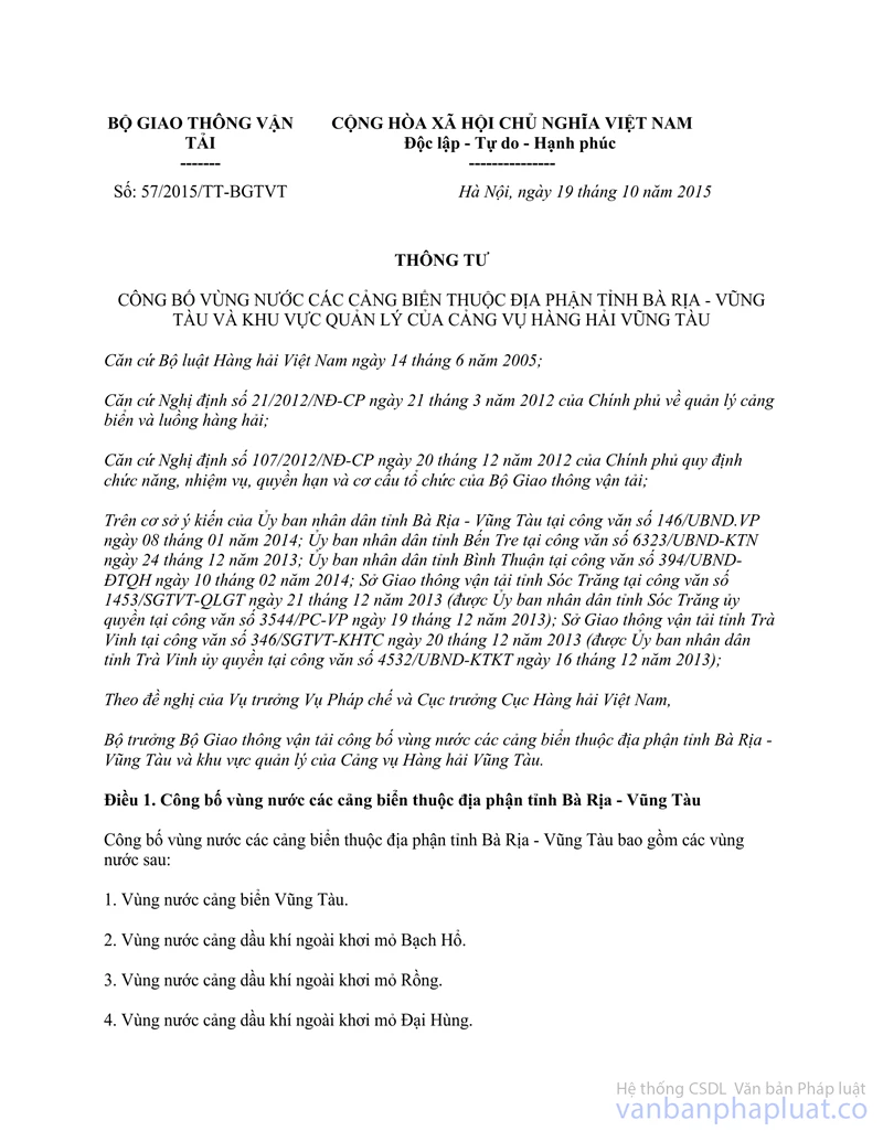
No.: 57/2015/TT-BGTVT |
Hanoi, October 19, 2015 |
CIRCULAR
ANNOUCEMENT OF SEAPORT WATERS IN BA RIA – VUNG TAU PROVINCE AND AREA UNDER MANAGEMENT OF VUNG TAU MARITIME ADMINISTRATION
Pursuant to the Maritime Code of Vietnam dated June 14, 2005;
Pursuant to the Government’s Decree No. 21/2012/ND-CP dated March 21, 2012 on management of seaports and navigational channels;
Pursuant to the Government’s Decree No. 107/2012/ND-CP dated December 20, 2012 defining the functions, tasks, powers and organizational structure of Ministry of Transport;
In consideration of opinions given by the People’s Committee of Ba Ria – Vung Tau Province at the Official Dispatch No. 146/UBND.VP dated January 08, 2014, the People’s Committee of Ben Tre Province at the Official Dispatch No. 6323/UBND-KTN dated December 24, 2013, the People’s Committee of Binh Thuan Province at the Official Dispatch No. 394/UBND-DTQH dated February 10, 2014, the Department of Transport of Soc Trang Province at the Official Dispatch No. 1453/SGTVT-QLGT dated December 21, 2013 (according to the authorization of the People’s Committee of Soc Trang Province at the Official Dispatch No. 3544/PC-VP dated December 19, 2013), and the Department of Transport of Tra Vinh Province at the Official Dispatch No. 346/SGTVT-KHTC dated December 20, 2013 (according to the authorization of the People’s Committee of Tra Vinh Province at the Official Dispatch No. 4532/UBND-KTKT dated December 16, 2013);
At the request of the Director of the Legal Department and the Director of Vietnam Maritime Administration;
Minister of Transport makes announcement of seaport waters in Ba Ria – Vung Tau Province and areas under the management of Vung Tau Maritime Administration.
Article 1. Announcement of seaport waters in Ba Ria – Vung Tau Province
Seaport waters in Ba Ria – Vung Tau Province include the following waters:
1. Vung Tau seaport waters.
2. Offshore oil port waters of Bach Ho Oilfield.
3. Offshore oil port waters of Rong Oilfield.
4. Offshore oil port waters of Dai Hung Oilfield.
5. Offshore oil port waters of Rang Dong Oilfield.
6. Offshore oil port waters of Rong Doi and Rong Doi Tay Oilfields.
7. Offshore oil port waters of Te Giac Trang Oilfield.
8. Offshore oil port waters of Chim Sao Oilfield.
9. Offshore oil port waters of Lan Tay Oilfield.
10. Offshore oil port waters of Bien Dong Oilfield.
Article 2. Area of seaport waters in Ba Ria – Vung Tau Province
Area of seaport waters in Ba Ria – Vung Tau Province shall be identified by the highest tides and determined as follows:
1. Area of Vung Tau seaport waters:
a) Seaward boundaries (in the South and Southwest of Ganh Rai Bay) are limited by straight lines successively connecting the following points, GR1, GR2, GR3, GR4, GR5 and GR6, with the following coordinates: GR1: 10°19’15” N, 107°04’55” E (Vung Tau cape);
GR2: 10°14’00” N, 107°07’56” E;
GR3: 10°11’00” N, 107°07’56” E;
GR4: 10°11’00” N, 107°00’00” E;
GR5: 10°24’00” N, 107°00’00” E;
GR6: 10°25’10” N, 106°58’12” E (in the northeastern edge of Can Gio cape).
b) The boundary towards the Western shore of Ganh Rai Bay: beginning at the point GR6 running along the meridian 106°58’12” E (which borders the seaport waters in the territory of Ho Chi Minh City) to the Southern edge of Phu Loi Island.
c) The boundary towards the Northern shore of Ganh Rai Bay: beginning at the intersection point of the meridian 106°58’12” E and the Southern edge of Phu Loi Island, running along the Eastern shore of Phu Loi Island in the northern direction to the farmost point of the rink bank of Cai Mep river mouth.
d) Boundaries on Cai Mep river and Thi Vai river:
Beginning at two farmost points of Cai Mep river mouth, running along two shores of Cai Mep river to the confluence of Cai Mep river, Go Gia river and Thi Vai river.
Beginning at two farmost points of Thi Vai river mouth (at the confluence of Thi Vai river, Go Gia river and Cai Mep river), running along two shores of Thi Vai river to the parallel 10°38’24” N.
dd) The boundary towards the northeastern shore of Ganh Rai Bay: beginning from the left bank of Cai Mep river mouth, running along the shore of Ganh Rai Bay through the southwestern edge of Phu Lang Island and Dong canal mouth to Ong Ben canal. e) The boundaries on Ong Ben canal and Rang river:
Beginning at two farmost points of Ong Ben canal mouth, running along two sides of Ong Ben canal towards upstream area of Rang river to the meridian 107°03’30” E across the river.
Beginning at the farmost point of the left bank of Ong Ben canal mouth, running along the southwestern shore of Long Son Commune, to two points, GR7 and GR8, with the following coordinates:
GR7: 10°26’08” N, 107°06’00” E;
GR8: 10°25’00” N, 107o07’00” E (the southern edge of Go Cong).
g) The boundaries on Dinh river and Rach Ba river:
Beginning at the point GR8, running along the right bank of Dinh river through the wharf of Truong Sa Marine Products One Member Limited Liability Company to the straight border across the river at the parallel 10°26’33” N. From the intersection point of the straight border across the river at the parallel 10°26’33” N and the left edge of Dinh riverside , running along Dinh riverside towards downstream area to the farmost point of the right bank of Rach Ba river mouth.
Beginning at two farmost points of Rach Ba river mouth, running along two shores of Rach Ba river to the straight line across the river at 100m far away from the dry dock of Vungtau Shipyard in the upstream direction (which is the boundary between the dry dock of Vungtau Shipyard and dedicated port of Vietnam Maritime Safety Corporation).
Beginning at the farmost point of the left bank of Rach Ba river, running along the Northern shore of Ben Dinh Island to the Ganh Rai cape.
Beginning from Ganh Rai cape running along the coast to point GR1.
h) Boundaries at Con Dao area:
Seaward boundary is limited by the straight lines connecting the following points, BĐ1, BĐ2, BĐ3 and BĐ4, with the following coordinates: BĐ1: 08°39’47” N, 106°32’23” E (the northwestern cape of Hon Ba island);
BĐ2: 08°42’26” N, 106°32’08” E (the southwestern cape of Hon Tre Lon island);
BĐ3: 08°41’08” N, 106°33’13” E (the southwestern cape of Hon Trac island);
BĐ4: 08°41’01” N, 106°33’34” E.
Landward boundary: beginning at the point BĐ4 running along the shore towards the South to the Northeast of Hon Ba island to the point BĐ1.
2. Area of offshore oil port waters of Bach Ho Oilfield:
Is limited by three circles with a 01-natical mile radius, centered at the following points BH1, BH2 and BH3, with the following coordinates:
BH1: 09°46’31” N, 107°58’43” E;
BH2: 09°48’54” N, 108°00’09” E;
BH3: 09°43’51” N, 107°57’02” E.
3. Area of offshore oil port waters of Rong Oilfield:
Is limited by the circle with a 01-natical mile radius, centered at the following point MR, with the following coordinates:
MR: 09°34’33”N, 107°52’52” E.
4. Area of offshore oil port waters of Dai Hung Oilfield:
Is limited by the circle with a 01-natical mile radius, centered at the following point ĐH, with the following coordinates:
ĐH: 08°28’36” N, 108°41’6” E.
5. Area of offshore oil port waters of Rang Dong Oilfield:
Is limited by the circle with a 01-natical mile radius, centered at the following point RĐ, with the following coordinates:
RĐ: 10°01’16” N, 108°16’01” E.
6. Area of offshore oil port waters of Rong Doi and Rong Doi Tay Oilfields:
Is limited by the circle with a 01-natical mile radius, centered at the following point RĐ - RĐT, with the following coordinates:
RĐ-RĐT: 07°48’36” N, 108°11’01” E.
7. Area of offshore oil port waters of Te Giac Trang Oilfield:
Is limited by the circle with a 01-natical mile radius, centered at the following point TGT, with the following coordinates:
TGT: 09°58’25” N, 107°58’10” E.
8. Area of offshore oil port waters of Chim Sao Oilfield:
Is limited by the circle with a 01-natical mile radius, centered at the following point CS, with the following coordinates:
CS: 07°20’43” N, 108°18’36” E.
9. Area of offshore oil port waters of Lan Tay Oilfield:
Is limited by the circle with a 01-natical mile radius, centered at the following point LT, with the following coordinates:
LT: 07°34’45” N, 108°52’03” E.
10. Area of offshore oil port waters of Bien Dong Oilfield:
Is limited by the circle with a 0.5-natical mile radius, centered at the following point HT - MT, with the following coordinates:
HT-MT: 08°03’06” N, 108°54’24” E.
11. Boundaries of seaport waters mentioned herein are determined on the nautical chart No. IA - 100 – 23, reissued in 2006 by the Vietnam People's Navy and relevant nautical charts. Coordinates of the points mentioned herein are applied according to the coordinate system VN-2000 and converted into corresponding coordinate systems provided in the Appendix enclosed herewith.
Article 3. Areas for pilot embarkation and disembarkation, quarantine areas, anchorage, transshipment areas and storm shelters
The Director of the Vietnam Maritime Administration shall announce the areas of pilot embarkation and disembarkation, quarantine areas, anchorage, transshipment areas and storm shelters where vessels enter and leave seaports of Ba Ria – Vung Tau Province, water areas and other relevant waters in accordance with applicable regulations.
Article 4. Responsibility of Vung Tau Maritime Administration and relevant maritime administrations
1. Vung Tau Maritime Administration shall:
a) Perform duties and powers as prescribed in the Vietnam Maritime Code and relevant laws in respect of maritime operations carried out at seaport waters in Ba Ria – Vung Tau Province.
b) Based on meteorological and hydrological conditions, drafts and deadweight of each vessel, and cargo properties, appoint specific positions for vessels embarking and disembarking pilot, following quarantine, anchoring, transshipping and seeking shelters from storms in waters in accordance with applicable regulations so as to ensure maritime safety and security as well as prevention of marine environmental pollution.
2. Responsibility for cooperation in management between Vung Tau Maritime Administration and Ho Chi Minh City Maritime Administration, Dong Nai Maritime Administration, My Tho Maritime Administration, Dong Thap Maritime Administration and Binh Thuan Maritime Administration:
a) Vung Tau Maritime Administration shall:
Based on actual meteorological and hydrological conditions, cargo properties, drafts and deadweights of vessels entering and leaving seaports under the management of Ho Chi Minh City Maritime Administration, Dong Nai Maritime Administration, My Tho Maritime Administration, Dong Thap Maritime Administration and Binh Thuan Maritime Administration, appoint specific positions for vessels embarking and disembarking pilot, following quarantine, anchoring, and seeking shelters from storms in the seaport waters in the territory of Ba Ria - Vung Tau Province as prescribed in Article 3 herein so as to ensure the maritime safety and security as well as prevention of marine environmental pollution, and inform relevant Maritime Administrations within one hour before a vessel enters a pilotage area.
b) Ho Chi Minh City Maritime Administration, Dong Nai Maritime Administration, My Tho Maritime Administration, Dong Thap Maritime Administration and Binh Thuan Maritime Administration shall:
Provide Vung Tau Maritime Administration with names, nationalities, primary specifications and other necessary information of vessels at least 02 hours before vessels enter pilotage areas of Vung Tau Province.
Inform Vung Tau Maritime Administration of maneuvering of a vessel leaving specific positions appointed by Vung Tau Maritime Administration to enter the seaport waters under their management at least one hour before leaving.
Follow procedures for vessels entering and leaving seaports in accordance with regulations in case vessels enter seaport waters under the management of a Maritime Administration.
Cooperate with Vung Tau Maritime Administration to take actions against any problems that arise while vessels enter or leave seaports in Ho Chi Minh City, and Dong Nai Province, Binh Duong Province, Tien Giang Province, Vinh Long Province, Ben Tre Province, Long An Province, Dong Thap Province and Binh Thuan Province, and while vessels are operated in seaport waters in Ba Ria - Vung Tau Province.
Article 5. Responsibility for state management of maritime operations in the sea waters of Ba Ria – Vung Tau Province, Tien Giang Province, Ben Tre Province, Tra Vinh Province and Soc Trang Province
Vung Tau Maritime Administration, outside the area of seaport waters specified in Article 2 herein, shall perform state management of maritime safety and security in sea waters of Ba Ria – Vung Tau Province, Tien Giang Province, Ben Tre Province, Tra Vinh Province and Soc Trang Province.
Article 6. Entry into force
This Circular comes into force from January 01, 2016. Decision No. 46/2007/QĐ-BGTVT dated September 05, 2007 by Minister of Transport on announcement of seaport waters in Ba Ria – Vung Tau Province, Binh Thuan Province and areas under the management of Vung Tau Maritime Administration is abrogated.
Article 7. Implementation
Chief of secretariat and chief of inspectorate of the Ministry of Transport, Directors, Director of the Vietnam Maritime Administration, Director of the Vietnam Inland Waterway Administration, Director of Vung Tau Maritime Administration, Director of Ho Chi Minh City Maritime Administration, Director of Dong Nai Maritime Administration, Director of My Tho Maritime Administration, Director of Dong Thap Maritime Administration, Director of Binh Thuan Maritime Administration, Director of Department of Transport of Ho Chi Minh City, Director of Department of Transport of Ba Ria – Vung Tau Province, Director of Department of Transport of Dong Nai Province, Director of Department of Transport of Binh Duong Province, Director of Department of Transport of Binh Thuan Province, Director of Department of Transport of Tra Vinh Province, Director of Department of Transport of Soc Trang Province, Director of Department of Transport of Ben Tre Province, Director of Department of Transport of Long An Province, Director of Department of Transport of Tien Giang Province, Director of Department of Transport of Dong Thap Province, heads of relevant authorities and organizations, and relevant individuals shall implement this Circular./.
|
|
MINISTER |
APPENDIX
COORDINATE SYSTEM CONVERSION
(Enclosed with the Circular No. 57/2015/TT-BGTVT dated October 19, 2015 by
the Minister of Transport)
|
Point/line |
VN-2000 coordinate system |
WGS-84 coordinate system |
||
|
Latitude (N) |
Longitude (E) |
Latitude (N) |
Longitude (E) |
|
|
GR1 |
10°19’15” |
107°04’55” |
10°19’11” |
107°05’01” |
|
GR2 |
10°14’00” |
107°07’56” |
10°13’56” |
107°08’02” |
|
GR3 |
10°11’00” |
107°07’56” |
10°10’56” |
107°08’02” |
|
GR4 |
10°11’00” |
107°00’00” |
10°10’56” |
107°00’06” |
|
GR5 |
10°24’00” |
107°00’00” |
10°23’56” |
107°00’06” |
|
GR6 |
10°25’10” |
106°58’12” |
10°25’06” |
106°58’18” |
|
GR7 |
10°26’08” |
107°06’00” |
10°26’04” |
107°06’06” |
|
GR8 |
10°25’00” |
107°07’00” |
10°24’56” |
107°07’06” |
|
BĐ1 |
08°39’47” |
106°32’23” |
08°39’43” |
106°32’30” |
|
BĐ2 |
08°42’26” |
106°32’08” |
08°42’22” |
106°32’15” |
|
BĐ3 |
08°41’08” |
106°33’13” |
08°41’04” |
106°33’20” |
|
BĐ4 |
08°41’01” |
106°33’34” |
08°40’57” |
106°33’41” |
|
BH1 |
09°46’31” |
107°58’43” |
09°46’28” |
107°58’50” |
|
BH2 |
09°48’54” |
108°00’09” |
09°48’51” |
108°00’16” |
|
BH3 |
09°43’51” |
107°57’02” |
09°43’48” |
107°57’09” |
|
MR |
09°34’33” |
107°52’52” |
09°34’30” |
107°52’59” |
|
ĐH |
08°28’36” |
108°41’16” |
08°28’33” |
108°41’23” |
|
RĐ |
10°01’16” |
108°16’01” |
10°01’12” |
108°16’08” |
|
RĐ-RĐT |
07°48’36” |
108°11’01” |
07°48’32” |
108°11’08” |
|
TGT |
09°58’25” |
107°58’10” |
09°58’22” |
107°58’17” |
|
CS |
07°20’43” |
108°18’36” |
07°20’40” |
108°18’43” |
|
LT |
07°34’45” |
108°52’03” |
07°34’42” |
108°52’10” |
|
HT-MT |
08°03’06” |
108°54’24” |
08°03’02” |
108°54’30” |
|
Meridian |
|
107°03’30” |
|
107°03’36” |
|
Meridian |
|
106°58’12” |
|
106°58’19” |
|
Parallel |
10°38’24” |
|
10°38’21” |
|
|
Parallel |
10°26’33” |
|
10°26’30” |
|
------------------------------------------------------------------------------------------------------
This translation is made by LawSoft and
for reference purposes only. Its copyright is owned by LawSoft
and protected under Clause 2, Article 14 of the Law on Intellectual Property.Your comments are always welcomed