Nội dung toàn văn Decision No. 356/QD-TTg approving the adjusted planning for road traffic develop
|
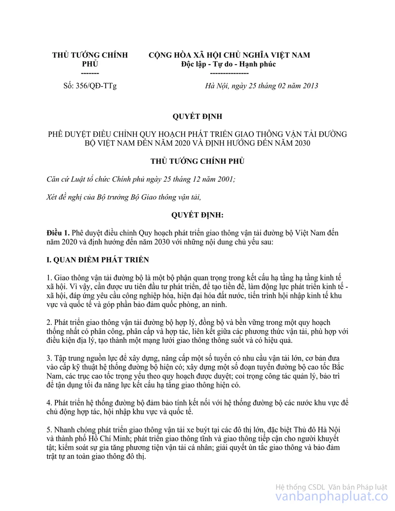
THE PRIME
MINISTER |
SOCIALIST
REPUBLIC OF VIETNAM |
|
No. 356/QD-TTg |
Hanoi, February 25th 2013 |
DECISION
APPROVING THE ADJUSTED PLANNING FOR ROAD TRAFFIC DEVELOPMENT IN VIETNAM BY 2020, AND THE ORIENTATION TOWARDS 2030
THE PRIME MINISTER
Pursuant to the Law on Government organization dated December 25th 2001;
At the proposal of the Minister of Transport,
DECIDES:
Article 1. Approving the adjusted planning for road traffic development in Vietnam by 2020, and the orientation towards 2030, in particular:
I. VIEWPOINTS ON DEVELOPMENT
1. Road traffic is a crucial component in the socio-economic infrastructure. Therefore, investment in its development must be prioritized to create the premise and motivation for socio-economic development, satisfying requirements for industrialization and modernization, for regional and international integration, and ensuring National defense and security.
2. The road traffic must be reasonably, comprehensively, and sustainably developed in a consistent planning, under the assignment, decentralization, and cooperation among means of transport, compatible with geographical conditions, in order to from a seamless and effective traffic network.
3. Concentrate resources on building and upgrading some routes that serve massive traffic; build some segments of the North – South freeway and key freeways according to the approve planning; emphasize the management and maintenance to utilize the current traffic infrastructure.
4. Ensure the connection with road traffic systems of regional countries to serve the cooperation and integration.
5. Rapidly develop bus services in major cities, especially Hanoi and Ho Chi Minh city; develop accessible traffic systems for the disabled; control the increase in quantity of private vehicles; relieve traffic congestion and ensure urban traffic safety and order.
6. Develop local traffic networks that satisfy the industrialization and modernization of agriculture and rural areas, connect local traffic networks with the national traffic network, provide the continuity and reasonable traffic costs that suit the majority of people.
7. Boost the application of science, new technologies and new materials to consultancy, construction, and exploitation of road traffic towards reducing environmental pollution and energy saving. Value the development of human resources serving traffic development.
8. Attract other economic sectors to investing in the development of road traffic infrastructure; mobilize all resources, especially domestic resources, to invest in development; users are responsible for paying fees for the maintenance and reinvestment in building road traffic infrastructure.
9. Preserve land for the development of road traffic infrastructure, ensure the traffic safety corridors; the protection of traffic works and assurance of traffic safety are responsibilities of local governments, sectors, the whole society, and every citizen.
II. DEVELOPMENT TARGETS
1. By 2020:
- Satisfy the demand for cargo and passenger transit with good quality and reasonable prices; ensure safety and convenience; control and reduce traffic accidents; limit environmental pollution; utilize the mobility and effectiveness of road traffic for short travel and goods collection, in order to facilitate other means of transport. Some specific targets:
+ The amount of passenger transport reaches 5.6 billion passengers, with 154.56 billion passengers in circulation.
+ The amount of cargo transport reaches 1,310 million tonnes with 73.32 billion tonnes of goods in circulation
+ The amount of cars reaches 3.2 – 3.5 million units.
- The Highway and provincial route systems are in correct technical level; expand and build new Highways and provincial routes serving heavy traffic; prioritize the upgrade and expansion of Highway 1; build some freeway segments along the North – South route, the routes that connect, Hanoi and Ho Chi Minh city with gateway ports and crucial traffic junctions; inaugurate the Ho Chi Minh route and upgrade the segments that cross Tay Nguyen; invest in coastal roads and frontier patrol roads according to the approve planning. The diplomatic routes satisfy technical standards of the entire area; develop urban traffic. Initiate Road maintenance fund for satisfying the demand for capital serving the maintenance of road traffic infrastructure.
+ Allocate land for building urban road traffic infrastructure that reaches 16 – 26% of construction land in cities.
+ Prioritize the development of rural roads for motor vehicles to all commune centers; ensure year-round continuity. The proportion of hard roads, asphalted roads, or concrete roads reaches 100% in districts, 70% in communes, and 50% in neighborhoods.
2. Orientation towards 2030:
- Satisfy the demand for transport and transport services of the society with high quality, high speed, convenience, and safety; connect other means of transport, especially between urban passenger transport and transshipment stations.
- Complete and modernize the road traffic infrastructure network; keep building freeway segments, urban roads, and ring-roads.
III. DEVELOPMENT PLANNING BY 2020
1. Highway system
a) North – South axis
- Highway 1: From Huu Nghi Quan (Lang Son) to Nam Can (Ca Mau), 2,395.5 km in length:
+ The segment from Hanoi to Can Tho: finish upgrading and expanding 1.054/2,887 km to 4 lanes of motor vehicles(390 km has been expanded to 4 lanes of motor vehicles and 2 lanes of mixed vehicles; build roads parallel with some segments; strengthen the ground, the road surface, and replace weak bridges.
+ The remaining segments reaches level III with 2 lanes.
+ Complete the road tunnels through Phu Gia mountain, Phuoc Tuong mountain (Thua Thien Hue) and Ca mountain (Phu Yen).
- Ho Chi Minh road, from Pac Bo (Cao Bang) to Dat Mui (Ca Mau), 3,183 km in length:
+ Inaugurate the whole road with 2 lanes in 2020; only invest in upgrading some segment that serve heavy traffic; prioritize Highway 14 – Ho Chi Minh road that cross Tay Nguyen.
+ After 2020, complete the road, build the segments according to freeway standards, which conform with the approved planning and capital sources.
b) In the North
* Diverging routes
- Maintain Highway 5, from Hanoi to Hai Phong, 113 km in length, at level II with 4 lanes.
- Highway 18: From Dai Phuc (Bac Ninh) to Bac Luan (Quang Ninh), 303 km in length: finish upgrading and expanding the segment from Uong Bi to Ha Long to reach level II with 4 lanes; the segment from Mong Duong – Mong Cai reaches level III with 2 lanes; other segments are maintained at current standards.
- Highway 2: From Phu Lo (Hanoi) to Thanh Thuy checkpoint (Ha Giang), 323 km in length: maintain the segment from Bac Thang Long – Noi Bai to Vinh Yen, including the segment bypassing Vinh Yen city (Vinh Phuc) at level II with 4 lanes; expand the segment from Vinh Yen – Viet Tri to reach level II with 4 lanes; finish upgrading other segments to reach at least level III with 2 lanes; the segments serving heavy traffic must reach level II or level I with 4 – 6 lanes.
- Finish building and expanding the whole Highway 3, from Duong bridge (Hanoi) to Ta Lung (Cao Bang), 303 km in length, to reach level III with 2 lanes.
- Highway 6, from Ha Dong (Hanoi) to Muong Lay (Lai Chau), 512 km in length: upgrade the segment from Xuan Mai to Hoa binh to reach level II with 4 lanes; the segment bypassing Hoa Binh city must reach level II or level I with 4 – 6 lanes; other segments must reach at least level III with 2 lanes.
- Highway 32, from Hanoi to Binh Lu (Lai Chau), 393 km in length: finish upgrading the segment from Trung Ha to Co Tiet with 4 lanes, integrate upgrading and expanding with fortifying Huu dyke along Hong river; other segments must reach at least level IV or level III with 2 lanes.
- Finish upgrading Highway 32B, from Thu Cuc (Phu Tho) to Muong Coi (Son La), 21 km in length, to reach at least level IV with 2 lanes.
- Highway 32C, from Hy Cuong, crossing Highway 2 (Phu Tho) to Au Lau (Yen Bai), 97 km in length: expand the segment from km8+000 to km21+100, 13.1 km in length, to reach level II with 4 lanes; finish upgrading the remaining segments to reach level IV or level III with 2 lanes.
- Finish building and expanding whole Highway 70, from Dau Lo (Phu Tho) to Ho Kieu (Lao Cai), 200 km in length, to reach level IV or II with 2 lanes.
* Ring roads
- Ring road 1 includes Highways 4, 4A, 4B, 4C, 4D, 4H from Quang Ninh to Dien Bien (Highway 4B runs from Tien Yen to Cai Bau island), 1,002 km in length.
Step by step finish upgrading the whole route to reach level IV with 2 lanes; the difficult segments must reach level V; the segment from Cao Bang through Lang Son to Quang ninh must reach level III with 2 lanes. Merge Highways 4A, 4B, 4C, 4D, 4H into Highway 4.
- Finish building and upgrading the whole Ring road 2 which is Highway 270, from Bai Chay (Quang Ninh) to Tay Trang (Dien Bien), 817 km in length, to reach at least level IV with 2 lanes.
- Finish upgrading the whole Ring road 3 which is Highway 37, from Diem Dien (Thai Binh) to Co Noi (Son La), 485 km in length, to reach at least level IV with 2 lanes in high lands; the segments in residential areas and in the plain must reach level III with 2 lanes.
* Other Highways
- Finish upgrading Highway 18C, from Tien Yen to Hoanh Mo (Quang Ninh), 50 km in length, to reach at least level III with 2 lanes.
- Finish upgrading the whole Highway 10, from Uong Bi (Quang Ninh) to Hoang Hoa (Thanh Hoa), 228 km in length, to reach level III with 2 lanes. The segment in Northern key economic regions must reach level II with 4 lanes.
- Finish upgrading Highway 38, from Bac Ninh city to Cho Dau (Ha Nam), 85 km in length, to reach at least level III with 2 lanes.
- Upgrade and expland Highway 38B, from Gia Loc junction (Hai Duong) to Anh Troi junction (Ninh Binh), 145 km in length, to reach at least level III with 2 lanes.
- Finish upgrading the whole Highway 39, from Pho Noi (Hung Yen) to Diem Dien (Thai Binh), 108 km in length, to reach at least level III with 2 lanes.
- Highway 12B, from Kim Dong (Ninh Binh) to Man Duc (Hoa Binh), 140 km in length: finish building and upgrading the segment from Kim Dong – Hang Tram to reach at least level III with 2 lanes; the remaining segments must reach at least level IV with 2 lanes.
- Finish building the whole Highway 12, from Son Tay (Ha Noi) to Hai Thinh harbor (Nam Dinh), 210 km in length, to reach at least level III with 2 lanes (from Km147+200 to Km 152+600 along the South East route of Nam Dinh city).
- Highway 21B from Phu Lam (Ha Noi) to Nam Dinh city, 95 km in length: finish building and upgrading the segment from Ba Da bridge to Phu Thu junction, the roads that connect two freeways and along the route being invested in to Nam Dinh city, to reach level II with 4 lanes.
- Highway 2B, from Doc Lap to Tam Dao, 25 km in length: finish upgrading the segments in inner-city areas to reach the standards of urban roads; the remaining segment must reach at least level IV with 2 lanes.
- Finish upgrading the whole Highway 2C, from Son Tay (Hanoi) to Na Hang town (Tuyen Quang), 241 km in length, to reach level III with 2 lanes; the segments with difficult terrain must reach at least level IV with 2 lanes.
- Highway 31, from Quan Thanh (Bac Giang) to Ban Chat (Lang Son), 160 km in length: upgrade and expand the first segment of the route from Quan Thanh (crossing Highway 1) to Luc Ngan town to reach at least level III with 2 lanes; the remaining segments must reach at least level IV with 2 lanes.
- Finish upgrading Highway 34, from Ha Giang city to Khau Don (Cao Bang), 265 km in length, to reach at least level IV with 2 lanes.
- Finish upgrading Highway 3B, from Bac Ninh city to Cho Dau (Ha Nam), 128 km in length, to reach at least level IV with 2 lanes.
- Finish upgrading Highway 1B, from Dong Dang (Lang Son) to Hoanh Mo (Quang Ninh), 145 km in length, to reach level IV or level III with 2 lanes.
- Finish upgrading Highway 43, from Gia Phu to Long Sap (Son La), 113 km in length, to reach at least level IV with 2 lanes.
- Finish upgrading Highway 4E, from Bac Ngam to Kim Tan (Lao Cai), 44.2 km in length, to reach at least level IV with 2 lanes.
- Finish upgrading Highway 4G, from Mai Son to Song Ma (Son La), 122 km in length, to reach at least level IV with 2 lanes.
- Finish upgrading Highway 12, from Ma Lu Thang (Lai Chau) to Dien Bien city, 206.65 km in length, to reach at least level IV with 2 lanes.
- Maintain Highway 100, from Nam Cay junction to Phong Tho Junction (Lai Chau), 20 km in length, at level IV with 2 lanes.
- Maintain the road from Noi Bai to Bac Ninh, 42 km in length, at level I.
- Maintain the road to Ninh Phuc harbor, from Highway 1 to Ninh Phuc harbor, 6 km in length, at level II.
- Finish upgrading and building Nghi Son – Bai Tranh road, from Nghi Son harbor to Ho Chi Minh road, 54.5 km in length, to reach at least level III with 2 lanes.
- Finish building some major bridges such as Nhat Tan, Vinh Thinh, Viet Tri II, Me So, etc.
c) In the Middle
- Finish upgrading the whole Highway 217, from Do Len to Na Meo (Thanh Hoa), 195 km in length, to reach at least level IV or level III with 2 lanes.
- Finish upgrading the whole Highway 47, from Sam Son to Muc Son (Thanh Hoa), 61 km in length, to reach at least level IV with 2 lanes; the segments crossing urban areas must reach urban road standards.
- Finish upgrading Highway 45, from Ria junction (Ninh Binh) to Nhu Xuan (Thanh Hoa), 134 km in length, to reach at least level IV with 2 lanes.
- Highway 48, from Yen Ly to Que Phong (Nghe An), 160 km in length: upgrade and expand the segment from Yen Ly to Thinh Minh (crossing Ho Chi Minh road) to to reach at least level III with 2 lanes; the remaining segments must reach at least level IV with 2 lanes.
- Finish upgrading the whole Highway 48B, from Lach Quen den Quy Chau (Nghe An), 25.5 km in length, to reach at least level III with 2 lanes.
- Finish upgrading Highway 48C, from Quy Hop to Tam Quang (Nghe An), 123 km in length, to reach at least level IV with 2 lanes.
- Finish upgrading Highway 7, from Dien Chau to Nam Can (Nghe An), 227 km in length, to reach at least level IV with 2 lanes.
- Finish upgrading Highway 46, from Thanh Thuy to Cua Lo (Nghe An), 107 km in length, to reach at least level III with 2 lanes.
- Finish upgrading the whole Highway 8, from Hong Linh to Cau Treo (Ha Tinh), 85.3 km in length, to reach level III with 2 lanes.
- Finish upgrading the Highway 8B, the segment from Hong Linh to Xuan An, 18 km in length, belonging to the project of expanding Highway 1, and the segment from Xuan An to Xuan Hai harbor (Ha Tinh), 7 km in length, to reach level III with 2 lanes.
- Finish building and upgrading Highway 12A, from Ba Don to Cha Lo (Quang Binh), 117 km in length, to reach at least level III with 2 lanes.
- Finish upgrading Highway 12C, from Vung Ang harbor (Ha Tinh) to Hoa Tien (crossing Ho Chi Minh road in Quang Binh), 98.3 km in length, to reach level IV or level III with 2 lanes; the sergment from Vung Ang harbor to Highway 1 must comply with the planning for Vung Ang industrial park.
- Highway 15, from Tong Dau (Hoa Binh) to Son Thuy (Quang Binh), 400.5 km in length: finish building and upgrading the segment from Tong Dau to Ngoc Lac to reach at least level III with 2 lanes; the remaining segments must reach at least level IV.
- Finish upgrading Highway 4G, from Mai Son to Song Ma (Son La), 122 km in length, to reach at least level IV with 2 lanes.
- Finish building and upgrading Highway 9, from Cua Viet to Lao Bao (Quang Tri), 118 km in length, to reach at least level III or level II with 2 – 4 lanes.
- Finish upgrading Highway 49, from Thuan An (Thua Thien Hue) to the border with Laos, 92 km in length, to reach at least level IV with 2 lanes.
- Maintain Highway 14B, from Tien Sa to Tuy Loan (Da Nang), 24 km in length, at level II with 4 lanes; the segment from Tuy Loan to Thach My (Quang Nam), 50 km in length, must comply with the planning for Ho Chi Minh road.
- Finish upgrading Highway 14D, from Giang to Ta Oc checkpoint (Quang Nam), 75 km in length, to reach at least level III or IV with 2 lanes.
- Finish building and upgrading Highway 14C, from Ngoc Hoi junction (Kon Tum) to Buprang checkpoint (Dak Nong), 375 km in length, to reach at least level IV with 2 lanes.
- Finish upgrading Highway 14E, from Binh Minh junction to Kham Duc (Quang Nam), 90 km in length, to reach at least level IV with 2 lanes.
- Finish upgrading and expanding Highway 14G, from Tuy Loan (Da Nang) to Dong Giang (Quang Nam), 66 km in length, to reach at least level IV with 2 lanes.
- Finish upgrading the whole Highway 24, from Thach Tru (Quang Ngai) to Kon Tum town, 168 km in length, to reach level III with 2 lanes.
- Finish upgrading Highway 24B, from Sa Ky harbor to Ba Tieu (Quang Ngai), 108 km in length, to reach at least level IV or III with 2 lanes.
- Finish upgrading Highway 19, from Quy Nhon (Binh Dinh) to Le Thanh (Gia Lai), 229 km in length, to reach at least level III with 2 lanes. The segment from Quy Nhon harbor to Highway 1 must reach level II or I with 4 – 6 lanes.
- Finish upgrading Highway 25, from Tuy Hoa (Phu Yen) To Chu Se (Gia Lai), 192 km in length, to reach at least level III with 2 lanes.
- Finish upgrading Highway 29, from Vung Ro (Phu Yen) to Buon Ho (Dak Lak), 178 km in length, to reach at least level IV with 2 lanes.
- Finish upgrading Highway 25, from Ninh Hoa (Khanh Hoa) to Buon Ma Thuot (Dak Lak), 151 km in length, to reach level III; the difficult segments must reach level IV with 2 lanes; Highway 26B, from Highway 1 to Huyndai Vinashin factory, must reach level II with 4 lanes; merge Highway 26 and Highway 26B into Highway 26.
- Finish upgrading Highway 27, from Buon Ma Thuot (Dak Lak) to Phan Rang (Ninh Thuan), 277 km in length, to reach at least level IV with 2 lanes.
- Finish upgrading Highway 27B, from Ninh Binh (Ninh Thuan) to Hoa Dien (Khanh Hoa), 53 km in length, to reach at least level III with 2 lanes.
- Finish building and upgrading Highway 28, from Phan Thiet (Binh Thuan) to Gia Nghia (Dak Nong), 180 km in length, to reach at least level IV with 2 lanes.
- Finish upgrading Highway 49B, from Quang Loi to Chan May harbor (Thua Thien Hue), 105 km in length, to reach at least level III with 2 lanes.
- Finish upgrading Highway 40, from Ngoc Hoi to Bo Y checkpoint (Kon Tum), 21 km in length, to reach at least level III with 2 lanes. The segment in the Bo Y Checkpoint economic zone shall comply with the economic zone planning.
- Highway 1D, from Quy Nhon (Binh Dinh) to Cau River (Phu Yen), 35 km in length: The inner-city segment shall follow urban planning, the other segments shall be maintained at level III with 2 lanes.
- Finish upgrading Highway 1 C, from Highway 1 to Nha Trang (Khanh Hoa), 17 km in length, to reach 4 lanes.
- Finish building Truong Son Dong road, from Thach My (Quang Nam) to Da Lat (Lam Dong), 671.16 km in length, to reach at least level IV.
b) In the South
* South East area
- Finish expanding and upgrading the whole Highway 51, from Bien Hoa (Dong Nai) to Vung Tau (Ba Ria – Vung Tau), 79 km in length, to reach level 1 with 6 lanes.
- Finish upgrading the whole Highway 55, from Ba Ria (Ba Ria – Vung Tau) to Dai Binh Junction (Lam Dong), 233 km in length, to reach at least level III with 2 lanes.
- Maintain Highway 56, from Tan Phong (Dong Nai) to Ba Ria (Ba Ria – Vung Tau), 51 km in length, at level III with 2 lanes.
- Maintain Highway 22, from Ho Chi Minh city to Moc Bai (Tay Ninh), 58 km in length, at level II or level 1 with 4 – 6 lanes.
- Maintain Highway 22B, from Go Dau to Xa Mat checkpoint (Tay Ninh), 183 km in length, at level III or II.
- Highway 13, from Ho Chi Minh city to Hoa Lu checkpoint (Binh Phuoc), 143 km in length: maintain the segment from Binh Phuoc junction to Thu Dau Mot at level II or level I with 4 – 6 lanes; finish upgrading the segment from Chon Thanh to Loc Tan to reach level II with 4 lanes; the segment from Loc Tan to Hoa Lu checkpoint shall comply with the planning for checkpoint economic zones.
- Maintain Highway 20, from Dau Giay (Dong Nai) to Da Lat (Lam Dong), 268 km in length, at level III with 2 lanes.
- Build Highway 1K, from Vuon Mit junction to Ring road 3 of Ho Chi Minh city, 9 km in length, to reach level I or urban road standards.
- Finish building some major bridges crossing Sai Gon river and Dong Nai river such as Sai Gon 2, Dong Nai 2, Hoa An, Thu Thiem 2, 3, 4, Nhon Trach (ring road 3), Binh Loi 2, etc.
* South West area
- Finish building and upgrading the whole Route N1, running along the border with Cambodia, from Duc Hue (Long An) to Ha Tien (Kien Giang), 235 km in length, to reach at least level IV with 2 lanes.
- Finish building and upgrading Highway 50, from Ho Chi Minh city to Lo Dua (Tien Giang), 88 km in length, to reach at least level III with 2 lanes.
- Finish upgrading Highway 62, from Tan An to Moc Hoa (Long An), 77 km in length, to reach at least level III with 2 lanes. The segment of Binh Hiep Checkpoint must comply with the economic zone planning.
- Finish upgrading Highway 30, from An Huu (Tien Giang) to Dinh Ba (Dong Thap), 120 km in length, to reach at least level III with 2 lanes. Build the segment from An Huu Junction to Dong Thap in order to connect Highway 1 and the freeway, and reach level II with 3 lanes.
- Finish upgrading Highway 54, from Binh Thanh (Dong Thap) to Tra Vinh city, 153 km in length, to reach at least level III with 2 lanes.
- Finish upgrading Highway 53, from Vinh Long city to Tap Son (Tra Vinh), 167 km in length, to reach at least level III with 2 lanes; the segment from Vinh Long – Tra Vinh city must reach level II with 4 lanes.
- Finish upgrading Highway 57, from Vinh Long city to Thanh Phu (Ben Tre), 105 km in length, to reach at least level III with 2 lanes.
- Finish building and upgrading Highway 60, from My Tho city to Soc Trang city, 108 km in length, to reach at least level III with 2 lanes.
- Finish upgrading Highway 61, from Cai Tac (Hau Giang) to Rach Soi (Kien Giang), 96 km in length, to reach at least level III with 2 lanes.
- Finish upgrading the whole Highway 61B, from Vinh Tuong junction (Hau Giang) to My Loc town (Soc Trang), 41km km in length, to reach level IV with 2 lanes; the segments from Vinh Tuong town to Long My town must reach at least level III with 2 lanes.
- Finish building and upgrading Highway 63, from Chau Thanh (Kien Giang) to Ca Mau city, 115 km in length, to reach at least level III with 2 lanes.
- Finish building and upgrading Highway 80, from My Thuan (Vinh Long) to Ha Tien (Kien Giang), 212 km in length, to reach at least level III with 2 lanes.
- Finish building the segment from Lo Te to Rach Soi, running parallel with Highway 80 to the East to reach level III during the investment period, and reach level II or level I with 4 – 6 lanes during the succeeding period.
- Finish upgrading the whole Highway 91, from Can Tho to Tinh Bien (An Giang), 145 km in length, to reach at least level III with 2 lanes.
- Finish upgrading the segment inside Can Tho city of Highway 91B, 16 km in length, to meet urban road standards.
- Finish upgrading the whole Highway 91C, from Chau Doc to the border with Cambodia (An Giang), 34 km in length, to reach at least level IV with 2 lanes.
- Maintain South Hau River road, 134.58 km in length, at level III with 2 lanes.
- Maintain Quan Lo – Phung Hiep route, 122.33 km in length, at level III with 2 lanes; and make it part of the North – South freeway.
- Upgrade Route N2, from Chon Thanh (Binh Duong) to Vam Ray (Kien Giang), 440km km in length, to reach at least level IV with 2 lanes. The segments that overlap Ho Chi Minh road shall comply with the planning for Ho Chi Minh road.
- Finish building some major bridges such as Duc Hue, Cao Lanh, Vam Cong, Co Chien, Dai Ngai (on Highway 60), Dinh Khao (on Highway 57), Xeo Ro – Tac Cau, etc.
d) Build and upgrade some routes to highways
Along highways: expand the segments going through cities, residential areas, and economic zones in accordance with the approved planning; build necessary bypasses. Consider upgrading some routes to highways to satisfy practical demands and highway criteria prescribed in the Law on Road traffic dated November 13th 2008, especially the following routes:
- The road that connects Ha Nam and Thai Binh: from Cau Gie freeway – Ninh Binh to Highway 21, through Ly Nhan (Ha Nam), crossing Hong river by Thai Ha bridge, crossing Highway 30 and Highway 10, connecting with Diem Dien harbor (Thai Binh), reaching level III or level II with 2 - 4 lanes.
- Hanoi – Hai Phong freeway, and the Cau Gie - Ninh Binh freeway: from the junction between Highway 39 and Ha Noi – Hai Phong freeway to Liem Tuyen junction (Km230+727 of Cau Gie – Ninh Binh freeway, 48 km in length, reaching level II with 4 lanes.
- Hanoi – Hai Phong freeway and Hanoi – Ha Long freeway: from Cai Mam junction (Km102+300/QL18) to the end of Hanoi – Hai Phong freeway, 25 km in length, reaching level II with 3 lanes.s
- My Dinh – Ba Sao – Bai Dinh road: from Hanoi to Bai Dinh (Ninh Binh), 78 km in length, reaching level II with 4 lanes.
- The roads that connect Lai Chau and Ha Giang with Hanoi – Lao Cai freeway: From Ha Giang city and Lai Chau town to Hanoi – Lao Cai freeway, reaching level II with 2 lanes.
- The road from Cai Mep to Thi Vai, 21 km in length, with 6 lanes.
- Luong Son – Dai Ninh road, from Luong Son (Binh Thuan) to Lam Dong, 76 km in length, reaching at least level III with 2 lanes.
- The road that connects Thai Binh, Nam Dinh, and Ha Nam province: from Diem Dien harbor (Thai Binh) to Binh Luc (Ha Nam), 124 km in length, reaching at least level III with 2 lanes.
- The roads from Hoi Xuan to Ten Tan checkpoint (Thanh Hoa), 122.65 km in length, reaching at least level IV with 2 lanes.
- South Quang Nam road: from Tam Thanh (Quang Nam) to Dak To (Kon Tum), 209 km in length, reaching at least level IV with 2 lanes.
2. Freeways:
Rapidly develop the freeway network, aiming to have 2,018.6 km of freeway, in particular:
a) The completed segments of freeway, 167 km in length:
- Ho Chi Minh city – Trung Luong, 40 km in lengh, 4 lanes.
- Cau Gie – Ninh Binh, 50 km in length, 4 lanes
- Lien Khuong – Da Lat, 19 km in length, 4 lanes
- Ring road 3 of Hanoi (the segment from Phu Dong bridge – Mai Dich), 28 km in length, 4 lanes
- Thang Long boulevard, 30 km in length, 6 lanes
- The projects being completed during 2013 – 2020 period, 1,851.6 km in length, including:
- North – South freeway, 776 km in length, 4 - 8 lanes
+ Upgrading the segment from Phap Van – Cau Gie, 30 km in length
+ Ninh Binh – Thanh Hoa, 75 km in length
+ Thanh Hoa – Ha Tinh, 160 km in length
+ La Son (Hue) – Tuy Loan (Da Nang), 84 km in length
+ Da Nang – Quang Ngai, 127 km in length
+ Ho Chi Minh city – Long Thanh – Dau Giay, 55 km in length
+ Dau Giay – Phan Thiet, 98 km in length
+ Ben Luc – Long Thanh – Dau Giay, 55 km in length
+ Trung Luong – My Thuan, 54 km in length
+ My Thuan – Can Tho, 38 km in length
- Northern freeway, 705 km in length, 4 - 6 lanes
+ Hanoi – Lang Son, 120 km in length
+ Hanoi – Lao Cai, 264 km in length
+ Hanoi – Hai Phong, 105 km in length
+ Hanoi –Thai Nguyen, 62 km in length
+ Hoa Lac – Hoa Binh, 26 km in length
+ Ha Long, Mong Cai, 128 km in length
- Southern freeway: Bien Hoa – Vung Tau (first stage: Bien Hoa – Phu My), 76 km in length, 6 lanes.
- Other freeways: Nha Trang – Phan Thiet, Dau Giay – Da Lat, and other routes, 200 km in length.
- Ring roads of Hanoi and Ho Chi Minh city, 94.6 km in length.
+ Ring road 3 - Hanoi (the segment from Mai Dich – Thang Long bridge), 5.6 km in length, 4 – 6 lanes
+ Ring road 4 - Hanoi, 47 km in length, 4 - 6 lanes
+ Ring road 5 – Ha Noi (reaching freeway standards, level I, II, or III)
+ Ring road 3 - Ho Chi Minh city, 42 km in length, 6 – 8 lanes
c) Consider adding some freeways and changing the direction of Ninh Binh – Hai Phong – Quang Ninh freeway.
d) Consider investing in freeways according to the approved planning when there is transport demand and capital for investment.
3. Coastal roads
Comply with the approved planning for Vietnam’s coastal road, prioritize the investments in the segments having inferior infrastructure along the coastal routes associated with sea dykes.
4. Bordering corridors
Comply with the approved planning for development bordering corridors.
5. Orienting the development of provincial road system.
The development of provincial road system is oriented as follows:
Restore, upgrade, ensure the roads reach level IV in the plains and level V on highlands; the segments running through cities shall comply with the approved planning.
Upgrade some important provincial roads to highways, upgrade some important district roads to provincial roads, change some routes or open some new routes in necessary areas.
6. Urban road traffic
Develop urban road traffic in accordance with the planning for the development of urban space and architecture, ensure the uniformity, balance, consistency, and continuity with regional, national, and international traffic networks.
- Renovate and expand convergent Highways, especially in major cities such as Hanoi and Ho Chi Minh city, to 4 – 6 lanes for motor vehicles; build junction on major highways, bypasses, and ring roads.
- Develop public transport by bus towards providing convenient bus services that satisfy the demand for travel of the majority of people, forming a premise for limiting the use of private vehicles, contributing to the relief of traffic congestion during the development of cities.
- Build bus stations and car parks.
7. Rural traffic
- Mobilize all resources to develop rural traffic; prioritize the construction of roads for car to all commune centers; the communes having difficult terrain must have roads for motorbikes and non-motorized vehicles; the communes on islands must have port to connect to the centers.
- 100% of roads in districts and communes are usable year round; the proportion of hard district roads (covered with asphalt or concrete) is 100%, and hard commune roads is 70%.
- District roads must reach at least level V, commune roads must reach at least level VI.
- At least 50% of roads in villages are solidified and reach at least level A of rural road standards.
- At least 45% of main rural roads are solidified to ensure convenience for motor vehicles.
- Step by step fortify bridges, build bridges that cross rivers and streams to serve people on highlands; eliminate all log bridges in Mekong Delta.
- Develop rural traffic to satisfy the demand for agricultural production, harvesting, processing, and sale of agricultural products and mechanization of agricultural production.
- Provide capital sources to maintain 100% district roads and at least 45% commune roads.
8. Orienting transport development
Organize traffic reasonably, use the finished road traffic works to promptly and efficiently satisfy requirements for socio-economic development.
- The amount of passenger transport averagely grows 11% per year, the amount of passenger in circulation grows 8.6% per year.
- The amount of cargo transit averagely grows 8.3% per year, the amount of cargo in circulation grows 7.44% per year.
- Road motor vehicles satisfy environmental standards equivalent to EURO IV.
- Public passenger transport satisfy 25% of demand in Hanoi and 15% of demand in Ho Chi Minh city by 2020.
9. Orienting vehicle development
a) Automobiles
There will be 3.2 – 3.5 million automobiles by 2020, 57% of which is cars, 14% is buses, and 29% is trucks.
Gradually eliminate the vehicles that are not suitable for traffic infrastructure.
b) Motorbikes
Reduce the growth in quantity of motorbikes using administrative, economic, and technical measures in order to limit the quantity or motorbikes nationwide; motorbikes are primarily used in rural areas and the areas without public passenger transport; there will be 36 million motorbikes by 2020.
c) Stations, car parks, and rest stops
Finish zoning bus stations suitable for the amount of passengers, especially traffic junctions. Prioritize investments in major bus stations in major cities.
Allocate land for building car parks; build underground and overhead bus stations in major cities.
Finish the planning and encourage the participation of economic sectors in investments in rest stops along the long routes, especially on highways.
10. Traffic safety assurance
- Reduce all 3 aspects of traffic accidents, reduce 5% to 10% of accidents and casualties due to traffic accidents every year.
- Complete the law system, strengthen the management organization from central to local government. Improve the propagation, dissemination, and education, together with intensifying the enforcement of laws on traffic safety and order.
- Develop road traffic infrastructure, ensure the traffic safety corridors; the safety for traffic of works must be inspected; the connection with highways must be conformable with law to ensure traffic safety.
- Invest in traffic supervision system and traffic control centers according to modern standards.
- Improve the quality of training, testing, and managing vehicle operators, and the quality of road motor vehicle inspection.
- Enhance the rescue works to minimize damage caused by road accidents.
11. Protection of the environment and land for road traffic
a) Environment protection
Complete the standards and regulations on environment protection on the construction and use of traffic works. Intensify propagation, education, and enforcement of laws on environment protection.
Assess the impact on the environment; integrate the climate change, sea level raise, and energy saving in the planning. Regularly supervise the compliance with laws on environment protection of projects of construction and traffic works; prioritize the application of new and eco-friendly technologies to minimize the negative impacts on the environment.
The traffic works and vehicles must have technical standards conformable with environment protection requirements.
Build a modern public traffic system together with efficient use of fuel, especially in urban traffic to minimize pollution.
b) Demand for land
The demand for land for the highway network is approximately 77,934 hectares by 2020 (including safety corridors), 21,203 hectares among which is needed by 2020.
The demand for land for developing freeways by 2020 (including safety corridors) is 41,100 hectares, 38,200 hectares among which is needed.
The demand for land for developing Ho Chi Minh road by 2020 (including safety corridors) is 8,873 hectares.
12. Demand for investment in road traffic infrastructure development
a) Investment capital
The demand for investment in road traffic infrastructure development by 2020 is estimated as follows:
- For highways (not including Highway 1 and Ho Chi Minh road): approximately 255,701 billion VND, averagely 31, 963 billion VND per year.
- For Highway 1: approximately 89.362 billion VND, averagely 22,340 billion VND per year.
- For Ho Chi Minh road: approximately 240,839 billion VND, averagely 26,760 billion VND per year.
- For freeways: approximately 392,379 billion VND, averagely 49,092 billion VND per year, 209,173 billion VND among which is for the East North-South freeway, approximately 26,146 billion VND per year.
- For coastal roads: approximately 28,132 billion VND (16,013 billion VND by 2020; 12,120 billion VND after 2020); approximately 1,600 billion VND per year by 2020.
- For provincial roads: approximately 120,000 billion VND, averagely 12,000 billion VND per year.
- For urban roads in Hanoi and Ho Chi Minh city: approximately 287,500 billion VND, averagely 29,000 billion VND per year.
- For rural roads: approximately 151,400 billion VND, averagely 15,140 billion VND per year.
b) Investment in maintenance
- The investment in the maintenance of roads under the management of the central government is averagely 6,700 billion VND per year.
- For local roads (including only provincial, district, and urban roads), it is 5,500 billion VND per year.
13. Policies on the development of road traffic development
a) Encourage the eligible economic sectors to participate in providing transport services and services that support road transport.
b) Create a healthy and impartial competitive environment among economic sectors participating in the provision of transport services and services that support road transport via bidding, in order to improve the quality of transport services and supporting services; fees and charges for transport services must follow the market mechanism under the management of the State.
c) Provide policies that enable transport enterprises to operate in difficult areas; provide policies on subsidies depending on the conditions of each locality and the policies on prioritizing the development of public transport and controlling the use of private vehicles in major cities. Provide policies to protect the users of passenger transport services.
d) Increase the investment from the State budget, issue Government bonds, and prioritize ODA capital to invest in road traffic infrastructure.
dd) Mobilize all resources at home and overseas, from all economic sectors, in various forms such as BOT, BTO, BT, and PPP; provide policies of financial supports, taxation, fees and charges, and franchise; keep investing in urgent and crucial works using the capital from Government bonds.
Mobilize land resources to develop road traffic infrastructure; lease out the terminable right to use and transfer road traffic infrastructure.
Establish “Road maintenance fund” to attract funding for the maintenance of road traffic works.
Support the investment in traffic works from the State budget according to regional distinction, especially the development of rural traffic and solidification of road surface the “New countryside” program.
e) Provide mechanisms and polices on the application of new technologies, the use of new and existing materials, and the technical standards suitable for each region, in order to development road traffic infrastructure.
g) Review, amend, and supplement the system of legislative documents, standards, regulations, and criteria to match international practice and conditions of Vietnam.
h) Focus on training scientists, experts, and proficient workers; provide training programs, raise the quality of training in road traffic career. Provide policies to attract scientists and experts to remote areas and difficult areas
Article 2. Organizing the implementation
1. The Ministry of Transport shall preside and cooperate with other Ministries, agencies, People’s Committees of central-affiliated cities and provinces in organize adjusted Planning for road traffic development in Vietnam by 2020 and the orientation towards 2030.
Based on the Planning, the Ministry of Transport shall specify, organize the implementation, and formulate detailed plans every 5 years that are suitable for the socio-economic development; inspect the implementation and suggest necessary solutions for the implementation of the Planning to the Prime Minister. Periodically review and assess the progress of the Planning.
2. Other Ministries, agencies, People’s Committees of central-affiliated cities and provinces, within their functions, tasks and powers, shall cooperate with the Ministry of Transport in performing the duties and pursuing the targets of the Planning on road traffic development, ensure the uniformity and consistency with the implementation of the plans of socio-economic development.
Article 3. This Decision takes effect on the date on which it is signed, and supersedes the Decision No. 1327/QD-TTg dated August 24th 2009. The contents at odds with this Decision are annulled.
Article 4. The Ministers, Heads of ministerial-level agencies, Heads of Governmental agencies, the Presidents of People’s Committees of central-affiliated cities and provinces are responsible for the implementation of this Decision./.
|
|
THE PRIME
MINISTER |
------------------------------------------------------------------------------------------------------
This translation is made by LawSoft and
for reference purposes only. Its copyright is owned by LawSoft
and protected under Clause 2, Article 14 of the Law on Intellectual Property.Your comments are always welcomed