Nội dung toàn văn Decision No. 37/2011/QD-UBND on regulation for inspection appraisal acceptance
|
THE PEOPLE’S
COMMITTEE OF BINHTHUAN PROVINCE |
SOCIALIST
REPUBLIC OF VIET NAM |
|
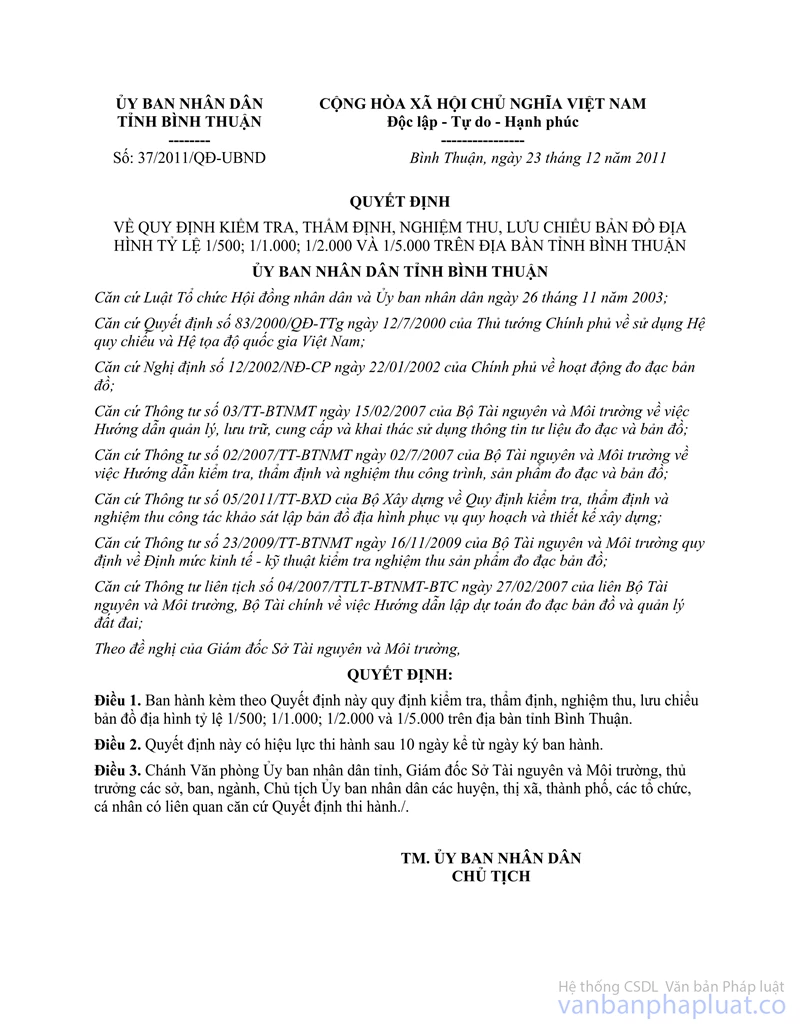
No.: 37/2011/QD-UBND |
BinhThuan, December 23, 2011 |
DECISION
ON REGULATION FOR INSPECTION, APPRAISAL, ACCEPTANCE, COPYRIGHT DEPOSIT OF TOPOGRAPHIC MAPS OF 1/500 1/1,000; 1/2,000 AND 1/5,000 SCALES IN BINHTHUAN PROVINCE
PEOPLE’S COMMITTEE OF BINHTHUAN PROVINCE
Pursuant to the November 26, 2003, Law on organization of People’s Council and People’s Committee;
Pursuant to the Decision No.83/2000/QD-TTg of July 12, 2000 of the Prime Minister on use of Vietnam’s national references and coordinates systems;
Pursuant to the Government’s Decree No.12/2002/ND-CP of January 22, 2002, on geodesic and cartographic activities;
Pursuant to the Circular No.03/TT-BTNMT, of February 15, 2005 of the Ministry of Natural Resources and Environment guiding management, storage, supply and use of geodesic and cartographic information and documents;
Pursuant to the Circular No.02/2007/TT-BTNMT of February 07, 2007 of the Ministry of Natural Resources and Environment guiding inspection, appraisal and acceptance of geodesic and cartographic works and products;
Pursuant to the Circular No.05/2011/TT-BXD of the Ministry of Construction on regulation for inspection, appraisal and acceptance of the survey work to make topographic map serviced for planning and construction design;
Pursuant to the Circular No.23/2009/TT-BTNMT of November 16, 2009 of the Ministry of Natural Resources and Environment providing eco-technical norms for inspection and acceptance of geodesic and cartographic products;
Pursuant to the Joint Circular No.04/2007/TTLT-BTNMT-BTC of February 27, 2007 of the Ministry of Natural Resources and Environment, the Ministry of Finance, guiding on making estimation for geodesic and cartographic and land management;
At the proposal of Director of Natural Resources and Environment Department,
DECIDES:
Article 1. To promulgate together with this Decision regulation on inspection, appraisal, acceptance, copyright deposit of topographic map of 1/500 1/1,000; 1/2,000 and 1/5,000 scales in Binhthuan province.
Article 2. This Decision takes effect after 10 days from the day of promulgation.
Article 3. The Chief officer of provincial People’s Committee, Director of Natural Resources and Environment Department, heads of Departments, sectors, lines, chairpersons of People’s Committee of districts, towns, cities attached province, and relevant organizations, individuals shall implement Decision.
|
|
ON BEHALF OF
THE PEOPLE’S COMMITTEE |
REGULATION
ON INSPECTION, APPRAISAL, ACCEPTANCE AND
COPYRIGHT DEPOSIT OF TOPOGRAPHIC MAPS OF 1/500 1/1,000; 1/2,000 AND 1/5,000
SCALES IN BINHTHUAN PROVINCE.
(Promulgated together with the Decision No.37/2011/QD-People’s
Committee, of December 23, 2011 of People’s Committee of Binhthuan province)
Chapter I
GENERAL PROVISIONS
Article 1. Scope of regulation and Subjects of application
1. This Decision stipulates inspection, appraisal, acceptance, copyright deposit of survey and cartographic documents for topographic maps of 1/500 1/1,000; 1/2,000 and 1/5,000 scales in Binhthuan province.
2. This Decision applies to organizations, individuals doing activities relating to inspection, appraisal, acceptance, copyright deposit of documents on survey, making technical design – estimation; topographic mapping and geodesy (hereinafter referred to as survey, topographic mapping and geodesy).
Article 2. Grounds and purpose of implementing inspection, appraisal, acceptance and copyright deposit of topographic maps
1. Inspection, appraisal, acceptance and copyright deposit of topographic maps are implemented on the basis of Regulation, standard, norms, technical provisions, eco-technical norms on survey, topographic mapping and geodesy being promulgated by competent state agencies and technical design – estimation approved by investor.
2. Purpose of inspection, appraisal, acceptance and copyright deposit of topographic maps:
a) Ensuring compliance of regulations, standards, norms, technical provisions, eco-technical norms on survey, topographic mapping and geodesy according to the Decision No.247/KT, of August, 09, 1990 of the Administration of state geodesy and cartography (now under management of the Ministry of Natural Resources and Environment) on Regulation on topographic mapping and geodesy of 1/500; 1/1,000; 1/2,000; 1/5,000; 1/10,000; 1/25,000 scales; the Decision No.248/KT, of August 09, 1990 of the Administration of state geodesy and cartography on Regulation on measuring and drawing outdoor topographic maps of 1/500; 1/1,000; 1/2,000; 1/5,000 scales; the Circular No.02/2007/TT-BTNMT of February 12, 2007 of the Ministry of Natural Resources and Environment guiding inspection, appraisal, acceptance of geodesic and cartographic works and products, the Circular No.05/2011/TT-BXD of the Ministry of Construction on regulation for inspection, appraisal and acceptance of the survey work to make topographic maps serviced for planning and construction design;
b) Detecting errors, violations in the course of implementation in order to timely handle, overcome and ensure quality of topographic maps;
c) Certifying quality, volume of finished the topographic map survey, measurement and drawing;
d) Unifying the central body of copyright deposit of types of topographic maps.
Article 3. Responsibilities of relevant parties
1. Responsibilities of the investor:
a) To implement management of survey quality including: Making and approving the technical design – estimation; organizing supervision, appraisal and acceptance of result. If the investor is not enough capacity to perform the above tasks, an inspection unit granted a permit of quality test of geodesic and cartographic works and product by the Vietnam Department of Survey and Mapping shall be hired for performance.
b) To select geodesic unit which is eligible on capacity according to the Decision No.05/2004/QD-BTNMT of May 04, 2004 of the Minister of Natural Resources and Environment in order to survey, measure and draw topographic maps;
c) To sign contract with geodesic unit, assigning task of surveying, topographic mapping and geodesy and handover of the site for geodesic unit, facilitating for geodesic unit to carry out survey works, measure and draw topographic maps and pay fully funds for geodesic unit on the basis of accepted volume of performance;
d) To terminate performance, partly or wholly cancel signed contract when the geodesic unit fail to implement proper the approved technical design – estimation;
dd) To supervise quality of information, documents relating to surveying and making technical design – estimation collected by the geodesic unit;
e) When receiving proposal for additional survey of geodesic unit, if accepting, the investor shall supplement tasks and sign survey contract Annex of arising volume with geodesic unit;
g) To organize storage of dossiers of survey, making technical design – estimation, topographic mapping and geodesy.
2. Responsibilities of the geodesic unit:
a) To survey and make technical design – estimation of topographic map measurement and drawing works according to requirement of the investor:
- To implement survey as prescribed in permit of geodesic and cartographic activities on the basis of technical design – estimation approved by investor and under content in signed contract;
- To allocate human with experiences and suitable professional knowledge for surveying and making technical design – estimation;
- To internally exanimate technical design – estimation before submitting for investor; take responsibilities before the investor and before law for result performed by its unit;
- To implement regular and systematic self-examination for application of regulations, standards, process under the approved technical design – estimation, to self-exanimate quality, volume and construction progress from the beginner to the end of works; to make dossier of examination of construction unit levels after ending works;
- When topographic mapping and geodesy, if arise volume or change of method, construction equipment comparing to the approved technical design – estimation, it must report in writing to the investor for adjustment of technical design – estimation and only perform when the investor accepted in written;
- To ensure safety for people, equipment, technical infrastructures and other construction works in the geodesic area; to protect environment, keep landscape in the geodesic area; to clean up the field after ending the measurement and mapping works;
- To use geodesic machines, equipments reaching standard and safety according to designed properties for survey tested by competent agencies. - Not to use equipments and measurement tools which have not yet tested, wrongly function or exceed working life as prescribed.
b) To organize storage of dossiers of surveying, topographic mapping and geodesy;
c) To implement secret-keeping as prescribed by State for documents which have requirement of keeping secrect relating to surveying, topographic mapping and geodesy (if any);
d) To pay damages when performance is not proper with approved technical design - estimation or when using informations, documents, regulations, standards not suitable bringing to erroneous results, arising volume of survey and other actions causing damages due to fault of its unit.
3. Responsibilities of the inspection unit:
If the investor hires inspection unit for performance of some or whole work relating to inspection, suppervision, appraisal, acceptance of works on topographic mapping and geodesy, the inspection unit have responsibility for:
a) To perform tasks exactly according to requirement of investor indicated in economy contract;
b) To appoint person who have suitable capacity to implement inspection, suppervision, appraisal, acceptance of works on topographic mapping and geodesy;
c) To examinate conformity on condition of capacity, machine, equipping which the geodesic unit commited with the investor in bid dossier or in signed contract;
d) To supervise all process of surveying, topographic mapping and geodesy including outdoor and in-room processes according to approved technical design – estimation;
dd) To appraise, accept, certify volume, quality of section of topographic mapping and geodesy in order to do as basic for the investor to make finalization;
e) To take responsibilities before the investor, before law on quality and volume of works of topographic mapping and geodesy. To pay damages if detecting the geodesic unit do not perform exactly according to the approved technical design - estimation bringing to the actual result fails to meet requirement of the investor and must rebuild, additionally build or other actions causing damages due to fault of its unit.
4. The responsibilities of the Natural Resources and Environment Department: Being responsible before provincial People’s Committee for inspection, appraisal, acceptance and copyright deposit of topographic map as prescribed by provincial People’s Committee.
Chapter II
DETAILING PROVISIONS
Article 4. Provisions on inspection
The technical inspection is undertaken by the investor (or inspection unit), geodesic unit in order to serve appraisal of the Department of Natural Resources and Environment and doing as basic for investor to accept the technical design - estimation and topographic mapping and geodesy.
1. The content of examination of investor (or inspection unit):
a) To inspect capacity of the geodesic unit in accordance with content of requirement in the approved technical design - estimation and relevant provisions of law;
b) To inspect machine, equipping in accordance with test dossier relating to construction of works on topographic mapping and geodesy;
c) To inspect quality of process and installment of benchmarks, control points of coordinates and height used in topographic mapping and geodesy;
d) To inspect ensurement of safety for people, equipment, technical infrastructures and other construction works in the geodesic area; implementation of environment protection and keeping landscapes in the geodesic area; recovery of field status quo after ending construction of topographic mapping and geodesy performed by the geodesic unit
e) To inspect construction progress according to the approved technical design - estimation and terms of contract.
2. The content of inspection of the geodesic unit:
a) To inspect mia, mirror, machine, relevant equipping, record, diary book of survey station and documents according to technical requirement on survey, topographic mapping and geodesy;
b) To inspect quality, volume of tasks perform outdoor (field inspection), in room (indoor inspection) according to the approved technical design - estimation. Content of field and indoor inspection tasks complies with the Annex promulgated together with this Decision;
c) To inspect ensurement safety for people, equipment in the course of survey;
d) To inspect progress of performance according to the technical design - estimation approved by competent level.
Article 5. Provisions on appraisal
The technical appraisal is undertaken by the Department of Natural Resources and Environment in order to serve acceptance of the technical design - estimation of topographic mapping and geodesy of the investor.
1. The legal basic for appraisal:
a) The technical design - estimation approved by the investor:
b) Regulations, standards, relevant legal documents on survey, topographic mapping and geodesy indicated in the Decision No.247/KT, of August, 09, 1990 of the Administration of state geodesy and cartography (now under management of the Ministry of Natural Resources and Environment) on Regulation on measuring and drawing topographic maps of 1/500; 1/1,000; 1/2,000; 1/5,000; 1/10,000; 1/25,000 scales; the Decision No.248/KT, of August 09, 1990 of the Administration of state geodesy and cartography on Regulation for measuring and drawing outdoor topographic maps of 1/500; 1/1,000; 1/2,000; 1/5,000 scales; the Circular No.02/2007/TT-BTNMT of February 12, 2007 of the Ministry of Natural Resources and Environment guiding inspection, appraisal, acceptance of geodesy and cartography works and products, the Circular No.05/2011/TT-BXD of the Ministry of Construction on regulation for inspection, appraisal and acceptance of the survey work to make topographic map serviced for planning and construction design.
2. The dossier submitted for appraisal:
a) The dossier submitted for appraisal is made according to Form of Annex promulgated together with this Regulation;
b) The technical summarising report of measuring and mapping of the geodesic unit (including reports on field survey of geodesic area and drawings, explanations).
3. The content of appraisal:
a) Capacity, machine, equipping of the geodesic unit according to dossier of registering to grant permit of geodesic and cartographic activities accepted by the Vietnam Department of Survey and Mapping
b) Application of regulations, standards and legal documents stated in Article 5, clause 1, item b of this Regulation;
c) Geodesic scope and the actual construction volume;
d) Quality of works performed outdoor (the field jobs) including:
- The test documents of machine, mia, mirror and relevant technical equipment; types of record, diary book of survey station (in case of electron survey machines with inside memory or accompanied Fieldbook equipment presentating details of survey stations by data file, it does not require noting in detail record) in the contact point course of coordinates, height and increasing thickness of geodesic grid, detail measurement of topographic map; quality of control points of coordinates and height.
- To take notes on point, diagram of landmark system, accuracy of landmarks, diagram of geodesic grid, diagram of calculation, adjustment, documents of measurement and conection controlling field pictures (if any); accuracy of contour line, height of some particular terrains, objects such as houses and construction and traffic works, irrigation system, pipelines, high-voltage lines, telegraph lines, lakes, ponds, rivers, and so on and observable physical – geological phenomenon such as faulting, landslide, caster and so on in geodesic area shall apply provisions in the Regulation on measuring and drawing topographic maps promulgated by the Ministry of Natural Resources and Environment.
dd) Quality of works performed in room (indoor jobs) including:
- Accuracy, synchronism, rationality of documents, parameters of references system, division of map pieces;
- Noting map, showing signs of geologic objects on map unified as prescirbed in Symbols of topographic map promulgated by the Ministry of Natural Resources and Environment, accuracy, adequacy when presentating elements of content in map according to provided symbols, repair the original map as prescribed such as: Force of stroke and font size, symbol; accuracy of position of objects, continuity of stroke elements, accuracy of determination of heigh for topographic elements, quality of bordering areas, and so on;
- Display of terrain comparing to height of noted ppoints, position of mutual geologic objects compared with control points of nearest coordinate or important geologic objects;
- Diagram of division of map pieces; diagram of grid controlling coordinates, height, survey grid;
- The calculation table of picture, pole closing error, other conditions; line closing error, independent closed rounds (if any) compared with height, gravity and documents of calculating flat surface, height; appraisal table of accuracy of coordinates points, height after adjustment;
- Result of calculation, adjustment printed on paper and file recording data;
- Book making area statistics (on paper and in disk CD; DVD, and so on);
- Data file of original map (recordes in disk CD; DVD, and so on);
- File recording data of topographic digital pattern (recordes in disk CD; DVD, and so on);
Content of technical reports made in according to requirements of regulations, norms, technical provisions including: Adequacy, rationality in explanation; Annexes containing content corresponding to word part; display being clear, clean, beautiful and right as prescribed.
e) Based on map scales, difficulty of conditions of terrains, geologic objects, contract between the investor and the geodesic unit, when apprasing, it may consider partlty or wholly major contents specified in point d and dd of this clause.
4. The result of appraisal is grounds for the investor to accept product of topographic map.
5. Appraisal agencies: Department of Natural Resources and Environment shall appraise topographic maps specified in Article 2 of this Regulation for all cases under and not under capital sources of province (the investor pays funds of measuring and drawing topographic maps by his capital).
When the investor send topographic map product for appraisal, it must be enclosed with a self-inspection dossier of the geodesic unit and inspection and acceptance dossier of the geodesic unit to the Department of Natural Resources and Environment for appraising volume, certifying quality of map using as basic for the investor to make finalization for works measuring and drawing topographic maps in the future.
Article 6. Provisions on acception
1. The content of acception:
a) The performed volume obtains technical quality comparing with the volume approved in the technical design – estimation;
b) Difficulty of condition of terrains, geologic objects for work items.
2. Dossier of acceptance comprises:
a) The inspection level of works items, topographic map products is made according to Form of Annex No.01 promulgated together with this Regulation;
b) The list of works, products delivered after inspection for acceptance is made according to Form of Annex No.02 promulgated together with this Regulation;
c) Dossier of survey for making technical design – estimation signed and sealed by the geodesic unit enclosed with appraisal written of technical design – estimation of the Natural Resources and Environment Department.
d) The appraisal written of quality, volume of measuring and drawing the topographic map of the Natural Resources and Environment Department;
e) The accpetnace minute of finished works of the investor is made according to Form of Annex promulgated together with this Regulation;
3. Time limit of acceptance not exceeding fifteen (15) working days after the investor receive regular and full dossier; result of acceptance must be made into a minute. The form of minute of submission of documents on measuring and drawing topographic map is made according to Annexes promulgated together with this Regulation;
4. The time limit of appraisal of acceptance result not exceeding ten (10) working days after the Natural Resources and Environment Department receive reguar dossier; the appraisal of acceptance result must be made into written clearly.
Article 7. Expenditure of inspection, appraisal, acceptance of topographical maps
1. Expenditure of inspection, appraisal, and acceptance is counted in total investment of the approved technical design - estimation and paid by the investor.
2. Expenditure in estimation is made according to provisions on the Joint Circular No.04/2007/TTLT-BTNMT-BTC of February 27, 2007 of the the Ministry of Natural Resources and Environment, the Ministry of Finance, guiding on making budget estimates for geodesic and cartography and land management;
3. Dificulty (terrain level) applies according to current provisions on classification of terrains working of leveling survey and measuring, drawing topographic map.
Article 8. Copyright deposit of topographic maps
Copyright deposit of topographic maps includes management, storage, supply, exploitation and use of information, documents and publications of topographic maps.
1. Principle of management, storage, supply, exploitation and use of information, documents and publications of topographic maps:
information, documents and publications of topographic maps must deliver as prescribed in Article 9 of this Regulation after being inspected, appraised, accepted.
Management, storage, supply, exploitation and use of information, documents and publications of topographic maps are implemented in according to provisions of Odinance on state secrets protection and provisions in this Regulation.
Information, documents and publications of topographic maps may be supplied, exploited and used only under form of copies or versions. In necessary case, it may be referenced the original after having permission of head of unit keeping such originals.
Agencies in charge or supply of information, documents and publications of topographic maps must ensure legality of copies or versions.
2. Content of state management on information, documents and publications of topographic maps:
The Department of Natural Resources and Environment shall formulate and organize implementation of program, plan, project on information, documents and publications of topographic maps (including documents on the database of geographical ground base enclosed with digital pattern of height and rates).
a) To promulgate, organize, direct and inspect implementation of legal documents, professional guides management, storage, supply, exploitation and use of information, documents and publications of topographic maps.
To make list of secret level, change secret level and solve state secret for information, documents and publications of topographic maps to submit to the competent state agencies to make decision servicing for civil purposes.
To organize, direct study and application of technology and scien advancements in activities of management, storage, supply, exploitation and use of information, documents and publications of topographic maps.
To track, guide work of publishment, issuance, exchange, export and import of information, documents and publications of topographic maps.
To certify legality of information, documents and publications of topographic maps.
To organize education, training for cadres, civil servants, public employees in field of management, storage and supply of information, documents and publications of topographic maps.
To inspect, solve disputes, complaints, denunciations and handle law violations on management, storage, supply, exploitation and use of information, documents and publications of topographic maps;
b) To cooperate domestic and international on activities of management, storage, supply, exploitation and use of information, documents and publications of topographic maps:
3. To classify management, storage, supply of information, documents and publications of topographic maps:
a) The provincial People’s Committee shall unify to implement state management on information, documents and publications of topogaraphic maps in scope of whole province;
b) The Natural Resources and Environment Department shall:
- To help the provincial People’s Committee to implement the state management function of information, documents and publications of topographic maps;
- To direct, guide professional knowledge on management, storage, supply, exploitation, use, collection and settlement of information, documents and publications of topogaraphic maps periodically for the centre of information technology under the Natural Resources and Environment Department (hereinafter refered to as the centre of information technology).
c) The centre of information technology shall:
- To save digital data of bais potographic map, background map including the database of geological ground base attached with height digital pattern, film, picture of plane in digital form, picture of satellite in digital form, electron atlas of all kinds (if any); period statistic, inventory and general documents on potographic map; copies submitted for copyright deposit of process, technical regulation, eco-technical norms, product price unit promulgated by the Ministry of Natural Resources and Environment, projects and results of projects, results of science research subjects after finished, types of map publications under decentralization of the Ministry of Natural Resources and Environment;
- To supply the synthetic and integrated information and documents of topographic map under this Regulation aiming to satisfy demand of use of agencies, organizations, individuals as prescribed by law.
4. Order, procedures of supply of information, documents and publications of topographic maps:
a) Procedures of supply of information, documents and publications of topographic maps are prescribed as follows:
- For information, documents and publications of topogaraphic maps which are published and not in scope of state secret, supply, exploitation and use is performed as follows:
+ If agencies, organizations have demand of use, they need have an approval written of the Natural Resources and Environment Department; quantity which is supplied under demand of use indicated on such approval written;
+ If an individual has demand of use, he or she shall be supplied a (01) set and need have an approval written of the Natural Resources and Environment Department; and he or she must present ID card.
- For information, documents and publications of topogaraphic maps which are not in scope of state secret but are types of non-publishment, the supply, exploitation and use are performed upon having a requesting official dispatch of head of agencies, organizations asking use;
- For information, documents and publications of topographic maps which are secret types, the supply, exploitation and use are performed only upon having a requesting official dispatch of leader of levels as follows:
+ Deparments, branches under the provincial People’s Committee;
+ People’s Committee of districs, towns, cities attached province;
+ Enterprises upon having permission of provincial People’s Committee.
- The information, documents and publications of topographic maps which are top secret types, are supplied only upon having requesting Official Dispatch of the chairperson of provincial People’s Committee or an equivalent level;
- Procedures of supply of information, documents and publications of topographic maps are prescribed in Article 8, clause 4, item A of this Regulation.
b) Order of supply of information, documents and publications of topographic maps is implemented as follows:
- A requesting Official Dispatch for supply of information, documents and publications of topographic maps is valid in only thirty (30) working days after signing and must state clearly purpose of use, type of information, documents and publications of topographic maps and quantity asked for supply;
- Within a (01) working day or not later than the next working day after receiving valid requesting paper, letter of introduction, requesting official dispatch for supply of information, documents and publications of topographic maps, the centre of information technology must implement supply;
If refuse because volume of information, documents asked for supply is too many, cannot meet supply in that day or the next day, the centre of information technology must notify particularly on supply time but not later than five (05) next working days.
5. Rights and duties of organizations, individuals exploiting and using information, documents and publications of topogaraphic maps:
a) Bringing abroad information, documents and publications of topographic maps which are published and not in scope of top secret, secret for use;
b) Not bringing out Vietnam’s territory for information, documents and publications of topographic maps which are top secret, secret not be published apart from special case allowed by agencies having competent to decide state secret level specified in the Ordinance on state secret protection;
c) Paying funds for the centre of information technology implementing supply as prescribed by provincial People’s Committee in the Decision No.82/2008/QD-UBND of September 18, 2008;
d) Not copying or transferring for other organizations, individuals;
e) Obeying provisions on keep secret of documents, protection of industrial ownership, copyright.
Article 9. Submission, preservation, notification, destruction of information, documents and publications of topographic maps:
1. Provisions on submission of information, documents and publications of topographic maps:
Information, documents and publications of topographic maps, digital data of topographic maps, publication of topographic maps apart from being submitted for copyright deposit as prescribed, they must be submitted a (01) copy for archive of the Natural Resources and Environment Department.
2. Procedure of submission:
a) Within five (05) working days, organizations being responsible for submission of information, documents and publications of topographic maps must have a written notification to the Natural Resources and Environment Department on time, place and method of submission.
b) The Natural Resources and Environment Department facilitates on place, method of submission under the time unified by two parties;
c) Submission of information, documents and publications of topographic maps is made into a submission minute of two parties.
3. Preservation of information, documents and publications of topographic maps:
a) Information, documents and publications of topographic maps must be preserved safely in the storehouse;
b) Information, documents and publications of topographic maps of top secret and secret types must be preserved in specialized-use storehouse;
c) Standard of types of storehouse and mode of preservation are stipulated in conformity with actual conditions on the basis of compliance of Ordinance of national archives;
d) It is not permitted to keep information, documents and publications of topographic maps of top secret and secret types into memory of computer connected with internet or the analogous large-scale electronic information networks;
e) For digital data, it must implement storage into two (02) copies and must make backups two (02) years per period.
4. Mode of notification on information, documents and publications of topographic maps:
a) Agencies assigned task of management, storage and supply of information, documents and publications of topographic maps by the provincial People’s Committee must notify to the Natural Resources and Environment Department on list of specialized-use information, documents and publications of topographic maps (including types of products, places of performance, duration of performance, investment capital of performance and archive agency) in scope of management of the provincial People’s Committee on December 15th annual;
b) The Natural Resources and Environment Department reports to the the Ministry of Natural Resources and Environment on list of specialized-use information, documents and publications of topographic maps (including types of products, places of performance, duration of performance, investment capital of performance and archive agency) of locality on December 31 annual; and notify in writing and introduce in the website of province on list of basic information, documents and publications of topographic maps being kept by the Department and specialized-use information, documents and publications of topographic maps existing in area of locality.
5. Destruction of information, documents:
a) Anualy, departments, branches having management function of archive and supply of information, documents and publications of topographic maps must consider and propose destruction of types of information, documents and publications of topographic maps which are invalid for use and make report (including list, quantity, reason of destruction) and send it to the Natural Resources and Environment Department for reviewing and consulting for the the chairperson of provincial People’s Committee to make decision on destruction;
b) The invalid information, documents and publications of topographic maps are information, documents which have been kept and used in time limit at least of ten (10) years, and they are replaced by new information, documentsm and they are not valid to use for any purpose.
c) Within thirty (30) working days after receiving the report, the Natural Resources and Environment Department shall consider and consult for the chairperson of provincial People’s Committee to make decision;
d) Within fifteen (15) working days after receiving decision on destruction of information, documents and publications of topographic maps, the Natural Resources and Environment Department shall establish a council of destruction of information, documents and publications of topographic maps; the Council including representatives of leader of the Natural Resources and Environment Department, of centre of information technology, of provincial Public Security shall directly implement sectorial monitor. Other members of Council are decided by the chairperson of provincial People’s Committee;
dd) Destruction of the invalid information, documents and publications of topographic maps must be performed by burning, trimming, fine grinding, dissolving with chemical and must ensure they cannot be recovered, restored;
e) Destruction of the invalid information, documents and publications of topographic maps must be set up dossier; the dossier includes:
- Report on destruction of the invalid information, documents and publications of topographic maps;
- List, quantity, reason for invalid information, documents;
- Decision on destruction of the invalid information, documents issued by the competent state agency;
- The minute of destruction of the invalid information, documents;
- Other relevant documents (if any).
g) Dossier on destruction of the invalid information, documents must be preservated in the agency archiving and supplying information, documents and publications of topographic maps which has destructed documents for twenty (20) years from the day of destruction.
Chapter III
ORGANIZATION OF IMPLEMENTATION
Article 10. Organization of implementation
1. The Natural Resources and Environment Department help the provincial People’s Committee to inspect regularly, periodically implementation of contents in this Regulation in scope of whole province.
2. Heads of departments, branches, chairpersons of People’s Committee of district, towns, and cities shall direct geodesic units under their management to implement fully contents stated in this Regulation.
Article 11. Implementation provisions
during the course of implementation, any problems should report to the People’s Committee of Binhthuan province by organizations, individuals (through the Natural Resources and Environment Department) for research and settlement.
------------------------------------------------------------------------------------------------------
This translation is made by LawSoft and
for reference purposes only. Its copyright is owned by LawSoft
and protected under Clause 2, Article 14 of the Law on Intellectual Property.Your comments are always welcomed